TopoQuest Logo
Do you find TopoQuest useful?
Help keep TopoQuest running and adding new maps/features by donating!
Bitcoin:  19c7KJd3qBynnjoSw5npx9KScwjBe4ifkT
Litecoin:  LXs6TkuXGGXo1vDsWCkWVdjQX94eUKd6ui
Home View Maps Find Maps Find Places Resources & Links


Cataldo, Idaho Topographic Map

USGS Map Title: Cataldo, ID
USGS Map MRC: 47116E3
DRG (GeoTIFF) Download: o47116e3.tif


Neighboring USGS Topographic Map Quads:


  Skitwish Peak, ID  
47116F4
 

  Bumblebee Peak, ID  
47116F3
 

  Steamboat Creek, ID  
47116F2
 

  Rose Lake, ID  
47116E4
 

  Cataldo, ID  
47116E3
 

  Kellogg West, ID  
47116E2
 

  Rochat Peak, ID  
47116D4
 

  Twin Crags, ID  
47116D3
 

  Masonia, ID  
47116D2


Map MRC Location:

N48°
W117°
N48°
W116°
H8 H7 H6 H5 H4 H3 H2 H1
G8 G7 G6 G5 G4 G3 G2 G1
F8 F7 F6 F5 F4 F3 F2 F1
E8 E7 E6 E5 E4 E3 E2 E1
D8 D7 D6 D5 D4 D3 D2 D1
C8 C7 C6 C5 C4 C3 C2 C1
B8 B7 B6 B5 B4 B3 B2 B1
A8 A7 A6 A5 A4 A3 A2 A1
N47°
W117°
N47°
W116°

Cataldo, ID USGS 1:24K Topographic Map Preview:
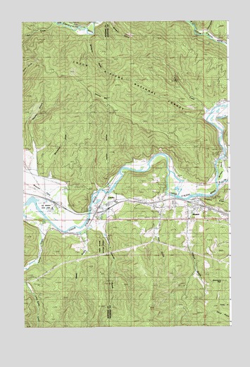
Cataldo, ID USGS Topographic Map
Click on map above to begin viewing in our Map Viewer.

This topographic map contains these locations and features:
Feature Name Type Latitude Longitude GNIS ID View Map
Canyon CreekStreamN47.6188°W116.2618°378879View Map
CataldoPopulated PlaceN47.5488°W116.3296°396248View Map
Cataldo GulchValleyN47.5385°W116.3260°379037View Map
Cataldo MissionChurchN47.5483°W116.3582°379038View Map
Cataldo MountainSummitN47.5949°W116.3302°379039View Map
Cataldo Post OfficePost OfficeN47.5486°W116.3301°2781731View Map
Drummond PeakSummitN47.5269°W116.2554°395316View Map
Drumond PeakSummitN47.5185°W116.2502°396418View Map
EnavillePopulated PlaceN47.5624°W116.2502°396466View Map
Freeman EddyBendN47.5860°W116.2616°382038View Map
French GulchValleyN47.5427°W116.2743°382067View Map
Hayden GulchValleyN47.5688°W116.3671°382987View Map
Hunt GulchValleyN47.5469°W116.2910°383558View Map
Idaho Department of Lands Cataldo Fire Protection District StationBuildingN47.5498°W116.2945°2619284View Map
KingstonPopulated PlaceN47.5491°W116.2707°396747View Map
Kingston Post OfficePost OfficeN47.5488°W116.2710°2767300View Map
Latour CreekStreamN47.5444°W116.3618°384468View Map
Little Tepee CreekStreamN47.6235°W116.3421°384972View Map
Mission GulchValleyN47.5588°W116.3471°387044View Map
North Fork Coeur d'Alene RiverStreamN47.5571°W116.2560°393937View Map
Old Mission CemeteryCemeteryN47.5502°W116.3563°2019052View Map
Old Mission State ParkParkN47.5491°W116.3610°394330View Map
Owl CreekStreamN47.6246°W116.3541°388055View Map
Prado CreekStreamN47.5827°W116.2599°388846View Map
Shoshone Memorial GardensCemeteryN47.5496°W116.2903°1802762View Map
Skeel GulchValleyN47.5346°W116.3377°390509View Map
South Fork Coeur d'Alene RiverStreamN47.5571°W116.2560°390910View Map
Whiteman DrawValleyN47.5624°W116.3582°393389View Map
Williams DrawValleyN47.6180°W116.3341°393473View Map

Note: Coordinates in the location and feature list above are referenced to NAD83 datum.


Copyright (C) 2008-2024 Ryan Niemi / Sunset Dynamics ... All Rights Reserved