TopoQuest Logo
Do you find TopoQuest useful?
Help keep TopoQuest running and adding new maps/features by donating!
Bitcoin:  19c7KJd3qBynnjoSw5npx9KScwjBe4ifkT
Litecoin:  LXs6TkuXGGXo1vDsWCkWVdjQX94eUKd6ui
Home View Maps Find Maps Find Places Resources & Links


Berlin, Wisconsin Topographic Map

USGS Map Title: Berlin, WI
USGS Map MRC: 43088H8
DRG (GeoTIFF) Download: o43088h8.tif


Neighboring USGS Topographic Map Quads:


  Redgranite, WI  
44089A1
 

  Auroraville, WI  
44088A8
 

  Eureka, WI  
44088A7
 

  Fairburn, WI  
43089H1
 

  Berlin, WI  
43088H8
 

  Rush Lake, WI  
43088H7
 

  Princeton East, WI  
43089G1
 

  Green Lake, WI  
43088G8
 

  Ripon, WI  
43088G7


Map MRC Location:

N44°
W89°
N44°
W88°
H8 H7 H6 H5 H4 H3 H2 H1
G8 G7 G6 G5 G4 G3 G2 G1
F8 F7 F6 F5 F4 F3 F2 F1
E8 E7 E6 E5 E4 E3 E2 E1
D8 D7 D6 D5 D4 D3 D2 D1
C8 C7 C6 C5 C4 C3 C2 C1
B8 B7 B6 B5 B4 B3 B2 B1
A8 A7 A6 A5 A4 A3 A2 A1
N43°
W89°
N43°
W88°

Berlin, WI USGS 1:24K Topographic Map Preview:
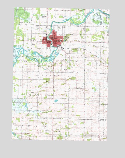
Berlin, WI USGS Topographic Map
Click on map above to begin viewing in our Map Viewer.

This topographic map contains these locations and features:
Feature Name Type Latitude Longitude GNIS ID View Map
All Saints Catholic SchoolSchoolN43.9668°W88.9558°1843712View Map
Barnes CreekStreamN43.9800°W88.9507°1561180View Map
Bennett FieldAirportN43.8766°W88.9007°1582184View Map
BerlinPopulated PlaceN43.9680°W88.9434°1561600View Map
Berlin Baptist ChurchChurchN43.9680°W88.9396°1843711View Map
Berlin City HallBuildingN43.9689°W88.9487°1843713View Map
Berlin Fen State Natural AreaParkN43.9625°W88.9051°2057271View Map
Berlin FieldAirportN43.9914°W88.9631°1581887View Map
Berlin Gospel TabernacleChurchN43.9678°W88.9446°1843714View Map
Berlin Grade School (historical)SchoolN43.9689°W88.9390°1843715View Map
Berlin High SchoolSchoolN43.9768°W88.9413°1843716View Map
Berlin Lock Number OneDamN43.9519°W88.9587°1561601View Map
Berlin Memorial HospitalHospitalN43.9785°W88.9411°1843717View Map
Berlin Middle SchoolSchoolN43.9692°W88.9387°2716796View Map
Berlin Police DepartmentBuildingN43.9687°W88.9491°2759586View Map
Berlin Post OfficePost OfficeN43.9675°W88.9476°1843718View Map
Berlin Public LibraryBuildingN43.9697°W88.9473°1843719View Map
Berlin Volunteer Fire Department / Berlin Emergency Medical ServicesBuildingN43.9645°W88.9437°2697972View Map
Broken Prop AirportAirportN43.9849°W88.9886°1581885View Map
Bush CemeteryCemeteryN43.9394°W88.9207°1562458View Map
City of BerlinCivilN43.9703°W88.9505°1582799View Map
Clay Lamberton Elementary SchoolSchoolN43.9747°W88.9397°1843722View Map
East Side ParkParkN43.9689°W88.9421°1843728View Map
Federated Church of BerlinChurchN43.9683°W88.9432°1843731View Map
First Baptist Church (historical)ChurchN43.9697°W88.9457°1843733View Map
First Methodist Episcopal Church (historical)ChurchN43.9697°W88.9471°1843734View Map
Gelhar SidingLocaleN43.9619°W88.9223°1565454View Map
Grace English Lutheran ChurchChurchN43.9772°W88.9437°1843736View Map
Griffith Memorial ChapelChurchN43.9694°W88.9315°1843747View Map
Market SquareParkN43.9689°W88.9496°1843757View Map
Mascoutin Golf ClubLocaleN43.9447°W88.9640°1843758View Map
McConnell School (historical)SchoolN43.8805°W88.9043°1569184View Map
Oakwood CemeteryCemeteryN43.9722°W88.9307°1570721View Map
River Side ParkParkN43.9778°W88.9501°1843770View Map
Rural Heights SchoolSchoolN43.9391°W88.9193°1572729View Map
Sacramento (historical)LocaleN43.9861°W88.9065°1572802View Map
Sacramento CemeteryCemeteryN43.9866°W88.9036°1845701View Map
Saint John Lutheran SchoolSchoolN43.9670°W88.9527°1843780View Map
Saint Johns Evangelical Lutheran ChurchChurchN43.9666°W88.9526°1843776View Map
Saint Josephs Roman Catholic ChurchChurchN43.9689°W88.9401°1843781View Map
Saint Josephs SchoolSchoolN43.9689°W88.9407°1843782View Map
Saint Michael's CemeteryCemeteryN43.9694°W88.9758°1573365View Map
Saint Michaels Polish Catholic ChurchChurchN43.9672°W88.9557°1843783View Map
Saint Stanislaus CemeteryCemeteryN43.9808°W88.9398°1573568View Map
Saint Stanislaus Roman Catholic ChurchChurchN43.9708°W88.9471°1843784View Map
Saint Stanislaus SchoolSchoolN43.9714°W88.9473°1573571View Map
School Number 12 (historical)SchoolN43.9411°W88.8915°1843807View Map
School Number 3 (historical)SchoolN43.9686°W88.9040°1843789View Map
School Number 8 (historical)SchoolN43.9133°W88.8862°1843802View Map
Seventh Day CemeteryCemeteryN43.9172°W88.9679°1843810View Map
Smick School (historical)SchoolN43.9978°W88.9771°1845705View Map
Spoor School (historical)SchoolN43.9975°W88.9457°1574571View Map
Spring Brook School (historical)SchoolN43.9039°W88.9459°1574605View Map
Town DrainStreamN43.9569°W88.9932°1575535View Map
Town of BerlinCivilN43.9351°W88.9436°1582800View Map
Traugoots SidingLocaleN43.9494°W88.8815°1575576View Map
Union ChurchChurchN43.9683°W88.9426°1843820View Map
Valley Trail Recycling and Disposal FacilityLocaleN43.9575°W88.9100°2635480View Map
Victory Baptist ChurchChurchN43.9683°W88.9457°1843821View Map
Washington Elementary SchoolSchoolN43.9680°W88.9571°1576269View Map
Wendts SidingLocaleN43.9611°W88.9057°1576428View Map
WISS-AM (Berlin)TowerN43.9486°W88.9859°1582544View Map
WISS-FM (Berlin)TowerN43.9486°W88.9859°1582580View Map
Wood Lawn School (historical)SchoolN43.9361°W88.9673°1576972View Map

Note: Coordinates in the location and feature list above are referenced to NAD83 datum.


Copyright (C) 2008-2024 Ryan Niemi / Sunset Dynamics ... All Rights Reserved