TopoQuest Logo
Do you find TopoQuest useful?
Help keep TopoQuest running and adding new maps/features by donating!
Bitcoin:  19c7KJd3qBynnjoSw5npx9KScwjBe4ifkT
Litecoin:  LXs6TkuXGGXo1vDsWCkWVdjQX94eUKd6ui
Home View Maps Find Maps Find Places Resources & Links


Deboullie Pond, Maine Topographic Map

USGS Map Title: Deboullie Pond, ME
USGS Map MRC: 46068H7
DRG (GeoTIFF) Download: o46068h7.tif


Neighboring USGS Topographic Map Quads:


  Pelletier Brook Lakes, ME  
47068A8
 

  McLean Mountain, ME  
47068A7
 

  Wallagrass Lakes, ME  
47068A6
 

  Gardner Pond, ME  
46068H8
 

  Deboullie Pond, ME  
46068H7
 

  Island Pond, ME  
46068H6
 

  Fish River Lake SW, ME  
46068G8
 

  Fish River Lake, ME  
46068G7
 

  Carr Pond, ME  
46068G6


Map MRC Location:

N47°
W69°
N47°
W68°
H8 H7 H6 H5 H4 H3 H2 H1
G8 G7 G6 G5 G4 G3 G2 G1
F8 F7 F6 F5 F4 F3 F2 F1
E8 E7 E6 E5 E4 E3 E2 E1
D8 D7 D6 D5 D4 D3 D2 D1
C8 C7 C6 C5 C4 C3 C2 C1
B8 B7 B6 B5 B4 B3 B2 B1
A8 A7 A6 A5 A4 A3 A2 A1
N46°
W69°
N46°
W68°

Deboullie Pond, ME USGS 1:24K Topographic Map Preview:
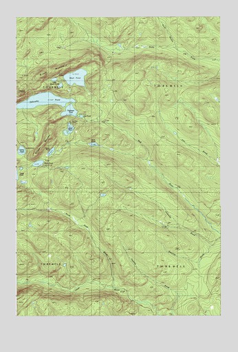
Deboullie Pond, ME USGS Topographic Map
Click on map above to begin viewing in our Map Viewer.

This topographic map contains these locations and features:
Feature Name Type Latitude Longitude GNIS ID View Map
Black MountainSummitN46.9761°W68.8592°562468View Map
Black PondLakeN46.9746°W68.8379°562497View Map
Deboullie PondLakeN46.9649°W68.8578°564933View Map
Denny PondLakeN46.9441°W68.8714°565047View Map
Fish PondLakeN46.9585°W68.8349°566216View Map
Island PondLakeN46.9529°W68.8423°568697View Map
Little Black PondsLakeN46.9739°W68.8514°569693View Map
Michauds MillLocaleN46.9950°W68.8323°571205View Map
North Branch Rocky BrookStreamN46.9873°W68.7781°572287View Map
North Pond BrookStreamN46.8853°W68.8142°572396View Map
Perch PondReservoirN46.9388°W68.8613°573191View Map
Perch Pond DamDamN46.9380°W68.8647°1774442View Map
Pushineer PondLakeN46.9606°W68.8419°573906View Map
Red River CampsLocaleN46.9567°W68.8412°574097View Map
Stink PondLakeN46.9467°W68.8273°576354View Map
T14 R8 WELSCivilN46.8885°W68.7601°1987198View Map
T15 R8 WELSCivilN46.9750°W68.7601°1987209View Map
Threemile BrookStreamN46.9042°W68.7548°577062View Map
Upper PondLakeN46.9437°W68.8534°577647View Map
Whitman MountainSummitN46.9517°W68.8546°578406View Map

Note: Coordinates in the location and feature list above are referenced to NAD83 datum.


Copyright (C) 2008-2025 Ryan Niemi / Sunset Dynamics ... All Rights Reserved