TopoQuest Logo
Do you find TopoQuest useful?
Help keep TopoQuest running and adding new maps/features by donating!
Bitcoin:  19c7KJd3qBynnjoSw5npx9KScwjBe4ifkT
Litecoin:  LXs6TkuXGGXo1vDsWCkWVdjQX94eUKd6ui
Home View Maps Find Maps Find Places Resources & Links


Flat Gap, Virginia Topographic Map

USGS Map Title: Flat Gap, VA
USGS Map MRC: 37082A6
DRG (GeoTIFF) Download: o37082a6.tif


Neighboring USGS Topographic Map Quads:


  Mayking, KY  
37082B7
 

  Jenkins West, KY  
37082B6
 

  Jenkins East, KY  
37082B5
 

  Whitesburg, KY  
37082A7
 

  Flat Gap, VA  
37082A6
 

  Pound, VA  
37082A5
 

  Appalachia, VA  
36082H7
 

  Norton, VA  
36082H6
 

  Wise, VA  
36082H5


Map MRC Location:

N38°
W83°
N38°
W82°
H8 H7 H6 H5 H4 H3 H2 H1
G8 G7 G6 G5 G4 G3 G2 G1
F8 F7 F6 F5 F4 F3 F2 F1
E8 E7 E6 E5 E4 E3 E2 E1
D8 D7 D6 D5 D4 D3 D2 D1
C8 C7 C6 C5 C4 C3 C2 C1
B8 B7 B6 B5 B4 B3 B2 B1
A8 A7 A6 A5 A4 A3 A2 A1
N37°
W83°
N37°
W82°

Flat Gap, VA USGS 1:24K Topographic Map Preview:
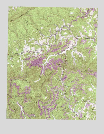
Flat Gap, VA USGS Topographic Map
Click on map above to begin viewing in our Map Viewer.

This topographic map contains these locations and features:
Feature Name Type Latitude Longitude GNIS ID View Map
Addington CemeteryCemeteryN37.0156°W82.6282°1481264View Map
Bad BranchStreamN37.0243°W82.6688°1481391View Map
Bad CreekStreamN37.0998°W82.6777°1481393View Map
Bear ForkStreamN37.0815°W82.7024°1481517View Map
Bee Bottom Picnic AreaLocaleN37.0932°W82.6849°1488729View Map
Bee BranchStreamN37.0137°W82.6629°1481583View Map
Bee BranchStreamN37.0934°W82.6832°1481584View Map
Big BranchStreamN37.0082°W82.6546°1481703View Map
Bolling CemeteryCemeteryN37.0756°W82.7065°1481918View Map
Bowling School (historical)SchoolN37.0620°W82.6990°1496589View Map
Buck KnobSummitN37.0529°W82.6418°1482112View Map
Buck Knob LookoutTowerN37.0540°W82.6424°1488728View Map
Cane Patch CampgroundLocaleN37.1029°W82.6785°1488724View Map
Cane Patch ChurchChurchN37.0990°W82.6790°1482302View Map
Creger BranchStreamN37.0165°W82.7343°1482827View Map
Critical ForkStreamN37.0268°W82.6696°1482839View Map
DeweyPopulated PlaceN37.0804°W82.6588°1494899View Map
District 1CivilN37.0116°W82.7026°1927193View Map
Divide RidgeRidgeN37.0098°W82.6802°1483030View Map
DixianaPopulated PlaceN37.0273°W82.6696°1483036View Map
Dixiana Mine DamDamN37.0518°W82.6715°1491037View Map
Donald BranchStreamN37.0609°W82.6979°1483061View Map
Flat GapPopulated PlaceN37.0743°W82.7029°1494926View Map
Flat GapGapN37.0747°W82.7249°2336308View Map
Flat Gap ChurchChurchN37.0895°W82.6907°1483438View Map
Flat Gap SchoolSchoolN37.0826°W82.6929°1483439View Map
Fork RidgeRidgeN37.0090°W82.7404°1483490View Map
Fox GapGapN37.0601°W82.6752°1483514View Map
GilleyPopulated PlaceN37.0993°W82.6749°1483631View Map
Gilley School (historical)SchoolN37.0993°W82.6790°1496616View Map
Glady ForkStreamN37.0890°W82.6321°1483662View Map
Glady Fork SchoolSchoolN37.0895°W82.6313°1483663View Map
Goble Branch School (historical)SchoolN37.1111°W82.7430°2097304View Map
Hall BranchStreamN37.0212°W82.6638°1483896View Map
Hopkins BranchStreamN37.1220°W82.6360°1484210View Map
Hopkins BranchLocaleN37.1207°W82.6421°1488621View Map
Hunsucker SchoolSchoolN37.0359°W82.6663°1484284View Map
Independent Bible ChurchChurchN37.0901°W82.6352°1484314View Map
Indian MountainRidgeN37.0534°W82.6299°1484332View Map
Laurel ForkStreamN37.1190°W82.6404°1484700View Map
Laurel Fork CampgroundLocaleN37.1240°W82.6510°1488619View Map
Laurel Fork CemeteryCemeteryN37.1212°W82.6596°1484704View Map
Laurel Fork SchoolSchoolN37.1184°W82.6402°1484706View Map
LippsPopulated PlaceN37.0043°W82.6513°1484862View Map
Marthas ChapelChurchN37.0807°W82.6588°1485202View Map
Meadow BranchStreamN37.0995°W82.6757°1485328View Map
North ForkPopulated PlaceN37.0701°W82.7213°1496634View Map
North Fork of Pound DamDamN37.1246°W82.6308°1491033View Map
North Fork of Pound LakeReservoirN37.1138°W82.6468°1502083View Map
Phillips CreekStreamN37.0609°W82.6977°1486179View Map
Phillips CreekStreamN37.1043°W82.6704°1486180View Map
Phillips Creek Picnic AreaLocaleN37.1068°W82.6715°1488725View Map
Pine BranchStreamN37.0701°W82.7452°500667View Map
Pinnacle GapGapN37.0201°W82.6368°1486274View Map
Poker HollowValleyN37.0006°W82.7498°1486312View Map
Pound ForkStreamN37.0165°W82.7346°1486393View Map
Pound LaunchLocaleN37.1234°W82.6349°1488620View Map
Raccoon BranchStreamN37.0079°W82.6577°1486476View Map
Rat CreekStreamN37.0779°W82.6582°1486510View Map
Roberts BranchStreamN37.0426°W82.6732°1486669View Map
Roberts BranchStreamN37.0709°W82.7313°502056View Map
Roberts Branch CemeteryCemeteryN37.0656°W82.7288°502060View Map
Rocky Fork SchoolSchoolN37.0195°W82.6374°1473458View Map
Rumley BranchStreamN37.0912°W82.6899°1486813View Map
Short BranchStreamN37.0120°W82.6632°1487214View Map
Short CreekStreamN37.0759°W82.6577°1487217View Map
Short Creek CemeteryCemeteryN37.0756°W82.6507°1487218View Map
Steer BranchStreamN37.0407°W82.6721°1487552View Map
Steer Branch DamDamN37.0468°W82.6682°1491035View Map
Steer Branch PondReservoirN37.0468°W82.6682°1491036View Map
Steve Horn BranchStreamN37.0351°W82.6665°1487557View Map
Steve Horn GapGapN37.0540°W82.6499°1487558View Map
Stidham ForkStreamN37.0098°W82.7290°1487573View Map
Straight ForkStreamN37.0215°W82.7371°1487653View Map
Upper Cumberland (historical)Populated PlaceN37.0707°W82.7357°2336226View Map
Upper Cumberland SchoolSchoolN37.0718°W82.7346°505872View Map
WIFX-FM (Jenkins)TowerN37.1107°W82.7382°517967View Map
Wise LaunchLocaleN37.1001°W82.6629°1488726View Map
WMMT-FM (Whitesburg)TowerN37.1107°W82.7374°518031View Map

Note: Coordinates in the location and feature list above are referenced to NAD83 datum.


Copyright (C) 2008-2024 Ryan Niemi / Sunset Dynamics ... All Rights Reserved