TopoQuest Logo
Do you find TopoQuest useful?
Help keep TopoQuest running and adding new maps/features by donating!
Bitcoin:  19c7KJd3qBynnjoSw5npx9KScwjBe4ifkT
Litecoin:  LXs6TkuXGGXo1vDsWCkWVdjQX94eUKd6ui
Home View Maps Find Maps Find Places Resources & Links


Pound, Virginia Topographic Map

USGS Map Title: Pound, VA
USGS Map MRC: 37082A5
DRG (GeoTIFF) Download: o37082a5.tif


Neighboring USGS Topographic Map Quads:


  Jenkins West, KY  
37082B6
 

  Jenkins East, KY  
37082B5
 

  Clintwood, VA  
37082B4
 

  Flat Gap, VA  
37082A6
 

  Pound, VA  
37082A5
 

  Caney Ridge, VA  
37082A4
 

  Norton, VA  
36082H6
 

  Wise, VA  
36082H5
 

  Coeburn, VA  
36082H4


Map MRC Location:

N38°
W83°
N38°
W82°
H8 H7 H6 H5 H4 H3 H2 H1
G8 G7 G6 G5 G4 G3 G2 G1
F8 F7 F6 F5 F4 F3 F2 F1
E8 E7 E6 E5 E4 E3 E2 E1
D8 D7 D6 D5 D4 D3 D2 D1
C8 C7 C6 C5 C4 C3 C2 C1
B8 B7 B6 B5 B4 B3 B2 B1
A8 A7 A6 A5 A4 A3 A2 A1
N37°
W83°
N37°
W82°

Pound, VA USGS 1:24K Topographic Map Preview:
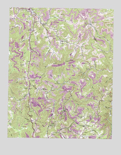
Pound, VA USGS Topographic Map
Click on map above to begin viewing in our Map Viewer.

This topographic map contains these locations and features:
Feature Name Type Latitude Longitude GNIS ID View Map
Addington CemeteryCemeteryN37.0384°W82.6221°1481265View Map
Addison ChapelChurchN37.0126°W82.5352°1481266View Map
Ambrose BranchStreamN37.0515°W82.5599°1481303View Map
Baker CemeteryCemeteryN37.0476°W82.5838°1481407View Map
Baker CemeteryCemeteryN37.0716°W82.5354°1481408View Map
Baker CemeteryCemeteryN37.0901°W82.5518°1481409View Map
Baker HollowValleyN37.0479°W82.5716°1481414View Map
Baker SchoolSchoolN37.0670°W82.5282°1481418View Map
Barn BranchStreamN37.0845°W82.5979°1481461View Map
Bean GapGapN37.0470°W82.5885°1481502View Map
Bennett CemeteryCemeteryN37.0165°W82.5201°1481628View Map
Berry CemeteryCemeteryN37.0457°W82.5593°1481646View Map
Bevins CemeteryCemeteryN37.0420°W82.5307°1481686View Map
Bevins CemeteryCemeteryN37.0423°W82.5379°1481687View Map
Big BranchStreamN37.0470°W82.5993°1481705View Map
Big BranchStreamN37.1148°W82.6188°1481711View Map
Big LaurelPopulated PlaceN37.0126°W82.6218°1499133View Map
Boggs CemeteryCemeteryN37.0565°W82.5324°1481902View Map
Boggs CemeteryCemeteryN37.0701°W82.6057°1481903View Map
Boggs CemeteryCemeteryN37.1115°W82.6013°1481904View Map
Boggs School (historical)SchoolN37.0970°W82.5777°1481907View Map
Bold Camp CreekStreamN37.1193°W82.5940°1481916View Map
Bold Camp MountainSummitN37.0707°W82.5649°1481917View Map
Bowser HollowValleyN37.0889°W82.5431°1481957View Map
Callaham CemeteryCemeteryN37.0452°W82.5552°1482227View Map
Cane BranchStreamN37.0734°W82.5988°1482297View Map
Cantrell CemeteryCemeteryN37.1040°W82.5680°1482312View Map
Cantrell CemeteryCemeteryN37.1132°W82.5518°1482313View Map
Cavenger HollowValleyN37.0554°W82.5996°1482389View Map
Clark CemeteryCemeteryN37.0404°W82.5246°1482542View Map
Clinchfield Moss MinesMineN37.1109°W82.5249°1482585View Map
Collins CemeteryCemeteryN37.0601°W82.5657°1482653View Map
Collins SchoolSchoolN37.0462°W82.5732°1482658View Map
Culbertson CemeteryCemeteryN37.0048°W82.5238°1482875View Map
Dale BranchStreamN37.0098°W82.5521°1482898View Map
Dale CemeteryCemeteryN37.0026°W82.5468°1482899View Map
District 2CivilN37.0196°W82.5222°1927214View Map
Dotson CemeteryCemeteryN37.1165°W82.5879°1483065View Map
Dotson CemeteryCemeteryN37.0945°W82.5619°1483066View Map
Dotson CreekStreamN37.0548°W82.5532°1483067View Map
Dotson ForkStreamN37.1087°W82.5793°1483068View Map
Dotson SchoolSchoolN37.0937°W82.5574°1483069View Map
Duckcamp BranchStreamN37.0909°W82.5454°1483153View Map
Duncan GapLocaleN37.0362°W82.5152°1483163View Map
Fairview ChurchChurchN37.1098°W82.5838°1483332View Map
Firbie ChapelChurchN37.0932°W82.5590°1483420View Map
Freeman CemeteryCemeteryN37.0376°W82.5574°1483534View Map
Gilliam CemeteryCemeteryN37.0037°W82.5729°1483635View Map
Gilliam CemeteryCemeteryN37.1040°W82.5968°1483636View Map
Gilliam School (historical)SchoolN37.0126°W82.5740°1483637View Map
Greene CemeteryCemeteryN37.0165°W82.5354°1483819View Map
Hamilton CemeteryCemeteryN37.1112°W82.5893°1483914View Map
Happy HollowValleyN37.0632°W82.5329°1483932View Map
Harmony ChapelChurchN37.1032°W82.5960°1483946View Map
Hash HollowValleyN37.0417°W82.6004°1483968View Map
Hays BranchStreamN37.1084°W82.6146°1483990View Map
Hill CemeteryCemeteryN37.0982°W82.5543°1484107View Map
Hill CemeteryCemeteryN37.1173°W82.5007°1484108View Map
Hillman CemeteryCemeteryN37.1045°W82.5979°1484117View Map
Hubbard ChapelChurchN37.0526°W82.5649°1488743View Map
HughPopulated PlaceN37.0934°W82.5593°1496620View Map
HurricanePopulated PlaceN37.0040°W82.5357°1499590View Map
Hurricane BranchStreamN37.0170°W82.5449°1484294View Map
Hutchinson CemeteryCemeteryN37.0432°W82.5071°1484301View Map
Indian CreekStreamN37.1190°W82.5974°1484316View Map
Indian GapGapN37.0165°W82.5965°1484323View Map
Indian RidgeRidgeN37.0745°W82.6127°1484333View Map
James Woodrow Adams Elementary and Middle SchoolSchoolN37.1108°W82.5990°2498430View Map
Jessee CemeteryCemeteryN37.0254°W82.5463°1484442View Map
Keith CemeteryCemeteryN37.0782°W82.5046°1484532View Map
Killen HollowValleyN37.1030°W82.5957°1484594View Map
Lane BranchStreamN37.0670°W82.5213°1484649View Map
Lane CemeteryCemeteryN37.0407°W82.5013°1484652View Map
Lane CemeteryCemeteryN37.0590°W82.5079°1484653View Map
Lane CemeteryCemeteryN37.0823°W82.5093°1484654View Map
Lanes StorePopulated PlaceN37.0690°W82.5263°1496624View Map
Left Fork Lick ForkStreamN37.0848°W82.5035°1487050View Map
Lick BranchStreamN37.0957°W82.6013°1484806View Map
Lick Fork PondReservoirN37.1168°W82.5299°1489597View Map
Lick Fork School (historical)SchoolN37.1065°W82.5221°1497392View Map
McFall ForkStreamN37.1154°W82.5740°1485288View Map
Meade CemeteryCemeteryN37.0915°W82.5624°1485320View Map
Meade ForkStreamN37.1090°W82.5849°1485323View Map
Meade School (historical)SchoolN37.1159°W82.5749°1496631View Map
Meadow BranchStreamN37.0626°W82.5349°1485327View Map
Moss Mine Number One DamDamN37.1168°W82.5299°1489596View Map
Mullins CemeteryCemeteryN37.1045°W82.5846°1485762View Map
Mullins CemeteryCemeteryN37.0857°W82.5765°1485763View Map
Mullins CemeteryCemeteryN37.0923°W82.5990°1485764View Map
Mullins CemeteryCemeteryN37.1062°W82.5732°1485765View Map
Mullins CemeteryCemeteryN37.0504°W82.5101°1485766View Map
Mullins ForkStreamN37.1090°W82.5846°1485767View Map
North Fork Pound RiverStreamN37.1229°W82.6129°1485900View Map
Old Regular ChurchChurchN37.0465°W82.5832°1485963View Map
Page CemeteryCemeteryN37.0215°W82.5302°1486034View Map
Parsons CemeteryCemeteryN37.0062°W82.5335°1486075View Map
Peak CemeteryCemeteryN37.0565°W82.6118°1486105View Map
Peak HollowValleyN37.0566°W82.6010°1486108View Map
Peaks StorePopulated PlaceN37.0507°W82.5990°1496636View Map
Perry CemeteryCemeteryN37.0254°W82.5988°1486150View Map
Potcamp BranchStreamN37.0412°W82.5999°1496638View Map
PoundPopulated PlaceN37.1237°W82.6013°1499906View Map
Pound Police DepartmentBuildingN37.1225°W82.6018°2767028View Map
Pound Post OfficePost OfficeN37.1224°W82.5974°2780815View Map
Pound Rescue SquadBuildingN37.1240°W82.6060°2721169View Map
Pound Volunteer Fire DepartmentBuildingN37.1248°W82.6001°2085830View Map
Powers CemeteryCemeteryN37.0004°W82.5096°1486416View Map
Powers CemeteryCemeteryN37.0220°W82.5160°1486417View Map
Powers CemeteryCemeteryN37.0582°W82.6027°1486418View Map
Powers CemeteryCemeteryN37.1170°W82.5060°1486419View Map
Powers Family CemeteryCemeteryN37.0964°W82.5478°2651569View Map
Pyles Memorial ChurchChurchN37.0973°W82.5779°1486460View Map
Red Onion State PrisonBuildingN37.1117°W82.5500°2741367View Map
Rickey BranchStreamN37.0404°W82.5482°1486601View Map
Riley BranchStreamN37.0507°W82.5988°1486617View Map
Riner SchoolSchoolN37.0501°W82.5996°1486621View Map
Robinson CemeteryCemeteryN37.0970°W82.5096°1486686View Map
Rock CreekStreamN37.0168°W82.5029°1486695View Map
Round TopPopulated PlaceN37.0287°W82.5165°1496643View Map
Round Top CemeteryCemeteryN37.0307°W82.5168°1486795View Map
Sally RidgeRidgeN37.0037°W82.6227°1486898View Map
Screech CemeteryCemeteryN37.0109°W82.6085°1486988View Map
Short (historical)Populated PlaceN37.1162°W82.5768°1496648View Map
Skeen SchoolSchoolN37.0279°W82.5565°1487276View Map
Skeen Union ChurchChurchN37.0279°W82.5571°1487277View Map
South Fork Pound RiverStreamN37.1232°W82.6132°1487407View Map
Stallard BranchStreamN37.0876°W82.5379°1487504View Map
Stallard CemeteryCemeteryN37.0887°W82.5382°1487513View Map
Stapleton CemeteryCemeteryN37.0473°W82.5856°1487524View Map
Steel ForkStreamN37.0168°W82.5029°1487545View Map
Steel Fork CemeteryCemeteryN37.0243°W82.5038°1487546View Map
Store House BranchStreamN37.0840°W82.5977°1487645View Map
Strouth CemeteryCemeteryN37.0718°W82.5235°1487670View Map
Tank HollowValleyN37.0327°W82.5982°1487771View Map
Trace ForkStreamN37.0232°W82.5021°1487973View Map
Turkey BranchStreamN37.0059°W82.5632°1488017View Map
Vanover CemeteryCemeteryN37.0822°W82.5730°1488111View Map
Wheatley CemeteryCemeteryN37.0007°W82.5468°1488268View Map
Wheatley CemeteryCemeteryN37.0018°W82.5276°1488269View Map
Yates HollowValleyN37.0294°W82.5019°1487112View Map

Note: Coordinates in the location and feature list above are referenced to NAD83 datum.


Copyright (C) 2008-2024 Ryan Niemi / Sunset Dynamics ... All Rights Reserved