TopoQuest Logo
Do you find TopoQuest useful?
Help keep TopoQuest running and adding new maps/features by donating!
Bitcoin:  19c7KJd3qBynnjoSw5npx9KScwjBe4ifkT
Litecoin:  LXs6TkuXGGXo1vDsWCkWVdjQX94eUKd6ui
Home View Maps Find Maps Find Places Resources & Links


Cathedral Peak, Colorado Topographic Map

USGS Map Title: Cathedral Peak, CO
USGS Map MRC: 38107E5
DRG (GeoTIFF) Download: o38107e5.tif


Neighboring USGS Topographic Map Quads:


  Grand View Mesa, CO  
38107F6
 

  Crawford, CO  
38107F5
 

  Mount Guero, CO  
38107F4
 

  Grizzly Ridge, CO  
38107E6
 

  Cathedral Peak, CO  
38107E5
 

  X Lazy F Ranch, CO  
38107E4
 

  Cerro Summit, CO  
38107D6
 

  Cimarron, CO  
38107D5
 

  Curecanti Needle, CO  
38107D4


Map MRC Location:

N39°
W108°
N39°
W107°
H8 H7 H6 H5 H4 H3 H2 H1
G8 G7 G6 G5 G4 G3 G2 G1
F8 F7 F6 F5 F4 F3 F2 F1
E8 E7 E6 E5 E4 E3 E2 E1
D8 D7 D6 D5 D4 D3 D2 D1
C8 C7 C6 C5 C4 C3 C2 C1
B8 B7 B6 B5 B4 B3 B2 B1
A8 A7 A6 A5 A4 A3 A2 A1
N38°
W108°
N38°
W107°

Cathedral Peak, CO USGS 1:24K Topographic Map Preview:
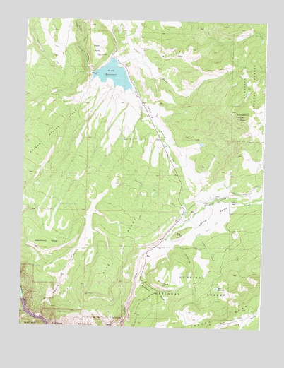
Cathedral Peak, CO USGS Topographic Map
Click on map above to begin viewing in our Map Viewer.

This topographic map contains these locations and features:
Feature Name Type Latitude Longitude GNIS ID View Map
Big HillSummitN38.5377°W107.5433°186884View Map
Bottle Stomp DamDamN38.6183°W107.5023°198936View Map
Bottle Stomp ReservoirReservoirN38.6175°W107.5024°197468View Map
Buckhorn GulchValleyN38.5183°W107.5657°186886View Map
Bull CreekStreamN38.6130°W107.5653°186897View Map
Cathedral PeakSummitN38.5866°W107.5123°186898View Map
Cattlemans DitchCanalN38.5908°W107.5656°203259View Map
Cedar PointSummitN38.6107°W107.5864°186896View Map
Cottonwood CreekStreamN38.5369°W107.5492°186883View Map
Crystal DamDamN38.5105°W107.6239°197469View Map
Crystal ValleyValleyN38.5323°W107.5554°186892View Map
Crystal Valley DitchCanalN38.5394°W107.5301°186881View Map
Dead Horse MesaSummitN38.5316°W107.6137°186891View Map
Don Meek Number 1 DamDamN38.5167°W107.5239°201034View Map
Dyer Fork DitchCanalN38.5550°W107.5087°203280View Map
FlatironSummitN38.5172°W107.5496°186885View Map
Gates CampLocaleN38.5514°W107.5145°186893View Map
Gould ReservoirReservoirN38.6027°W107.5794°186895View Map
Hay Park Reservoir DamDamN38.5167°W107.5239°200590View Map
Meek ReservoirReservoirN38.5161°W107.5234°186879View Map
Onion ValleyValleyN38.6072°W107.5815°186894View Map
Onion Valley DamDamN38.6033°W107.5939°199266View Map
Onion Valley ReservoirReservoirN38.6033°W107.5939°199267View Map
Pine RidgeRidgeN38.5137°W107.5893°186889View Map
Pool GulchValleyN38.5053°W107.6226°186841View Map
Quacker CreekStreamN38.5383°W107.5320°186880View Map
Schmit CreekStreamN38.5442°W107.5217°186882View Map
Spring GulchValleyN38.5052°W107.6198°186890View Map

Note: Coordinates in the location and feature list above are referenced to NAD83 datum.


Copyright (C) 2008-2024 Ryan Niemi / Sunset Dynamics ... All Rights Reserved