TopoQuest Logo
Do you find TopoQuest useful?
Help keep TopoQuest running and adding new maps/features by donating!
Bitcoin:  19c7KJd3qBynnjoSw5npx9KScwjBe4ifkT
Litecoin:  LXs6TkuXGGXo1vDsWCkWVdjQX94eUKd6ui
Home View Maps Find Maps Find Places Resources & Links


Cebolla, New Mexico Topographic Map

USGS Map Title: Cebolla, NM
USGS Map MRC: 36106E4
DRG (GeoTIFF) Download: o36106e4.tif


Neighboring USGS Topographic Map Quads:


  Tierra Amarilla, NM  
36106F5
 

  Penasco Amarillo, NM  
36106F4
 

  East Gavilan Canyon, NM  
36106F3
 

  Las Nutrias, NM  
36106E5
 

  Cebolla, NM  
36106E4
 

  Canjilon Mountain, NM  
36106E3
 

  Alire, NM  
36106D5
 

  Canjilon, NM  
36106D4
 

  Mogote Peak, NM  
36106D3


Map MRC Location:

N37°
W107°
N37°
W106°
H8 H7 H6 H5 H4 H3 H2 H1
G8 G7 G6 G5 G4 G3 G2 G1
F8 F7 F6 F5 F4 F3 F2 F1
E8 E7 E6 E5 E4 E3 E2 E1
D8 D7 D6 D5 D4 D3 D2 D1
C8 C7 C6 C5 C4 C3 C2 C1
B8 B7 B6 B5 B4 B3 B2 B1
A8 A7 A6 A5 A4 A3 A2 A1
N36°
W107°
N36°
W106°

Cebolla, NM USGS 1:24K Topographic Map Preview:
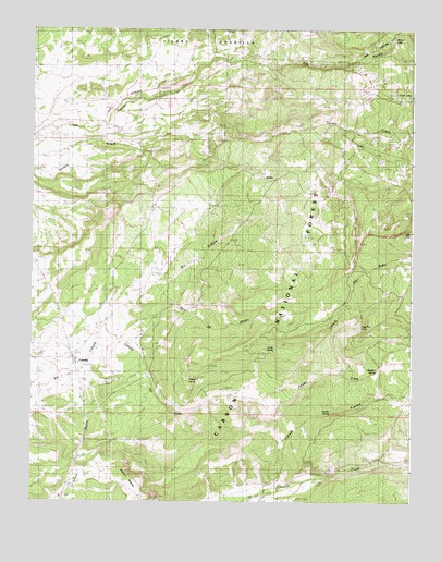
Cebolla, NM USGS Topographic Map
Click on map above to begin viewing in our Map Viewer.

This topographic map contains these locations and features:
Feature Name Type Latitude Longitude GNIS ID View Map
Amador CreekStreamN36.5278°W106.4264°903126View Map
Amador SpringSpringN36.5350°W106.3861°2678119View Map
Bano TankReservoirN36.5321°W106.4442°913002View Map
Beaver TankReservoirN36.5594°W106.4101°913005View Map
Blanco TankReservoirN36.5150°W106.4650°2678121View Map
Bronco TankReservoirN36.5500°W106.4476°913006View Map
Burns LakeReservoirN36.5903°W106.3856°912996View Map
Caņada de BanoStreamN36.5411°W106.4786°904395View Map
Caņada FuertesStreamN36.5047°W106.4198°904451View Map
Canjilon - Cebolla Volunteer Fire Department Station 2BuildingN36.5409°W106.4839°2657929View Map
CebollaPopulated PlaceN36.5383°W106.4864°923578View Map
Cebolla CorralLocaleN36.5300°W106.4803°913007View Map
Cebolla Post OfficePost OfficeN36.5296°W106.4837°937504View Map
Duke PitBasinN36.5383°W106.4245°913003View Map
Dulce SpringSpringN36.5403°W106.4228°2678120View Map
Fuertes SpringSpringN36.5233°W106.4019°912584View Map
Fuertes TankReservoirN36.5259°W106.3782°913004View Map
Hidden LakeLakeN36.6224°W106.3821°906951View Map
Nutrias TankReservoirN36.6069°W106.4074°913000View Map
Red HillSummitN36.5720°W106.3750°910060View Map
Rincon BlancoRidgeN36.5089°W106.4661°2678122View Map
Rito del MedioStreamN36.5420°W106.4689°910278View Map
San Antonio ChurchChurchN36.6000°W106.4728°910600View Map
Terrero TankReservoirN36.5863°W106.4265°912998View Map
Tonita LakeLakeN36.5860°W106.4250°912997View Map
Trout LakesLakeN36.6064°W106.3790°911827View Map
Trout Lakes CampgroundLocaleN36.6089°W106.3825°913001View Map
Turkey SpringSpringN36.5319°W106.4458°2678123View Map
Vega Paz TankReservoirN36.5463°W106.3924°912083View Map

Note: Coordinates in the location and feature list above are referenced to NAD83 datum.


Copyright (C) 2008-2025 Ryan Niemi / Sunset Dynamics ... All Rights Reserved