TopoQuest Logo
Do you find TopoQuest useful?
Help keep TopoQuest running and adding new maps/features by donating!
Bitcoin:  19c7KJd3qBynnjoSw5npx9KScwjBe4ifkT
Litecoin:  LXs6TkuXGGXo1vDsWCkWVdjQX94eUKd6ui
Home View Maps Find Maps Find Places Resources & Links


Cedar Canyon, Texas Topographic Map

USGS Map Title: Cedar Canyon, TX
USGS Map MRC: 31101A8
DRG (GeoTIFF) Download: o31101a8.tif


Neighboring USGS Topographic Map Quads:


  Square Top Mountain, TX  
31102B1
 

  Rankin, TX  
31101B8
 

  Rankin NE, TX  
31101B7
 

  Table Top Mountain, TX  
31102A1
 

  Cedar Canyon, TX  
31101A8
 

  Rankin SE, TX  
31101A7
 

  Indian Mesa NE, TX  
30102H1
 

  Iraan, TX  
30101H8
 

  Twelvemile Camp, TX  
30101H7


Map MRC Location:

N32°
W102°
N32°
W101°
H8 H7 H6 H5 H4 H3 H2 H1
G8 G7 G6 G5 G4 G3 G2 G1
F8 F7 F6 F5 F4 F3 F2 F1
E8 E7 E6 E5 E4 E3 E2 E1
D8 D7 D6 D5 D4 D3 D2 D1
C8 C7 C6 C5 C4 C3 C2 C1
B8 B7 B6 B5 B4 B3 B2 B1
A8 A7 A6 A5 A4 A3 A2 A1
N31°
W102°
N31°
W101°

Cedar Canyon, TX USGS 1:24K Topographic Map Preview:
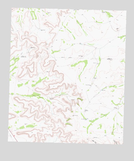
Cedar Canyon, TX USGS Topographic Map
Click on map above to begin viewing in our Map Viewer.

This topographic map contains these locations and features:
Feature Name Type Latitude Longitude GNIS ID View Map
Carter WindmillLocaleN31.1052°W101.9676°1353897View Map
Cedar CanyonValleyN31.0470°W101.9973°1354042View Map
Cedar Canyon WindmillLocaleN31.0415°W101.9560°1354045View Map
Cedar HillSummitN31.1079°W101.8860°1354101View Map
Jacks TankReservoirN31.0930°W101.9231°1360095View Map
Javelina WindmillLocaleN31.0260°W101.9304°1360181View Map
Munro WindmillLocaleN31.1246°W101.9312°1363486View Map
Oil Well WindmillLocaleN31.0877°W101.9787°1364361View Map
Point WindmillLocaleN31.0407°W101.9326°1365505View Map
Red Tower WindmillLocaleN31.1232°W101.8985°1366245View Map
Rock TankReservoirN31.0503°W101.9000°1366710View Map
Round MountainSummitN31.0310°W101.9174°1366941View Map
Round Mountain TankReservoirN31.0226°W101.9155°1366960View Map
Telephone TankReservoirN31.0614°W101.9090°1369689View Map
Telephone WindmillLocaleN31.0546°W101.9121°1369691View Map
Twenty-Five Foot WindmillLocaleN31.0338°W101.8835°1370328View Map
West WindmillLocaleN31.0813°W101.9218°1371276View Map

Note: Coordinates in the location and feature list above are referenced to NAD83 datum.


Copyright (C) 2008-2025 Ryan Niemi / Sunset Dynamics ... All Rights Reserved