TopoQuest Logo
Do you find TopoQuest useful?
Help keep TopoQuest running and adding new maps/features by donating!
Bitcoin:  19c7KJd3qBynnjoSw5npx9KScwjBe4ifkT
Litecoin:  LXs6TkuXGGXo1vDsWCkWVdjQX94eUKd6ui
Home View Maps Find Maps Find Places Resources & Links


Center, Washington Topographic Map

USGS Map Title: Center, WA
USGS Map MRC: 47122H7
DRG (GeoTIFF) Download: o47122h7.tif


Neighboring USGS Topographic Map Quads:


  Gardiner, WA  
48122A8
 

  Port Townsend South, WA  
48122A7
 

  Nordland, WA  
48122A6
 

  Uncas, WA  
47122H8
 

  Center, WA  
47122H7
 

  Port Ludlow, WA  
47122H6
 

  Mount Walker, WA  
47122G8
 

  Quilcene, WA  
47122G7
 

  Lofall, WA  
47122G6


Map MRC Location:

N48°
W123°
N48°
W122°
H8 H7 H6 H5 H4 H3 H2 H1
G8 G7 G6 G5 G4 G3 G2 G1
F8 F7 F6 F5 F4 F3 F2 F1
E8 E7 E6 E5 E4 E3 E2 E1
D8 D7 D6 D5 D4 D3 D2 D1
C8 C7 C6 C5 C4 C3 C2 C1
B8 B7 B6 B5 B4 B3 B2 B1
A8 A7 A6 A5 A4 A3 A2 A1
N47°
W123°
N47°
W122°

Center, WA USGS 1:24K Topographic Map Preview:
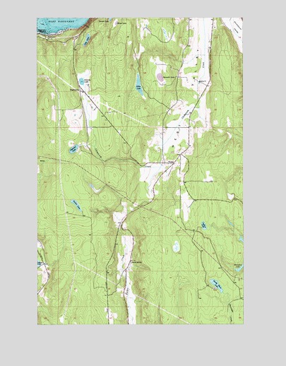
Center, WA USGS Topographic Map
Click on map above to begin viewing in our Map Viewer.

This topographic map contains these locations and features:
Feature Name Type Latitude Longitude GNIS ID View Map
Beausite LakeLakeN47.9756°W122.8015°1516305View Map
Browns LakeLakeN47.9312°W122.8432°1530334View Map
CenterLocaleN47.9404°W122.7932°1517590View Map
City Lakes DamDamN47.9898°W122.8479°1532062View Map
Dabob SchoolSchoolN47.8995°W122.8193°1518447View Map
Delanty LakeLakeN47.9739°W122.8492°1518665View Map
Discovery JunctionPopulated PlaceN47.9937°W122.8746°1518799View Map
EaglemountPopulated PlaceN47.9698°W122.8496°1519063View Map
FairmontPopulated PlaceN47.9929°W122.8660°1519432View Map
Gibbs LakeLakeN47.9721°W122.8144°1519940View Map
Horseshoe LakeLakeN47.8975°W122.7535°1520960View Map
Jefferson County Fire District 2 Quilcene Fire Rescue Station 23BuildingN47.8759°W122.8208°2767933View Map
Kingdom Hall of Jehovahs WitnessesChurchN47.9528°W122.7514°2609378View Map
Larson LakeLakeN47.9268°W122.7592°1530343View Map
Leland Lake CampgroundLocaleN47.8990°W122.8727°1529632View Map
Ludlow LakeLakeN47.9149°W122.7752°1522571View Map
Moon LakeLakeN47.9978°W122.8281°1523345View Map
Peterson LakeLakeN47.9463°W122.8541°1524364View Map
Sandy Shore LakeLakeN47.8908°W122.7676°1525430View Map
Stacey's AirportAirportN47.9746°W122.7725°2443359View Map
Sunset LakeLakeN47.9993°W122.8318°1526778View Map
Tarboo LakeLakeN47.9237°W122.8526°1526940View Map
Timberline Quarter Horse Farm Airport (historical)AirportN47.9606°W122.7591°1533898View Map

Note: Coordinates in the location and feature list above are referenced to NAD83 datum.


Copyright (C) 2008-2025 Ryan Niemi / Sunset Dynamics ... All Rights Reserved