TopoQuest Logo
Do you find TopoQuest useful?
Help keep TopoQuest running and adding new maps/features by donating!
Bitcoin:  19c7KJd3qBynnjoSw5npx9KScwjBe4ifkT
Litecoin:  LXs6TkuXGGXo1vDsWCkWVdjQX94eUKd6ui
Home View Maps Find Maps Find Places Resources & Links


Central City East, Nebraska Topographic Map

USGS Map Title: Central City East, NE
USGS Map MRC: 41097A8
DRG (GeoTIFF) Download: o41097a8.tif


Neighboring USGS Topographic Map Quads:


  Hord, NE  
41098B1
 

  Polk NW, NE  
41097B8
 

  Clarks, NE  
41097B7
 

  Central City West, NE  
41098A1
 

  Central City East, NE  
41097A8
 

  Polk, NE  
41097A7
 

  Murphy, NE  
40098H1
 

  Hampton, NE  
40097H8
 

  Henderson NE, NE  
40097H7


Map MRC Location:

N42°
W98°
N42°
W97°
H8 H7 H6 H5 H4 H3 H2 H1
G8 G7 G6 G5 G4 G3 G2 G1
F8 F7 F6 F5 F4 F3 F2 F1
E8 E7 E6 E5 E4 E3 E2 E1
D8 D7 D6 D5 D4 D3 D2 D1
C8 C7 C6 C5 C4 C3 C2 C1
B8 B7 B6 B5 B4 B3 B2 B1
A8 A7 A6 A5 A4 A3 A2 A1
N41°
W98°
N41°
W97°

Central City East, NE USGS 1:24K Topographic Map Preview:
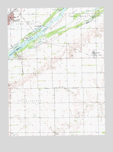
Central City East, NE USGS Topographic Map
Click on map above to begin viewing in our Map Viewer.

This topographic map contains these locations and features:
Feature Name Type Latitude Longitude GNIS ID View Map
Bankson Airport (historical)AirportN41.0761°W97.9148°1881628View Map
Cedar IslandIslandN41.1072°W97.9056°828006View Map
Central City Baptist ChurchChurchN41.1153°W97.9939°1881302View Map
Central City Elementary SchoolSchoolN41.1145°W97.9981°1881309View Map
Central City High SchoolSchoolN41.1042°W97.9998°1881308View Map
Central City Post OfficePost OfficeN41.1159°W97.9999°1881276View Map
Central City Public LibraryBuildingN41.1161°W97.9995°1881275View Map
Chader DamDamN41.0900°W97.9124°1766983View Map
Chader ReservoirReservoirN41.0890°W97.9114°1766984View Map
Covenant Cedars CampLocaleN41.1170°W97.8856°828413View Map
Election Precinct 7CivilN41.0585°W97.8830°1929196View Map
Election Precinct 8CivilN41.0001°W97.9999°1929199View Map
Episcopal ChurchChurchN41.1170°W97.9984°1881297View Map
First Baptist ChurchChurchN41.0756°W97.8853°1881624View Map
Fridhem Lutheran ChurchChurchN41.0756°W97.8853°1881623View Map
HeberPopulated PlaceN41.1111°W97.9751°835318View Map
Hord Lake State Recreation AreaParkN41.1075°W97.9559°830130View Map
Hord SchoolSchoolN41.1189°W97.9656°830131View Map
HordvillePopulated PlaceN41.0756°W97.8853°830132View Map
HordvilleLocaleN41.0778°W97.8864°1881625View Map
Hordville Post OfficePost OfficeN41.0789°W97.8887°1881622View Map
Hordville Volunteer Fire DepartmentBuildingN41.0785°W97.8888°2553334View Map
Island Number 1IslandN41.0953°W97.9406°836055View Map
Island Number 2IslandN41.0931°W97.9559°836057View Map
Island Number 7IslandN41.0931°W97.9631°836058View Map
KronborgPopulated PlaceN41.0028°W97.9401°830557View Map
Larson DamDamN41.0033°W97.9597°1769868View Map
Larson ReservoirLakeN41.0055°W97.9621°1769869View Map
Long IslandIslandN41.1120°W97.9039°830860View Map
Mamre ChurchChurchN41.0458°W97.9506°831018View Map
Merrick County CourthouseBuildingN41.1136°W97.9995°1881305View Map
Merrick County Sheriff's OfficeBuildingN41.1135°W97.9995°1881304View Map
Mount Zion CemeteryCemeteryN41.0467°W97.9131°831492View Map
OverlandPopulated PlaceN41.0775°W97.9862°835400View Map
OverlandLocaleN41.0775°W97.9862°1881578View Map
Overland Census Designated PlaceCensusN41.0809°W97.9783°2583892View Map
Parker IslandIslandN41.1053°W97.9539°831984View Map
Polk-Hordville Middle SchoolSchoolN41.0811°W97.8895°1881761View Map
Riverside ParkPopulated PlaceN41.0964°W97.9728°832590View Map
Township of BluffCivilN41.0833°W97.9170°1881577View Map
Township of OtisCivilN41.0028°W97.8809°1881566View Map
Township of South PlatteCivilN41.0028°W97.9976°1881583View Map
United Co-op Incorporated ElevatorLocaleN41.0756°W97.8853°1881621View Map
Village of HordvilleCivilN41.0794°W97.8903°2398545View Map

Note: Coordinates in the location and feature list above are referenced to NAD83 datum.


Copyright (C) 2008-2025 Ryan Niemi / Sunset Dynamics ... All Rights Reserved