TopoQuest Logo
Do you find TopoQuest useful?
Help keep TopoQuest running and adding new maps/features by donating!
Bitcoin:  19c7KJd3qBynnjoSw5npx9KScwjBe4ifkT
Litecoin:  LXs6TkuXGGXo1vDsWCkWVdjQX94eUKd6ui
Home View Maps Find Maps Find Places Resources & Links


Cerro, New Mexico Topographic Map

USGS Map Title: Cerro, NM
USGS Map MRC: 36105G5
DRG (GeoTIFF) Download: o36105g5.tif


Neighboring USGS Topographic Map Quads:


  Ute Mountain, NM  
36105H6
 

  Costilla, NM  
36105H5
 

  Amalia, NM  
36105H4
 

  Sunshine, NM  
36105G6
 

  Cerro, NM  
36105G5
 

  Latir Peak, NM  
36105G4
 

  Guadalupe Mountain, NM  
36105F6
 

  Questa, NM  
36105F5
 

  Red River, NM  
36105F4


Map MRC Location:

N37°
W106°
N37°
W105°
H8 H7 H6 H5 H4 H3 H2 H1
G8 G7 G6 G5 G4 G3 G2 G1
F8 F7 F6 F5 F4 F3 F2 F1
E8 E7 E6 E5 E4 E3 E2 E1
D8 D7 D6 D5 D4 D3 D2 D1
C8 C7 C6 C5 C4 C3 C2 C1
B8 B7 B6 B5 B4 B3 B2 B1
A8 A7 A6 A5 A4 A3 A2 A1
N36°
W106°
N36°
W105°

Cerro, NM USGS 1:24K Topographic Map Preview:
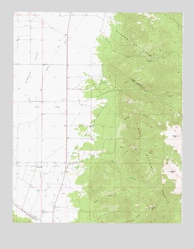
Cerro, NM USGS Topographic Map
Click on map above to begin viewing in our Map Viewer.

This topographic map contains these locations and features:
Feature Name Type Latitude Longitude GNIS ID View Map
10021 Water WellWellN36.7792°W105.6072°924775View Map
10022 Water WellWellN36.7556°W105.6158°927018View Map
10026 Water WellWellN36.8442°W105.6200°927027View Map
10032 Water WellWellN36.8159°W105.5870°927022View Map
10051 Water WellWellN36.8584°W105.6222°927031View Map
10054 WAter WellWellN36.8431°W105.6028°927026View Map
10055 Water WellWellN36.8209°W105.5686°926874View Map
10108 Water WellWellN36.8634°W105.6128°926856View Map
10110 Water WellWellN36.8431°W105.6020°926864View Map
10111 Water WellWellN36.8036°W105.5861°927021View Map
10112 Water WellWellN36.7997°W105.6025°926869View Map
Buena VistaPopulated PlaceN36.7839°W105.6039°904162View Map
Cabresto Lake DamDamN36.7500°W105.5006°924016View Map
Cabresto PeakSummitN36.7806°W105.5086°904290View Map
Caņada PinabeteStreamN36.7625°W105.5978°904477View Map
CerroPopulated PlaceN36.7539°W105.6128°904926View Map
Cerro Community DitchCanalN36.7831°W105.5856°929134View Map
Cerro Fire DepartmentBuildingN36.7597°W105.6230°2658147View Map
Cerro Post OfficePost OfficeN36.7540°W105.6136°937986View Map
Cerro Weather StationLocaleN36.7539°W105.6128°932565View Map
Community DitchCanalN36.8050°W105.5695°905286View Map
El Cerro CemeteryCemeteryN36.7514°W105.6079°931317View Map
El RitoPopulated PlaceN36.8000°W105.5678°928724View Map
Esperanza ClaimMineN36.7584°W105.5406°917748View Map
Jaracito CanyonValleyN36.8120°W105.5458°907307View Map
Latir CemeteryCemeteryN36.8084°W105.5747°907890View Map
Latir Peak WildernessReserveN36.7771°W105.5021°923547View Map
Latir Volunteer Fire DepartmentBuildingN36.8150°W105.5809°2657650View Map
Main LateralCanalN36.7709°W105.5925°908371View Map
Number Four DitchCanalN36.7834°W105.6086°905782View Map
Number Three DitchCanalN36.7795°W105.6033°905781View Map
Number Two DitchCanalN36.7689°W105.6058°905780View Map
Pinabete CanyonMineN36.7672°W105.5428°916409View Map
Pinabete PeakSummitN36.7584°W105.5233°909644View Map
PUBSUP Water Well 1WellN36.7575°W105.6139°927019View Map
Questa Municipal Number 2 AirportAirportN36.7916°W105.5975°937002View Map
Revelation Manganese D MineMineN36.7628°W105.5608°917804View Map
Rito del MedioStreamN36.8020°W105.5717°910279View Map
Rito PrimeroStreamN36.7850°W105.5836°910312View Map
Sawmill Canyon ProspectMineN36.7628°W105.5439°916657View Map
Sunshine CanalCanalN36.8067°W105.6045°911498View Map
Testhole R4 Water WellWellN36.7778°W105.6072°924774View Map
Urraca CanyonValleyN36.8520°W105.5506°912009View Map
Water Well 1WellN36.8217°W105.6042°927023View Map
Water Well 1WellN36.8664°W105.6139°926857View Map
Water Well 2WellN36.8231°W105.6128°927024View Map
Water Well 2WellN36.8586°W105.6220°926854View Map
Water Well 3WellN36.8617°W105.6139°926855View Map

Note: Coordinates in the location and feature list above are referenced to NAD83 datum.


Copyright (C) 2008-2024 Ryan Niemi / Sunset Dynamics ... All Rights Reserved