TopoQuest Logo
Do you find TopoQuest useful?
Help keep TopoQuest running and adding new maps/features by donating!
Bitcoin:  19c7KJd3qBynnjoSw5npx9KScwjBe4ifkT
Litecoin:  LXs6TkuXGGXo1vDsWCkWVdjQX94eUKd6ui
Home View Maps Find Maps Find Places Resources & Links


Red River, New Mexico Topographic Map

USGS Map Title: Red River, NM
USGS Map MRC: 36105F4
DRG (GeoTIFF) Download: o36105f4.tif


Neighboring USGS Topographic Map Quads:


  Cerro, NM  
36105G5
 

  Latir Peak, NM  
36105G4
 

  Comanche Point, NM  
36105G3
 

  Questa, NM  
36105F5
 

  Red River, NM  
36105F4
 

  Red River Pass, NM  
36105F3
 

  Arroyo Seco, NM  
36105E5
 

  Wheeler Peak, NM  
36105E4
 

  Eagle Nest, NM  
36105E3


Map MRC Location:

N37°
W106°
N37°
W105°
H8 H7 H6 H5 H4 H3 H2 H1
G8 G7 G6 G5 G4 G3 G2 G1
F8 F7 F6 F5 F4 F3 F2 F1
E8 E7 E6 E5 E4 E3 E2 E1
D8 D7 D6 D5 D4 D3 D2 D1
C8 C7 C6 C5 C4 C3 C2 C1
B8 B7 B6 B5 B4 B3 B2 B1
A8 A7 A6 A5 A4 A3 A2 A1
N36°
W106°
N36°
W105°

Red River, NM USGS 1:24K Topographic Map Preview:
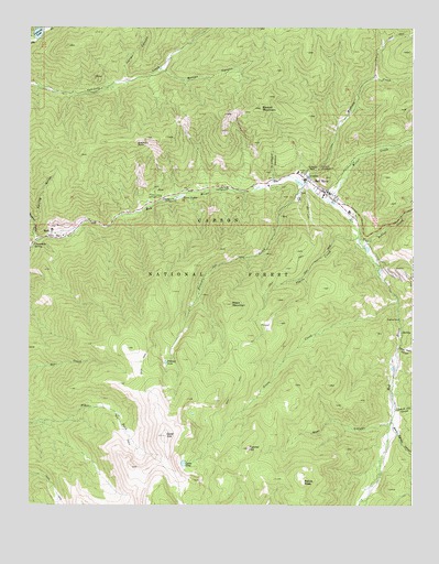
Red River, NM USGS Topographic Map
Click on map above to begin viewing in our Map Viewer.

This topographic map contains these locations and features:
Feature Name Type Latitude Longitude GNIS ID View Map
Ajax Tunnel ProspectMineN36.7006°W105.4181°916648View Map
Anderson ProspectMineN36.6864°W105.3764°916649View Map
Bear CanyonValleyN36.6464°W105.3825°903628View Map
Beverly ProspectMineN36.6934°W105.3894°937209View Map
Bitter CreekStreamN36.7045°W105.4028°903845View Map
Bitter Creek Group MineMineN36.7175°W105.3936°917813View Map
Bitter Creek Placer MineMineN36.7175°W105.3936°917814View Map
Black Copper CanyonValleyN36.6445°W105.3811°903859View Map
Black MountainSummitN36.6778°W105.4339°903884View Map
Bobcat CreekStreamN36.6945°W105.3925°903976View Map
Bonito CanyonValleyN36.7386°W105.4553°903997View Map
Brigham J Young House Historic SiteBuildingN36.7081°W105.4061°934464View Map
Buffalo MineMineN36.6831°W105.4136°917781View Map
Bunker Hill GroupMineN36.6623°W105.4381°916643View Map
Bunker Hill MineMineN36.6656°W105.4400°899173View Map
Cabresta CanyonMineN36.7389°W105.4925°916414View Map
Cabresto LakeLakeN36.7484°W105.4972°904287View Map
Cabresto LakeReservoirN36.7485°W105.4971°924017View Map
Cabresto Lake CampgroundLocaleN36.7467°W105.4992°899176View Map
Cabresto Lake ProspectMineN36.7495°W105.4989°917750View Map
Caribel MineMineN36.6750°W105.4506°917751View Map
Chambers SpringSpringN36.6934°W105.4989°905017View Map
Copper King MineMineN36.7023°W105.4058°916647View Map
Creek Tunnel ProspectMineN36.6909°W105.4228°917785View Map
Crowe AditMineN36.6842°W105.4417°917818View Map
Edward P Westoby Cabin Historic SiteBuildingN36.7081°W105.4061°934411View Map
Elephant RockPillarN36.7195°W105.4644°906114View Map
Elephant Rock CampgroundLocaleN36.7056°W105.4517°906116View Map
Entrance Tunnel ProspectMineN36.7073°W105.4119°916638View Map
Esther ProspectMineN36.7064°W105.3978°917749View Map
Ethel GroupMineN36.7150°W105.3992°916639View Map
Faith Mountain Fellowship ChurchChurchN36.7081°W105.4061°902542View Map
Fawn LakesLakeN36.7060°W105.4505°906238View Map
Fawn Lakes CampgroundLocaleN36.7059°W105.4567°906239View Map
Foster Park CanyonValleyN36.6661°W105.3800°906345View Map
Fourth of July CanyonValleyN36.6495°W105.3806°906358View Map
Gilt Edge PlacerMineN36.7064°W105.4031°917788View Map
Gold HillSummitN36.6431°W105.4558°906611View Map
Gold Reef ProspectMineN36.6748°W105.4222°917824View Map
Golden GooseMineN36.6553°W105.4231°917790View Map
Golden Treasure GroupMineN36.6723°W105.4261°917825View Map
Goose CreekStreamN36.6789°W105.3800°906649View Map
Goose LakeLakeN36.6359°W105.4496°906651View Map
GraniteMineN36.7048°W105.3936°917826View Map
Graveyard CanyonValleyN36.7109°W105.4203°906723View Map
Hillside ProspectMineN36.6923°W105.4239°917834View Map
Hilltop Gold Placer ProspectMineN36.6820°W105.4042°916672View Map
Hornet GroupMineN36.7361°W105.4867°916673View Map
IndianaMineN36.7089°W105.4025°917828View Map
Inferno GroupMineN36.6778°W105.4344°917793View Map
IoneMineN36.7053°W105.3944°917830View Map
Iron King ProspectMineN36.7481°W105.4797°917829View Map
Italian CanyonValleyN36.7375°W105.4683°907264View Map
Jay Hawk MineMineN36.6778°W105.4231°916629View Map
Jefferson ProspectMineN36.6709°W105.4117°916666View Map
June Bug CampgroundLocaleN36.7078°W105.4347°907482View Map
Lone Star LodeMineN36.6867°W105.4067°917798View Map
Mallette CampgroundLocaleN36.7131°W105.4056°908376View Map
Mallette CreekStreamN36.7092°W105.4100°908377View Map
Melson-Oldham Cabin Historic SiteBuildingN36.7081°W105.4061°934327View Map
Moberg GroupMineN36.6911°W105.4283°916661View Map
MolyPopulated PlaceN36.6970°W105.4928°908829View Map
Nashville ProspectMineN36.6681°W105.4239°917835View Map
Orin Mallette Cabin Historic SiteBuildingN36.7081°W105.4061°934328View Map
Pierce-Fuller House Historic SiteBuildingN36.7081°W105.4061°934456View Map
Pioneer CreekStreamN36.7092°W105.4100°909732View Map
Pioneer LakeLakeN36.6625°W105.4555°909733View Map
Placer CreekStreamN36.6953°W105.3928°909746View Map
Purkapile ProspectMineN36.6903°W105.4036°916626View Map
Questa Ranger DistrictForestN36.6878°W105.4347°2038639View Map
Ragged Pants Dick ProspectMineN36.6895°W105.3800°917802View Map
Raton GroupMineN36.6648°W105.4322°917803View Map
Red RiverPopulated PlaceN36.7081°W105.4061°910074View Map
Red River Community HouseChurchN36.7081°W105.4061°902585View Map
Red River Elementary SchoolSchoolN36.7081°W105.4061°933890View Map
Red River Fire DepartmentBuildingN36.7083°W105.4057°2657698View Map
Red River Police DepartmentBuildingN36.7079°W105.4051°2722513View Map
Red River Post OfficePost OfficeN36.7087°W105.4069°937901View Map
Red River SchoolhouseSchoolN36.7081°W105.4061°935965View Map
Red River Ski AreaLocaleN36.7075°W105.4158°899177View Map
Red River Weather StationLocaleN36.7081°W105.4061°932552View Map
Relica PeakSummitN36.6311°W105.4106°910117View Map
Saint Edwin ChapelChurchN36.7131°W105.4092°910521View Map
Saint Edwins Catholic ChurchChurchN36.7081°W105.4061°902541View Map
Sampson ProspectMineN36.7067°W105.4231°917806View Map
Sawmill MountainSummitN36.7289°W105.4239°910847View Map
Scarlet GroupMineN36.6723°W105.4175°916658View Map
Silver King ProspectMineN36.7306°W105.4872°917838View Map
Silver Tip GroupMineN36.6953°W105.4192°917807View Map
Spring GulchValleyN36.6989°W105.4981°911331View Map
Stella ProspectMineN36.6867°W105.4281°916622View Map
Sulphur GulchValleyN36.6953°W105.4981°911478View Map
Sylvester M Mallette Cabin Historic SiteBuildingN36.7081°W105.4061°934410View Map
Sylvia TunnelMineN36.6798°W105.4239°917809View Map
Tom BoyMineN36.6867°W105.4369°917811View Map
Town of Red RiverCivilN36.7038°W105.3978°2412537View Map
Tunnel HillSummitN36.6398°W105.4283°911855View Map
Victor Number Two ProspectMineN36.7045°W105.4428°917844View Map
Wheeler Peak Fire DistrictBuildingN36.6504°W105.3787°2657612View Map
Willard ProspectMineN36.6986°W105.3975°917845View Map
Willow ForkStreamN36.6467°W105.4958°899174View Map
Willow PlacerMineN36.7092°W105.4211°916656View Map

Note: Coordinates in the location and feature list above are referenced to NAD83 datum.


Copyright (C) 2008-2024 Ryan Niemi / Sunset Dynamics ... All Rights Reserved