TopoQuest Logo
Do you find TopoQuest useful?
Help keep TopoQuest running and adding new maps/features by donating!
Bitcoin:  19c7KJd3qBynnjoSw5npx9KScwjBe4ifkT
Litecoin:  LXs6TkuXGGXo1vDsWCkWVdjQX94eUKd6ui
Home View Maps Find Maps Find Places Resources & Links


Charlotteville, New York Topographic Map

USGS Map Title: Charlotteville, NY
USGS Map MRC: 42074E6
DRG (GeoTIFF) Download: o42074e6.tif


Neighboring USGS Topographic Map Quads:


  Westford, NY  
42074F7
 

  South Valley, NY  
42074F6
 

  Richmondville, NY  
42074F5
 

  Schenevus, NY  
42074E7
 

  Charlotteville, NY  
42074E6
 

  Summit, NY  
42074E5
 

  Davenport, NY  
42074D7
 

  Harpersfield, NY  
42074D6
 

  Stamford, NY  
42074D5


Map MRC Location:

N43°
W75°
N43°
W74°
H8 H7 H6 H5 H4 H3 H2 H1
G8 G7 G6 G5 G4 G3 G2 G1
F8 F7 F6 F5 F4 F3 F2 F1
E8 E7 E6 E5 E4 E3 E2 E1
D8 D7 D6 D5 D4 D3 D2 D1
C8 C7 C6 C5 C4 C3 C2 C1
B8 B7 B6 B5 B4 B3 B2 B1
A8 A7 A6 A5 A4 A3 A2 A1
N42°
W75°
N42°
W74°

Charlotteville, NY USGS 1:24K Topographic Map Preview:
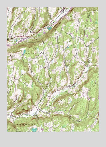
Charlotteville, NY USGS Topographic Map
Click on map above to begin viewing in our Map Viewer.

This topographic map contains these locations and features:
Feature Name Type Latitude Longitude GNIS ID View Map
ArabiaPopulated PlaceN42.5340°W74.6357°972171View Map
Baird CornersLocaleN42.5123°W74.6274°942808View Map
Barton CornersLocaleN42.5426°W74.6982°943116View Map
Center ValleyValleyN42.5231°W74.7085°946203View Map
Center Valley School (historical)SchoolN42.5581°W74.6932°977452View Map
Central School (historical)SchoolN42.5922°W74.7453°2106389View Map
CharlottevillePopulated PlaceN42.5454°W74.6646°946420View Map
Charlotteville CemeteryCemeteryN42.5486°W74.6643°2554860View Map
Charlotteville Post OfficePost OfficeN42.5449°W74.6663°2617859View Map
Charlotteville Volunteer Fire DepartmentBuildingN42.5449°W74.6662°2735230View Map
Clapper HollowValleyN42.5209°W74.6957°946730View Map
Clapper Hollow CreekStreamN42.5234°W74.6996°977490View Map
Clapper Hollow School (historical)SchoolN42.5215°W74.6646°977453View Map
Dugway CemeteryCemeteryN42.5219°W74.7022°948771View Map
East WorcesterPopulated PlaceN42.6234°W74.6715°970104View Map
East Worcester CemeteryCemeteryN42.6200°W74.6784°2558765View Map
East Worcester Hose Company 1BuildingN42.6226°W74.6729°2735147View Map
Fox CemeteryCemeteryN42.5667°W74.6669°2554863View Map
Fuller District School Number Four (historical)SchoolN42.5012°W74.6896°977489View Map
Hall School (historical)SchoolN42.5506°W74.7393°977457View Map
Hollenbeck School (historical)SchoolN42.5798°W74.7024°977458View Map
Hudson LakeLakeN42.6039°W74.6916°953390View Map
LutheranvillePopulated PlaceN42.5848°W74.6410°972746View Map
Lutheranville CemeteryCemeteryN42.5856°W74.6401°2554861View Map
Meade HillSummitN42.5404°W74.6521°956869View Map
Methodist Church CemeteryCemeteryN42.5438°W74.6678°2554862View Map
Mud Lake School (historical)SchoolN42.5951°W74.6807°977460View Map
Oak CreekStreamN42.6117°W74.6826°959095View Map
Oliver School (historical)SchoolN42.5667°W74.6296°977461View Map
Pine HillSummitN42.5379°W74.7096°960465View Map
Post CemeteryCemeteryN42.5945°W74.6599°961010View Map
Saint Josephs Catholic ChurchChurchN42.5936°W74.7455°2597911View Map
Saint Josephs CemeteryCemeteryN42.5941°W74.7457°2558766View Map
School Number 15 (historical)SchoolN42.5662°W74.6690°977469View Map
School Number 9 (historical)SchoolN42.5856°W74.6392°2106785View Map
Snooks CemeteryCemeteryN42.5658°W74.6411°965577View Map
South WorcesterPopulated PlaceN42.5179°W74.7499°965892View Map
Strain CemeteryCemeteryN42.5170°W74.7382°966615View Map
Strain MountainSummitN42.5251°W74.7238°966616View Map
Tannery Hill CemeteryCemeteryN42.5664°W74.6673°2554859View Map
Titus LakeLakeN42.5018°W74.7124°967565View Map
Titus Lake CemeteryCemeteryN42.5004°W74.7354°967564View Map
Town of WorcesterCivilN42.5834°W74.7142°979656View Map
Wayman HillSummitN42.5309°W74.6785°968951View Map
Worcester Census Designated PlaceCensusN42.6018°W74.7490°2628193View Map
Worcester Free LibraryBuildingN42.5920°W74.7486°2598965View Map
Worcester SchoolSchoolN42.5923°W74.7455°2597197View Map
Worcester Westbound Rest AreaLocaleN42.6089°W74.6854°2598945View Map

Note: Coordinates in the location and feature list above are referenced to NAD83 datum.


Copyright (C) 2008-2024 Ryan Niemi / Sunset Dynamics ... All Rights Reserved