TopoQuest Logo
Do you find TopoQuest useful?
Help keep TopoQuest running and adding new maps/features by donating!
Bitcoin:  19c7KJd3qBynnjoSw5npx9KScwjBe4ifkT
Litecoin:  LXs6TkuXGGXo1vDsWCkWVdjQX94eUKd6ui
Home View Maps Find Maps Find Places Resources & Links


Chatfield, Minnesota Topographic Map

USGS Map Title: Chatfield, MN
USGS Map MRC: 43092G2
DRG (GeoTIFF) Download: o43092g2.tif


Neighboring USGS Topographic Map Quads:


  Marion, MN  
43092H3
 

  Eyota, MN  
43092H2
 

  Saint Charles, MN  
43092H1
 

  Washington, MN  
43092G3
 

  Chatfield, MN  
43092G2
 

  Pilot Mound, MN  
43092G1
 

  Wykoff, MN  
43092F3
 

  Fountain, MN  
43092F2
 

  Preston, MN  
43092F1


Map MRC Location:

N44°
W93°
N44°
W92°
H8 H7 H6 H5 H4 H3 H2 H1
G8 G7 G6 G5 G4 G3 G2 G1
F8 F7 F6 F5 F4 F3 F2 F1
E8 E7 E6 E5 E4 E3 E2 E1
D8 D7 D6 D5 D4 D3 D2 D1
C8 C7 C6 C5 C4 C3 C2 C1
B8 B7 B6 B5 B4 B3 B2 B1
A8 A7 A6 A5 A4 A3 A2 A1
N43°
W93°
N43°
W92°

Chatfield, MN USGS 1:24K Topographic Map Preview:
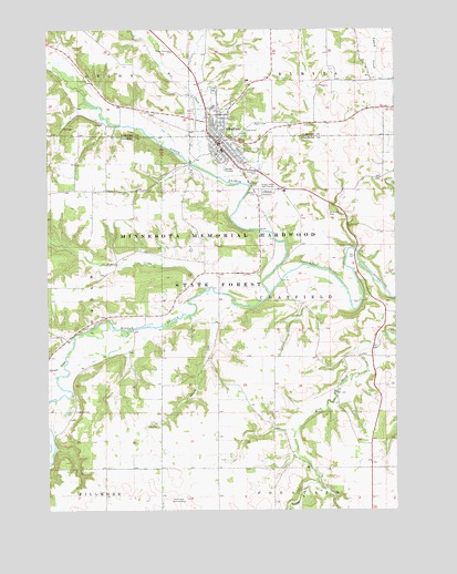
Chatfield, MN USGS Topographic Map
Click on map above to begin viewing in our Map Viewer.

This topographic map contains these locations and features:
Feature Name Type Latitude Longitude GNIS ID View Map
Bear CreekStreamN43.8072°W92.1932°639756View Map
Calvary Baptist ChurchChurchN43.8416°W92.1802°2050677View Map
Calvary CemeteryCemeteryN43.8329°W92.1735°640744View Map
Carson CreekStreamN43.7891°W92.2435°640939View Map
ChatfieldPopulated PlaceN43.8455°W92.1891°641133View Map
Chatfield Ambulance ServiceBuildingN43.8459°W92.1889°2721238View Map
Chatfield CemeteryCemeteryN43.8329°W92.1704°641134View Map
Chatfield Fire DepartmentBuildingN43.8444°W92.1870°2050674View Map
Chatfield Historical MarkerParkN43.8394°W92.1766°2050844View Map
Chatfield Junior and Senior High SchoolSchoolN43.8547°W92.1903°2069194View Map
Chatfield Lutheran ChurchChurchN43.8455°W92.1863°2050681View Map
Chatfield Police DepartmentBuildingN43.8464°W92.1885°2050675View Map
Chatfield Post OfficePost OfficeN43.8447°W92.1888°2050673View Map
Chatfield Public LibraryBuildingN43.8452°W92.1882°2050672View Map
Chatfield United Methodist ChurchChurchN43.8472°W92.1869°2069193View Map
Chosen Valley Care CenterHospitalN43.8414°W92.1774°2050682View Map
Chosen Valley Elementary SchoolSchoolN43.8433°W92.1871°2050683View Map
Chosen Valley Golf CourseLocaleN43.8339°W92.1679°659806View Map
City of ChatfieldCivilN43.8445°W92.1829°2393810View Map
Jordan CreekStreamN43.7844°W92.2471°645737View Map
Kohlmeyer Airport (historical)AirportN43.7530°W92.2035°660169View Map
Loughrey CemeteryCemeteryN43.7758°W92.2415°647219View Map
Middle Branch Root RiverStreamN43.8066°W92.1704°647799View Map
Mill CreekStreamN43.8372°W92.1896°647847View Map
North Branch Root RiverStreamN43.8066°W92.1704°648617View Map
Parsley BridgeBridgeN43.8177°W92.1393°2050848View Map
Parsley Bridge Rest AreaLocaleN43.8169°W92.1404°2050849View Map
Pioneer Presbyterian ChurchChurchN43.8461°W92.1874°2050680View Map
Ray Waller DamDamN43.8316°W92.1652°1776447View Map
Ronald Gehling DamDamN43.7800°W92.2252°1777240View Map
Saint Mary's Catholic ChurchChurchN43.8433°W92.1888°2050676View Map
Saint Marys CemeteryCemeteryN43.8269°W92.1488°650844View Map
Saint Matthew's Episcopal ChurchChurchN43.8469°W92.1885°2050678View Map
Saint Paul CemeteryCemeteryN43.8338°W92.1757°650955View Map
Saint Paul Lutheran ChurchChurchN43.8464°W92.1882°2050679View Map
Shady CreekStreamN43.8039°W92.1838°651883View Map
Sugar CreekStreamN43.7577°W92.1532°652769View Map
Township of ChatfieldCivilN43.8021°W92.1475°663787View Map

Note: Coordinates in the location and feature list above are referenced to NAD83 datum.


Copyright (C) 2008-2024 Ryan Niemi / Sunset Dynamics ... All Rights Reserved