TopoQuest Logo
Do you find TopoQuest useful?
Help keep TopoQuest running and adding new maps/features by donating!
Bitcoin:  19c7KJd3qBynnjoSw5npx9KScwjBe4ifkT
Litecoin:  LXs6TkuXGGXo1vDsWCkWVdjQX94eUKd6ui
Home View Maps Find Maps Find Places Resources & Links


Fountain, Minnesota Topographic Map

USGS Map Title: Fountain, MN
USGS Map MRC: 43092F2
DRG (GeoTIFF) Download: o43092f2.tif


Neighboring USGS Topographic Map Quads:


  Washington, MN  
43092G3
 

  Chatfield, MN  
43092G2
 

  Pilot Mound, MN  
43092G1
 

  Wykoff, MN  
43092F3
 

  Fountain, MN  
43092F2
 

  Preston, MN  
43092F1
 

  Cherry Grove, MN  
43092E3
 

  Greenleafton, MN  
43092E2
 

  Harmony, MN  
43092E1


Map MRC Location:

N44°
W93°
N44°
W92°
H8 H7 H6 H5 H4 H3 H2 H1
G8 G7 G6 G5 G4 G3 G2 G1
F8 F7 F6 F5 F4 F3 F2 F1
E8 E7 E6 E5 E4 E3 E2 E1
D8 D7 D6 D5 D4 D3 D2 D1
C8 C7 C6 C5 C4 C3 C2 C1
B8 B7 B6 B5 B4 B3 B2 B1
A8 A7 A6 A5 A4 A3 A2 A1
N43°
W93°
N43°
W92°

Fountain, MN USGS 1:24K Topographic Map Preview:
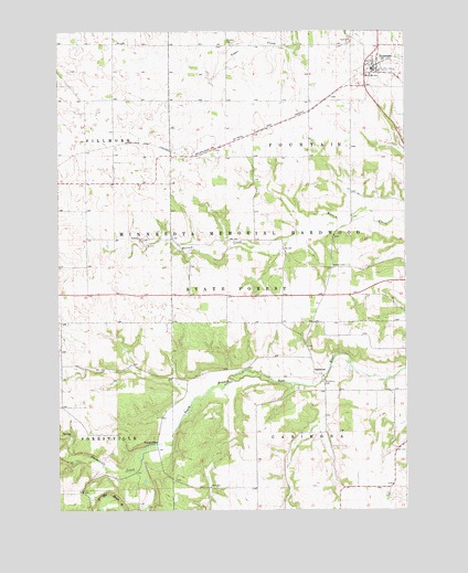
Fountain, MN USGS Topographic Map
Click on map above to begin viewing in our Map Viewer.

This topographic map contains these locations and features:
Feature Name Type Latitude Longitude GNIS ID View Map
CarimonaPopulated PlaceN43.6602°W92.1577°640893View Map
Carimona CemeteryCemeteryN43.6583°W92.1546°640894View Map
Carimona Post Office (historical)Post OfficeN43.6602°W92.1577°2050640View Map
City of FountainCivilN43.7425°W92.1342°2394801View Map
Duff CemeteryCemeteryN43.6300°W92.2082°2050801View Map
Eickhoff Detention DamDamN43.7316°W92.1968°1777091View Map
Erickson Detention DamDamN43.7333°W92.2002°1777092View Map
Fillmore County AirportAirportN43.6768°W92.1797°660363View Map
Fillmore County Historical CenterBuildingN43.7400°W92.1363°2050859View Map
ForestvillePopulated PlaceN43.6427°W92.2149°654708View Map
Forestville BridgeBridgeN43.6425°W92.2149°2050847View Map
Forestville CreekStreamN43.6408°W92.2204°643817View Map
Forestville Post Office (historical)Post OfficeN43.6427°W92.2149°2050627View Map
Forestville State ParkParkN43.6255°W92.2474°2050840View Map
FountainPopulated PlaceN43.7400°W92.1363°643839View Map
Fountain (historical)LocaleN43.7400°W92.1363°2050855View Map
Fountain Fire DepartmentBuildingN43.7408°W92.1367°2666213View Map
Fountain Lutheran ChurchChurchN43.7400°W92.1363°2050858View Map
Fountain Methodist ChurchChurchN43.7400°W92.1363°2050857View Map
Fountain Police DepartmentBuildingN43.7402°W92.1366°2758705View Map
Fountain Post OfficePost OfficeN43.7400°W92.1363°2050856View Map
Geology of Sinkholes Historical MarkerParkN43.7389°W92.1388°2050843View Map
KFIL-AM (Preston)TowerN43.6800°W92.1410°662972View Map
KFIL-FM (Preston)TowerN43.6800°W92.1410°663106View Map
Otto Meyer DamDamN43.6550°W92.2335°1776448View Map
Pioneer CemeteryCemeteryN43.6527°W92.2390°2050797View Map
Township of CarimonaCivilN43.6303°W92.1498°663749View Map
Township of FillmoreCivilN43.7174°W92.2393°664166View Map
Township of FountainCivilN43.7171°W92.1505°664208View Map
Watson CemeteryCemeteryN43.6886°W92.1460°653845View Map
Winslow CemeteryCemeteryN43.7463°W92.1879°654274View Map

Note: Coordinates in the location and feature list above are referenced to NAD83 datum.


Copyright (C) 2008-2025 Ryan Niemi / Sunset Dynamics ... All Rights Reserved