TopoQuest Logo
Do you find TopoQuest useful?
Help keep TopoQuest running and adding new maps/features by donating!
Bitcoin:  19c7KJd3qBynnjoSw5npx9KScwjBe4ifkT
Litecoin:  LXs6TkuXGGXo1vDsWCkWVdjQX94eUKd6ui
Home View Maps Find Maps Find Places Resources & Links


Chatham, Michigan Topographic Map

USGS Map Title: Chatham, MI
USGS Map MRC: 46086C8
DRG (GeoTIFF) Download: o46086c8.tif


Neighboring USGS Topographic Map Quads:


  Sand River, MI  
46087D1
 

  Rock River, MI  
46086D8
 

  Au Train, MI  
46086D7
 

  Ladoga, MI  
46087C1
 

  Chatham, MI  
46086C8
 

  Forest Lake, MI  
46086C7
 

  Diffin, MI  
46087B1
 

  Trenary, MI  
46086B8
 

  Lake Stella, MI  
46086B7


Map MRC Location:

N47°
W87°
N47°
W86°
H8 H7 H6 H5 H4 H3 H2 H1
G8 G7 G6 G5 G4 G3 G2 G1
F8 F7 F6 F5 F4 F3 F2 F1
E8 E7 E6 E5 E4 E3 E2 E1
D8 D7 D6 D5 D4 D3 D2 D1
C8 C7 C6 C5 C4 C3 C2 C1
B8 B7 B6 B5 B4 B3 B2 B1
A8 A7 A6 A5 A4 A3 A2 A1
N46°
W87°
N46°
W86°

Chatham, MI USGS 1:24K Topographic Map Preview:
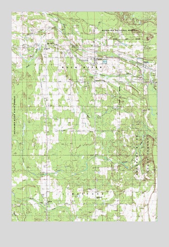
Chatham, MI USGS Topographic Map
Click on map above to begin viewing in our Map Viewer.

This topographic map contains these locations and features:
Feature Name Type Latitude Longitude GNIS ID View Map
Black CreekStreamN46.3049°W86.8835°1619274View Map
Bohemian CreekStreamN46.3286°W86.8788°1623142View Map
Calvary Free Lutheran ChurchChurchN46.3553°W86.9661°2352340View Map
ChathamPopulated PlaceN46.3477°W86.9290°1619481View Map
Chatham CornersLocaleN46.3333°W86.9288°623131View Map
Chatham Hill Ski AreaLocaleN46.3569°W86.8868°1625096View Map
Chatham Landing Strip (historical)AirportN46.3619°W86.9065°1625095View Map
Chatham ParkParkN46.3355°W86.9293°1622626View Map
Chatham Post OfficePost OfficeN46.3478°W86.9261°2352348View Map
Chatham Ski TrailTrailN46.3613°W86.8921°1622679View Map
Chatham Station (historical)LocaleN46.3478°W86.9289°2352345View Map
Eben JunctionPopulated PlaceN46.3549°W86.9701°625319View Map
Eben Junction Post OfficePost OfficeN46.3546°W86.9712°2352339View Map
Eben Junction Station (historical)LocaleN46.3550°W86.9706°2352338View Map
Ivars CreekStreamN46.3430°W86.8788°1622236View Map
Ivars PondLakeN46.3470°W86.8907°1617002View Map
Johnson CreekStreamN46.3055°W86.8832°1620376View Map
Laakso LakeLakeN46.3471°W86.9897°1622235View Map
LimestonePopulated PlaceN46.2608°W86.9293°630437View Map
Limestone Baptist ChurchChurchN46.2631°W86.9278°2352336View Map
Limestone Post Office (historical)Post OfficeN46.2614°W86.9281°2352337View Map
Limestone Township CemeteryCemeteryN46.2600°W86.9278°2352392View Map
Michigan State University UP Research StationLocaleN46.3527°W86.9335°1622627View Map
Mikulich General Store Historical MarkerParkN46.2608°W86.9681°2352401View Map
North Branch Slapneck CreekStreamN46.3613°W86.9532°1621034View Map
Old Apostolic Lutheran ChurchChurchN46.3442°W86.9292°2352347View Map
Pine Grove CemeteryCemeteryN46.3539°W86.8882°634929View Map
Rock River Township Fire DepartmentBuildingN46.3474°W86.9312°2352349View Map
Rock River Township Recreation AreaParkN46.3474°W86.9376°1622266View Map
Sion Lutheran ChurchChurchN46.3431°W86.9292°2352346View Map
SlapneckPopulated PlaceN46.3427°W86.8865°1617853View Map
South Branch Slapneck CreekStreamN46.3636°W86.9718°638313View Map
Superior Central SchoolSchoolN46.3529°W86.9717°1622265View Map
Township of Rock RiverCivilN46.3412°W86.9957°1626993View Map
TraunikPopulated PlaceN46.2608°W86.9696°1621939View Map
Traunik Post OfficePost OfficeN46.2608°W86.9697°2352359View Map
Village of ChathamCivilN46.3441°W86.9313°2397607View Map

Note: Coordinates in the location and feature list above are referenced to NAD83 datum.


Copyright (C) 2008-2025 Ryan Niemi / Sunset Dynamics ... All Rights Reserved