TopoQuest Logo
Do you find TopoQuest useful?
Help keep TopoQuest running and adding new maps/features by donating!
Bitcoin:  19c7KJd3qBynnjoSw5npx9KScwjBe4ifkT
Litecoin:  LXs6TkuXGGXo1vDsWCkWVdjQX94eUKd6ui
Home View Maps Find Maps Find Places Resources & Links


Chef Menteur, Louisiana Topographic Map

USGS Map Title: Chef Menteur, LA
USGS Map MRC: 30089A7
DRG (GeoTIFF) Download: o30089a7.tif


Neighboring USGS Topographic Map Quads:


  South Point, LA  
30089B8
 

  North Shore, LA  
30089B7
 

  Rigolets, LA  
30089B6
 

  Little Woods, LA  
30089A8
 

  Chef Menteur, LA  
30089A7
 

  Alligator Point, LA  
30089A6
 

  Chalmette, LA  
29089H8
 

  Martello Castle, LA  
29089H7
 

  Proctor Point, LA  
29089H6


Map MRC Location:

N31°
W90°
N31°
W89°
H8 H7 H6 H5 H4 H3 H2 H1
G8 G7 G6 G5 G4 G3 G2 G1
F8 F7 F6 F5 F4 F3 F2 F1
E8 E7 E6 E5 E4 E3 E2 E1
D8 D7 D6 D5 D4 D3 D2 D1
C8 C7 C6 C5 C4 C3 C2 C1
B8 B7 B6 B5 B4 B3 B2 B1
A8 A7 A6 A5 A4 A3 A2 A1
N30°
W90°
N30°
W89°

Chef Menteur, LA USGS 1:24K Topographic Map Preview:
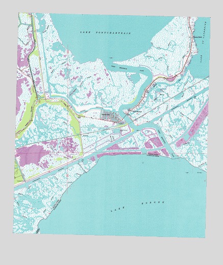
Chef Menteur, LA USGS Topographic Map
Click on map above to begin viewing in our Map Viewer.

This topographic map contains these locations and features:
Feature Name Type Latitude Longitude GNIS ID View Map
Bayou CatherineBayN30.0513°W89.7573°532494View Map
Bayou CedarGutN30.0821°W89.7784°532495View Map
Bayou CharleauxBayN30.0693°W89.7674°532501View Map
Bayou CheveeGutN30.0949°W89.8490°532511View Map
Bayou de LesaireGutN30.1066°W89.7634°559634View Map
Bayou DupontBayN30.0569°W89.7742°532583View Map
Bayou GentillyGutN30.0455°W89.8498°559646View Map
Bayou LecheBayN30.0280°W89.8538°532667View Map
Bayou LecheGutN30.0235°W89.8667°532668View Map
Bayou MariaGutN30.0796°W89.7823°532683View Map
Bayou MartinezGutN30.0555°W89.8126°532686View Map
Bayou SauvageGutN30.0638°W89.8665°532770View Map
Bayou Sauvage National Wildlife RefugeParkN30.0475°W89.8419°1958662View Map
Bayou ThomasGutN30.0602°W89.8365°532792View Map
Big Cedar BayouStreamN30.1096°W89.7878°539323View Map
Brothers BayouStreamN30.0835°W89.8376°540713View Map
Chef MenteurPopulated PlaceN30.0696°W89.8020°543076View Map
Chef Menteur PassBayN30.0507°W89.7754°559668View Map
Chico LagoonLakeN30.0793°W89.8381°556548View Map
Fort Macomb (historical)MilitaryN30.0647°W89.8039°558222View Map
Fort Macomb State Historic SiteParkN30.0646°W89.8042°558021View Map
Fourth Island BayouBayN30.0291°W89.8470°540709View Map
Greens DitchPopulated PlaceN30.1138°W89.7612°535401View Map
Irish Bayou CanalCanalN30.1038°W89.8651°535944View Map
Little Cedar BayouStreamN30.1055°W89.7912°539485View Map
Marquez CanalCanalN30.0680°W89.8028°540706View Map
New Orleans Fire Department Engine 31BuildingN30.0654°W89.8136°2332690View Map
New Orleans Police DepartmentBuildingN30.0648°W89.8070°2333925View Map
Saint Catherines IslandIslandN30.1099°W89.7717°557913View Map
Stump BayouGutN30.1158°W89.8559°539699View Map
Third Island BayouBayN30.0369°W89.8320°2564463View Map
Venetian IslesPopulated PlaceN30.0671°W89.8128°543757View Map

Note: Coordinates in the location and feature list above are referenced to NAD83 datum.


Copyright (C) 2008-2025 Ryan Niemi / Sunset Dynamics ... All Rights Reserved