TopoQuest Logo
Do you find TopoQuest useful?
Help keep TopoQuest running and adding new maps/features by donating!
Bitcoin:  19c7KJd3qBynnjoSw5npx9KScwjBe4ifkT
Litecoin:  LXs6TkuXGGXo1vDsWCkWVdjQX94eUKd6ui
Home View Maps Find Maps Find Places Resources & Links


Amboy, Georgia Topographic Map

USGS Map Title: Amboy, GA
USGS Map MRC: 31083G5
DRG (GeoTIFF) Download: o31083g5.tif


Neighboring USGS Topographic Map Quads:


  Penia, GA  
31083H6
 

  Pitts, GA  
31083H5
 

  Rochelle, GA  
31083H4
 

  Arabi, GA  
31083G6
 

  Amboy, GA  
31083G5
 

  Rebecca, GA  
31083G4
 

  Ashburn, GA  
31083F6
 

  Bethel, GA  
31083F5
 

  Irwinville, GA  
31083F4


Map MRC Location:

N32°
W84°
N32°
W83°
H8 H7 H6 H5 H4 H3 H2 H1
G8 G7 G6 G5 G4 G3 G2 G1
F8 F7 F6 F5 F4 F3 F2 F1
E8 E7 E6 E5 E4 E3 E2 E1
D8 D7 D6 D5 D4 D3 D2 D1
C8 C7 C6 C5 C4 C3 C2 C1
B8 B7 B6 B5 B4 B3 B2 B1
A8 A7 A6 A5 A4 A3 A2 A1
N31°
W84°
N31°
W83°

Amboy, GA USGS 1:24K Topographic Map Preview:
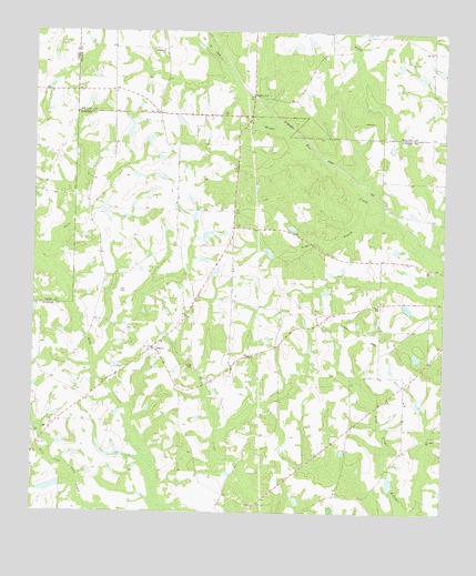
Amboy, GA USGS Topographic Map
Click on map above to begin viewing in our Map Viewer.

This topographic map contains these locations and features:
Feature Name Type Latitude Longitude GNIS ID View Map
Amboy Baptist ChurchChurchN31.7943°W83.5857°343178View Map
ArmboyPopulated PlaceN31.7924°W83.5874°310617View Map
Burges School (historical)SchoolN31.7591°W83.5427°343187View Map
Date Lake DamDamN31.7735°W83.5699°342256View Map
Deep Creek School (historical)SchoolN31.7680°W83.6232°343198View Map
Double RunPopulated PlaceN31.8582°W83.5582°355525View Map
Double Run Missionary Baptist ChurchChurchN31.8627°W83.5604°345468View Map
Durham School (historical)SchoolN31.8332°W83.5810°343199View Map
Felder (historical)Populated PlaceN31.8241°W83.5641°343200View Map
Gibbs LakeReservoirN31.8224°W83.5720°340899View Map
Gibbs Lake DamDamN31.8218°W83.5732°340898View Map
Gilmore School (historical)SchoolN31.7855°W83.5249°343205View Map
Hobby LakeReservoirN31.7565°W83.6191°337264View Map
Hobby Lake DamDamN31.7568°W83.6166°337263View Map
Kings BranchStreamN31.8318°W83.5232°316441View Map
Oak Hill Church (historical)ChurchN31.7724°W83.5499°343217View Map
Oklahoma CemeteryCemeteryN31.8704°W83.5879°345485View Map
Oklahoma ChurchChurchN31.8702°W83.5860°319937View Map
Pate CemeteryCemeteryN31.8074°W83.5982°320258View Map
Pate LakeReservoirN31.7735°W83.5699°342257View Map
Pates BranchStreamN31.8135°W83.6207°320260View Map
Pleasant Grove ChurchChurchN31.8327°W83.5641°343220View Map
Rainey CemeteryCemeteryN31.7880°W83.5757°321286View Map
Rebecca DivisionCivilN31.7868°W83.5311°1936484View Map
Saint Lukes ChurchChurchN31.7691°W83.5049°322158View Map
Shinglers (historical)Populated PlaceN31.7705°W83.6241°343231View Map
Tom Halls PondReservoirN31.7908°W83.5081°343237View Map
Turner County Fire and Rescue Amboy StationBuildingN31.7929°W83.5889°2604736View Map
Webbs Chapel (historical)ChurchN31.8535°W83.5954°343246View Map
Whelchel LakeReservoirN31.8502°W83.6116°342255View Map
Whelchel Lake DamDamN31.8502°W83.6116°342254View Map

Note: Coordinates in the location and feature list above are referenced to NAD83 datum.


Copyright (C) 2008-2024 Ryan Niemi / Sunset Dynamics ... All Rights Reserved