TopoQuest Logo
Do you find TopoQuest useful?
Help keep TopoQuest running and adding new maps/features by donating!
Bitcoin:  19c7KJd3qBynnjoSw5npx9KScwjBe4ifkT
Litecoin:  LXs6TkuXGGXo1vDsWCkWVdjQX94eUKd6ui
Home View Maps Find Maps Find Places Resources & Links


Ashburn, Georgia Topographic Map

USGS Map Title: Ashburn, GA
USGS Map MRC: 31083F6
DRG (GeoTIFF) Download: o31083f6.tif


Neighboring USGS Topographic Map Quads:


  Pateville, GA  
31083G7
 

  Arabi, GA  
31083G6
 

  Amboy, GA  
31083G5
 

  Cuffietown, GA  
31083F7
 

  Ashburn, GA  
31083F6
 

  Bethel, GA  
31083F5
 

  Sylvester, GA  
31083E7
 

  Sumner, GA  
31083E6
 

  Chula, GA  
31083E5


Map MRC Location:

N32°
W84°
N32°
W83°
H8 H7 H6 H5 H4 H3 H2 H1
G8 G7 G6 G5 G4 G3 G2 G1
F8 F7 F6 F5 F4 F3 F2 F1
E8 E7 E6 E5 E4 E3 E2 E1
D8 D7 D6 D5 D4 D3 D2 D1
C8 C7 C6 C5 C4 C3 C2 C1
B8 B7 B6 B5 B4 B3 B2 B1
A8 A7 A6 A5 A4 A3 A2 A1
N31°
W84°
N31°
W83°

Ashburn, GA USGS 1:24K Topographic Map Preview:
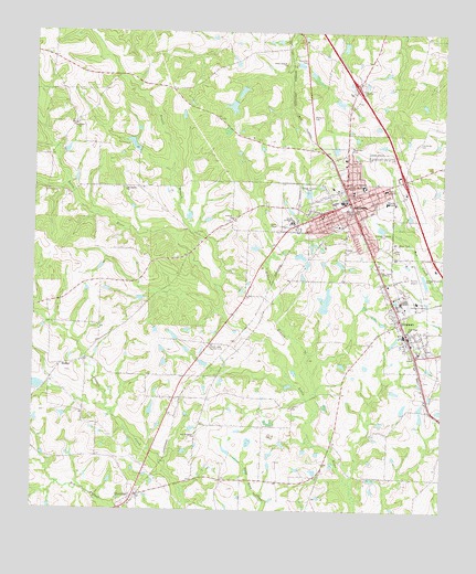
Ashburn, GA USGS Topographic Map
Click on map above to begin viewing in our Map Viewer.

This topographic map contains these locations and features:
Feature Name Type Latitude Longitude GNIS ID View Map
AshburnPopulated PlaceN31.7060°W83.6532°354404View Map
Ashburn BranchStreamN31.6493°W83.6638°310643View Map
Ashburn ChurchChurchN31.7010°W83.6885°354405View Map
Ashburn City HallBuildingN31.7041°W83.6524°343179View Map
Ashburn Division (historical)CensusN31.7280°W83.7049°1936086View Map
Ashburn Elementary SchoolSchoolN31.7093°W83.6496°343180View Map
Ashburn Fire and Emergency ServicesBuildingN31.7037°W83.6520°2603895View Map
Ashburn Methodist ChurchChurchN31.7099°W83.6552°343181View Map
Ashburn Police DepartmentBuildingN31.7038°W83.6519°2733871View Map
Ashburn Post OfficePost OfficeN31.7075°W83.6525°352142View Map
Ashburn-Sycamore DivisionCivilN31.6939°W83.6538°1936087View Map
Betts PondReservoirN31.6635°W83.6978°343185View Map
City of AshburnCivilN31.7096°W83.6528°2403117View Map
City of SycamoreCivilN31.6711°W83.6351°2405557View Map
County Line School (historical)SchoolN31.7391°W83.7232°343192View Map
CoverdalePopulated PlaceN31.6282°W83.7191°331466View Map
Exit 28CrossingN31.7116°W83.6368°1672962View Map
Exit 29CrossingN31.7357°W83.6518°1672963View Map
First Baptist ChurchChurchN31.7088°W83.6527°343201View Map
Friendship ChurchChurchN31.7091°W83.7218°314401View Map
Green Branch CemeteryCemeteryN31.7410°W83.6741°343207View Map
Green Branch ChurchChurchN31.7416°W83.6729°314822View Map
H E Jones LakeReservoirN31.6917°W83.6687°340903View Map
H E Jones Lake DamDamN31.6918°W83.6699°340902View Map
Henderson CemeteryCemeteryN31.7216°W83.6324°356255View Map
HobbyPopulated PlaceN31.6627°W83.7407°331998View Map
Little River School (historical)SchoolN31.6274°W83.6641°343214View Map
Nelson LakeReservoirN31.6577°W83.7495°340901View Map
Nelson Lake DamDamN31.6568°W83.7466°340900View Map
New Prospect ChurchChurchN31.6443°W83.7002°319501View Map
Newell BranchStreamN31.6835°W83.6927°319571View Map
Oak Grove Baptist ChurchChurchN31.7257°W83.7377°319777View Map
Rogers Plaza Shopping CenterLocaleN31.7057°W83.6518°343228View Map
Rose Hill CemeteryCemeteryN31.7204°W83.6540°321910View Map
Shingler School (historical)SchoolN31.6780°W83.7166°343230View Map
Story LakeReservoirN31.6797°W83.6606°337258View Map
Story Lake DamDamN31.6768°W83.6616°337257View Map
Sumners CemeteryCemeteryN31.7363°W83.6496°323747View Map
SycamorePopulated PlaceN31.6743°W83.6374°333176View Map
Sycamore Baptist ChurchChurchN31.6741°W83.6393°343235View Map
Sycamore Consolidated High School (historical)SchoolN31.6666°W83.6321°343236View Map
Sycamore Fire DepartmentBuildingN31.6705°W83.6363°2604924View Map
Sycamore Police DepartmentBuildingN31.6622°W83.6336°2734022View Map
Turner County AirportAirportN31.6884°W83.6350°351659View Map
Turner County CourthouseBuildingN31.7080°W83.6527°343239View Map
Turner County Elementary SchoolSchoolN31.6666°W83.6321°343240View Map
Turner County Fire and Rescue Coverdale StationBuildingN31.6334°W83.6918°2604737View Map
Turner County Fire and Rescue HeadquartersBuildingN31.7103°W83.6430°2604977View Map
Turner County High SchoolSchoolN31.7060°W83.6421°343241View Map
Turner County Industrial ParkLocaleN31.6807°W83.6368°343242View Map
Turner County JailBuildingN31.6861°W83.6394°343243View Map
Turner County Junior High SchoolSchoolN31.7005°W83.6713°343244View Map
Turner County Sheriff's OfficeBuildingN31.6860°W83.6394°2733642View Map
Turner Pre-Release CenterBuildingN31.6622°W83.6336°2735756View Map
Victoria Evans Memorial LibraryBuildingN31.7077°W83.6518°343245View Map
Wanee Lake Country ClubLocaleN31.6677°W83.6957°344378View Map
Ward Lake SouthReservoirN31.7318°W83.6866°342113View Map
Ward Lake South DamDamN31.7318°W83.6866°342112View Map
Ward Lake WestReservoirN31.7205°W83.7196°342115View Map
Ward Lake West DamDamN31.7202°W83.7182°342114View Map
Ward Pond NorthReservoirN31.7347°W83.6868°342111View Map
Ward Pond North DamDamN31.7352°W83.6866°342110View Map
WFFM-FM (Ashburn)TowerN31.6882°W83.6438°352611View Map
Widdons CemeteryCemeteryN31.7282°W83.6643°325247View Map
WNNQ-AM (Ashburn)TowerN31.6882°W83.6438°352332View Map
Zion Hope ChurchChurchN31.6727°W83.6354°325708View Map

Note: Coordinates in the location and feature list above are referenced to NAD83 datum.


Copyright (C) 2008-2024 Ryan Niemi / Sunset Dynamics ... All Rights Reserved