TopoQuest Logo
Do you find TopoQuest useful?
Help keep TopoQuest running and adding new maps/features by donating!
Bitcoin:  19c7KJd3qBynnjoSw5npx9KScwjBe4ifkT
Litecoin:  LXs6TkuXGGXo1vDsWCkWVdjQX94eUKd6ui
Home View Maps Find Maps Find Places Resources & Links


Cherokee Lake, Minnesota Topographic Map

USGS Map Title: Cherokee Lake, MN
USGS Map MRC: 47090H7
DRG (GeoTIFF) Download: o47090h7.tif


Neighboring USGS Topographic Map Quads:


  Gillis Lake, MN  
48090A8
 

  Long Island Lake, MN  
48090A7
 

  Gunflint Lake, MN  
48090A6
 

  Kelso Mountain, MN  
47090H8
 

  Cherokee Lake, MN  
47090H7
 

  Brule Lake, MN  
47090H6
 

  Beth Lake, MN  
47090G8
 

  Sawbill Camp, MN  
47090G7
 

  Tait Lake, MN  
47090G6


Map MRC Location:

N48°
W91°
N48°
W90°
H8 H7 H6 H5 H4 H3 H2 H1
G8 G7 G6 G5 G4 G3 G2 G1
F8 F7 F6 F5 F4 F3 F2 F1
E8 E7 E6 E5 E4 E3 E2 E1
D8 D7 D6 D5 D4 D3 D2 D1
C8 C7 C6 C5 C4 C3 C2 C1
B8 B7 B6 B5 B4 B3 B2 B1
A8 A7 A6 A5 A4 A3 A2 A1
N47°
W91°
N47°
W90°

Cherokee Lake, MN USGS 1:24K Topographic Map Preview:
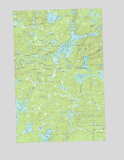
Cherokee Lake, MN USGS Topographic Map
Click on map above to begin viewing in our Map Viewer.

This topographic map contains these locations and features:
Feature Name Type Latitude Longitude GNIS ID View Map
Ada CreekStreamN47.9177°W90.8579°655075View Map
Ada LakeLakeN47.9313°W90.8422°655076View Map
Arctic LakeLakeN47.9182°W90.8340°655149View Map
Aria LakeLakeN47.9423°W90.8084°655152View Map
Ash LakeLakeN47.9974°W90.7647°655164View Map
Bologna LakeLakeN47.9873°W90.8720°655473View Map
Burnt LakeLakeN47.8778°W90.8357°655570View Map
Cede LakeLakeN47.9493°W90.8411°655689View Map
Chase LakeLakeN47.9907°W90.8644°655701View Map
Cherokee CreekStreamN47.9482°W90.8179°655703View Map
Cherokee LakeLakeN47.9600°W90.7971°655704View Map
Choker LakeLakeN47.9579°W90.8669°655716View Map
Clam LakeLakeN47.9258°W90.8070°655732View Map
Cleft LakeLakeN47.9880°W90.7615°655752View Map
Cream LakeLakeN47.9462°W90.8682°655865View Map
Dalbec LakeLakeN47.9531°W90.8283°655919View Map
Fetters LakeLakeN47.9924°W90.8462°656223View Map
Flame LakeLakeN47.8877°W90.8402°656261View Map
Frost LakeLakeN47.9921°W90.8194°656333View Map
Fur LakeLakeN47.9781°W90.8476°656345View Map
Gordon LakeLakeN47.9877°W90.7909°656416View Map
Guard LakeLakeN47.9695°W90.8260°656470View Map
Gunstock LakeLakeN47.9833°W90.7595°656489View Map
Herb LakeLakeN47.9502°W90.8584°656576View Map
Hide LakeLakeN47.9238°W90.8344°656580View Map
Iris LakeLakeN47.9972°W90.8412°656711View Map
Jack LakeLakeN47.8921°W90.7987°656752View Map
Java LakeLakeN47.9314°W90.8746°656777View Map
Jay LakeLakeN47.9936°W90.7600°656779View Map
Myth LakeLakeN47.9958°W90.8742°657562View Map
Night LakeLakeN47.9920°W90.7783°657598View Map
No Sleep LakeLakeN47.9565°W90.8446°657609View Map
Noodle LakeLakeN47.9777°W90.8228°657613View Map
North Temperance LakeLakeN47.9483°W90.7754°657627View Map
Octopus LakeLakeN47.9857°W90.8464°657655View Map
Olio LakeLakeN47.9633°W90.8298°657668View Map
Pipe CreekStreamN47.8849°W90.7940°657855View Map
Ranger LakeLakeN47.9691°W90.8174°657978View Map
Siamese LakesLakeN47.9498°W90.8683°658257View Map
Sitka LakeLakeN47.9462°W90.7984°658278View Map
Skoop LakeLakeN47.9399°W90.8440°659142View Map
Smoke LakeLakeN47.8881°W90.8575°658314View Map
Sneaker LakeLakeN47.9571°W90.8610°658326View Map
Sniff LakeLakeN47.9575°W90.8214°658327View Map
Snip LakeLakeN47.9577°W90.8259°658328View Map
Snub LakeLakeN47.9508°W90.8013°658337View Map
South Temperance LakeLakeN47.9350°W90.7801°658378View Map
Squish LakeLakeN47.9797°W90.8558°658448View Map
Stem LakeLakeN47.8908°W90.7670°658470View Map
Temperance RiverStreamN47.9199°W90.7835°659145View Map
Tent LakeLakeN47.9556°W90.8355°658636View Map
Tiny LakeLakeN47.9616°W90.7770°658695View Map
Town LakeLakeN47.9753°W90.7627°658726View Map
Triplet LakesLakeN47.9637°W90.8514°658752View Map
Unload LakeLakeN47.9939°W90.8023°658814View Map
Uva LakeLakeN47.9618°W90.8374°658831View Map
Venus LakeLakeN47.9703°W90.8506°658843View Map
Vern RiverStreamN47.9138°W90.7873°658848View Map
Vigl LakeLakeN47.9377°W90.8273°658853View Map
Violation LakeLakeN47.9508°W90.8507°658854View Map
Weird LakeLakeN47.9133°W90.7900°658928View Map
Wench LakeLakeN47.9459°W90.7552°658934View Map
Wichita LakeLakeN47.9524°W90.8584°659001View Map
Wing LakeLakeN47.9707°W90.8327°659042View Map

Note: Coordinates in the location and feature list above are referenced to NAD83 datum.


Copyright (C) 2008-2025 Ryan Niemi / Sunset Dynamics ... All Rights Reserved