TopoQuest Logo
Do you find TopoQuest useful?
Help keep TopoQuest running and adding new maps/features by donating!
Bitcoin:  19c7KJd3qBynnjoSw5npx9KScwjBe4ifkT
Litecoin:  LXs6TkuXGGXo1vDsWCkWVdjQX94eUKd6ui
Home View Maps Find Maps Find Places Resources & Links


Chesterville, Ohio Topographic Map

USGS Map Title: Chesterville, OH
USGS Map MRC: 40082D6
DRG (GeoTIFF) Download: o40082d6.tif


Neighboring USGS Topographic Map Quads:


  Mount Gilead, OH  
40082E7
 

  Shauck, OH  
40082E6
 

  Bellville, OH  
40082E5
 

  Marengo, OH  
40082D7
 

  Chesterville, OH  
40082D6
 

  Fredericktown, OH  
40082D5
 

  Olive Green, OH  
40082C7
 

  Centerburg, OH  
40082C6
 

  Homer, OH  
40082C5


Map MRC Location:

N41°
W83°
N41°
W82°
H8 H7 H6 H5 H4 H3 H2 H1
G8 G7 G6 G5 G4 G3 G2 G1
F8 F7 F6 F5 F4 F3 F2 F1
E8 E7 E6 E5 E4 E3 E2 E1
D8 D7 D6 D5 D4 D3 D2 D1
C8 C7 C6 C5 C4 C3 C2 C1
B8 B7 B6 B5 B4 B3 B2 B1
A8 A7 A6 A5 A4 A3 A2 A1
N40°
W83°
N40°
W82°

Chesterville, OH USGS 1:24K Topographic Map Preview:
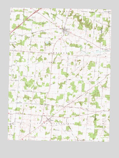
Chesterville, OH USGS Topographic Map
Click on map above to begin viewing in our Map Viewer.

This topographic map contains these locations and features:
Feature Name Type Latitude Longitude GNIS ID View Map
Aaronsburg (historical)Populated PlaceN40.3984°W82.6952°1067295View Map
Anthony Mining Company DamDamN40.4734°W82.6816°1079127View Map
Anthony Mining Company PondReservoirN40.4734°W82.6816°1079128View Map
Bethel CemeteryCemeteryN40.4237°W82.6999°1963202View Map
Bethel School (historical)SchoolN40.4215°W82.7007°1082312View Map
Big Walnut Joint Fire District Station 2BuildingN40.4802°W82.6831°2550670View Map
Bloomfield CemeteryCemeteryN40.3787°W82.7221°1038122View Map
Bowen CornersLocaleN40.4101°W82.7393°1038219View Map
Camp WheelerLocaleN40.4676°W82.7018°1038764View Map
Chester Baptist CemeteryCemeteryN40.4484°W82.6979°1963207View Map
Chester Baptist ChurchChurchN40.4492°W82.6980°1039035View Map
Chester School (historical)SchoolN40.4489°W82.7116°1082313View Map
ChestervillePopulated PlaceN40.4801°W82.6835°1056798View Map
Chesterville Methodist ChurchChurchN40.4798°W82.6816°1069708View Map
Chesterville Post OfficePost OfficeN40.4806°W82.6832°2039661View Map
Fairfield School (historical)SchoolN40.4687°W82.6493°1082315View Map
Fairview School (historical)SchoolN40.4020°W82.7318°1082314View Map
Gardner School (historical)SchoolN40.4070°W82.6616°1082316View Map
Gordon School (historical)SchoolN40.4970°W82.6454°1082317View Map
Harmony ChapelChurchN40.4967°W82.7491°1075138View Map
Harmony Chapel CemeteryCemeteryN40.4964°W82.7482°1963213View Map
Hedding ChurchChurchN40.4042°W82.6521°1963214View Map
Highland High SchoolSchoolN40.3951°W82.6980°1054471View Map
Highland North Elementary SchoolSchoolN40.4826°W82.6818°1054472View Map
Hulse HillSummitN40.3887°W82.7088°1041869View Map
Interchange 151CrossingN40.4967°W82.7180°1054476View Map
Jackson School (historical)SchoolN40.4767°W82.7227°1082318View Map
Lake PenielReservoirN40.4634°W82.7082°1079330View Map
Lake Peniel DamDamN40.4634°W82.7082°1079329View Map
Life Line Medical AmbulanceBuildingN40.4415°W82.6976°2550910View Map
LucernePopulated PlaceN40.4626°W82.6285°1061450View Map
Lucerne Post Office (historical)Post OfficeN40.4626°W82.6291°2025598View Map
Maple Grove CemeteryCemeteryN40.4762°W82.6779°1042942View Map
Mead CornersLocaleN40.4087°W82.7052°1043188View Map
Moore CornersLocaleN40.3995°W82.7318°1082293View Map
Mount Pisgah ChurchChurchN40.4448°W82.7471°1043607View Map
Ohio State Highway Patrol - Mount Gilead Patrol PostBuildingN40.4940°W82.7182°2733125View Map
PenlanLocaleN40.4453°W82.7463°1044367View Map
Red Hill CemeteryCemeteryN40.3760°W82.6617°1963223View Map
Red Hill School (historical)SchoolN40.3762°W82.6607°1082319View Map
Rogers LakeLakeN40.4675°W82.7036°1045156View Map
Salem ChurchChurchN40.4839°W82.6266°1045891View Map
Salem Methodist Episcopal CemeteryCemeteryN40.4840°W82.6262°1961279View Map
Shaw School (historical)SchoolN40.4042°W82.6327°1082408View Map
South Branch Kokosing RiverStreamN40.4776°W82.6916°1066215View Map
SpartaPopulated PlaceN40.3948°W82.7005°1065362View Map
Sparta Post OfficePost OfficeN40.3948°W82.7002°1083383View Map
State of OhioCivilN40.4155°W82.7094°1085497View Map
Sylvester RunStreamN40.4853°W82.6993°1046928View Map
Tim CornersLocaleN40.4073°W82.6818°1047062View Map
Township of ChesterCivilN40.4569°W82.6871°1086700View Map
Township of South BloomfieldCivilN40.3835°W82.6927°1086709View Map
Vail School (historical)SchoolN40.4353°W82.6785°1082320View Map
Village of ChestervilleCivilN40.4777°W82.6818°2397619View Map
Village of SpartaCivilN40.3944°W82.6996°2399867View Map
Washington School (historical)SchoolN40.4317°W82.6571°1082321View Map

Note: Coordinates in the location and feature list above are referenced to NAD83 datum.


Copyright (C) 2008-2025 Ryan Niemi / Sunset Dynamics ... All Rights Reserved