TopoQuest Logo
Do you find TopoQuest useful?
Help keep TopoQuest running and adding new maps/features by donating!
Bitcoin:  19c7KJd3qBynnjoSw5npx9KScwjBe4ifkT
Litecoin:  LXs6TkuXGGXo1vDsWCkWVdjQX94eUKd6ui
Home View Maps Find Maps Find Places Resources & Links


Marengo, Ohio Topographic Map

USGS Map Title: Marengo, OH
USGS Map MRC: 40082D7
DRG (GeoTIFF) Download: o40082d7.tif


Neighboring USGS Topographic Map Quads:


  Denmark, OH  
40082E8
 

  Mount Gilead, OH  
40082E7
 

  Shauck, OH  
40082E6
 

  Ashley, OH  
40082D8
 

  Marengo, OH  
40082D7
 

  Chesterville, OH  
40082D6
 

  Kilbourne, OH  
40082C8
 

  Olive Green, OH  
40082C7
 

  Centerburg, OH  
40082C6


Map MRC Location:

N41°
W83°
N41°
W82°
H8 H7 H6 H5 H4 H3 H2 H1
G8 G7 G6 G5 G4 G3 G2 G1
F8 F7 F6 F5 F4 F3 F2 F1
E8 E7 E6 E5 E4 E3 E2 E1
D8 D7 D6 D5 D4 D3 D2 D1
C8 C7 C6 C5 C4 C3 C2 C1
B8 B7 B6 B5 B4 B3 B2 B1
A8 A7 A6 A5 A4 A3 A2 A1
N40°
W83°
N40°
W82°

Marengo, OH USGS 1:24K Topographic Map Preview:
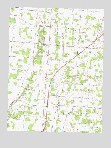
Marengo, OH USGS Topographic Map
Click on map above to begin viewing in our Map Viewer.

This topographic map contains these locations and features:
Feature Name Type Latitude Longitude GNIS ID View Map
Alum Creek CemeteryCemeteryN40.4064°W82.8602°1963201View Map
Alum Creek ChurchChurchN40.4059°W82.8585°1075126View Map
Asbury CemeteryCemeteryN40.4812°W82.8229°1037500View Map
Bennington SpringsPopulated PlaceN40.3872°W82.8319°2514433View Map
Big Walnut Joint Fire DepartmentBuildingN40.4013°W82.7989°2550424View Map
Biggs CemeteryCemeteryN40.4328°W82.7849°1038045View Map
Blackbird School (historical)SchoolN40.4967°W82.7521°1080693View Map
Blackhawk School (historical)SchoolN40.4328°W82.7946°1080699View Map
Brookside ChapelChurchN40.4809°W82.8313°1038360View Map
Buck CemeteryCemeteryN40.4812°W82.8223°1038449View Map
Bunker RunStreamN40.3901°W82.8741°1060907View Map
Castro RunStreamN40.4289°W82.8030°1038872View Map
Chestnut Grove School (historical)SchoolN40.4901°W82.7902°1080694View Map
Dudley School (historical)SchoolN40.3756°W82.8021°1080702View Map
Ebenezer CemeteryCemeteryN40.4259°W82.8255°1040053View Map
FultonPopulated PlaceN40.4626°W82.8288°1072215View Map
Fulton CemeteryCemeteryN40.4626°W82.8349°1963212View Map
Fulton Church of the NazareneChurchN40.4609°W82.8224°1074917View Map
Fulton Post OfficePost OfficeN40.4626°W82.8288°2038904View Map
Goose Heaven School (historical)SchoolN40.4912°W82.8685°1080703View Map
Harmony ChurchChurchN40.4601°W82.7668°1075139View Map
Highland West Elementary SchoolSchoolN40.4020°W82.8127°1054473View Map
Kenney CemeteryCemeteryN40.4896°W82.7879°1963215View Map
Light CreekStreamN40.3920°W82.7846°1042559View Map
Little Ruth ChurchChurchN40.3909°W82.8521°1042689View Map
MarengoPopulated PlaceN40.4009°W82.8107°1042984View Map
Marengo CemeteryCemeteryN40.4112°W82.8091°1042985View Map
Marengo Post OfficePost OfficeN40.4015°W82.8110°2038937View Map
Marengo United Methodist ChurchChurchN40.4012°W82.8105°1074919View Map
Mill CreekStreamN40.3987°W82.8068°1043326View Map
Morrow County Emergency Medical ServicesBuildingN40.4013°W82.7991°2550900View Map
North Fargo CemeteryCemeteryN40.3823°W82.8274°1963218View Map
Oaklawn School (historical)SchoolN40.3867°W82.8141°1080701View Map
Oliveroot School (historical)SchoolN40.4092°W82.7688°1080695View Map
Phillips School (historical)SchoolN40.4612°W82.7921°1080698View Map
Railroad School (historical)SchoolN40.4115°W82.8102°1080700View Map
South WoodburyPopulated PlaceN40.4198°W82.8568°1065359View Map
Stilers Corner School (historical)SchoolN40.4801°W82.8205°1080697View Map
Township of BenningtonCivilN40.3877°W82.7897°1086697View Map
Township of HarmonyCivilN40.4663°W82.7728°1086704View Map
Township of LincolnCivilN40.4601°W82.8578°1086705View Map
Turney Center School (historical)SchoolN40.3912°W82.7610°1080696View Map
Village of FultonCivilN40.4631°W82.8285°2398930View Map
Village of MarengoCivilN40.4008°W82.8110°2399254View Map
Walnut Creek FarmsLocaleN40.3903°W82.8172°2651868View Map
Watson School (historical)SchoolN40.3912°W82.8530°1080705View Map
West Salem School (historical)SchoolN40.4356°W82.8343°1080704View Map
Wildcat School (historical)SchoolN40.4673°W82.7571°1080692View Map
Woodbury Methodist Episcopal CemeteryCemeteryN40.4208°W82.8555°1963227View Map

Note: Coordinates in the location and feature list above are referenced to NAD83 datum.


Copyright (C) 2008-2025 Ryan Niemi / Sunset Dynamics ... All Rights Reserved