TopoQuest Logo
Do you find TopoQuest useful?
Help keep TopoQuest running and adding new maps/features by donating!
Bitcoin:  19c7KJd3qBynnjoSw5npx9KScwjBe4ifkT
Litecoin:  LXs6TkuXGGXo1vDsWCkWVdjQX94eUKd6ui
Home View Maps Find Maps Find Places Resources & Links


Chestnut Hill, Tennessee Topographic Map

USGS Map Title: Chestnut Hill, TN
USGS Map MRC: 35083H3
DRG (GeoTIFF) Download: o35083h3.tif


Neighboring USGS Topographic Map Quads:


  Jefferson City, TN  
36083A4
 

  White Pine, TN  
36083A3
 

  Rankin, TN  
36083A2
 

  Shady Grove, TN  
35083H4
 

  Chestnut Hill, TN  
35083H3
 

  Newport, TN  
35083H2
 

  Richardson Cove, TN  
35083G4
 

  Jones Cove, TN  
35083G3
 

  Hartford, TN  
35083G2


Map MRC Location:

N36°
W84°
N36°
W83°
H8 H7 H6 H5 H4 H3 H2 H1
G8 G7 G6 G5 G4 G3 G2 G1
F8 F7 F6 F5 F4 F3 F2 F1
E8 E7 E6 E5 E4 E3 E2 E1
D8 D7 D6 D5 D4 D3 D2 D1
C8 C7 C6 C5 C4 C3 C2 C1
B8 B7 B6 B5 B4 B3 B2 B1
A8 A7 A6 A5 A4 A3 A2 A1
N35°
W84°
N35°
W83°

Chestnut Hill, TN USGS 1:24K Topographic Map Preview:
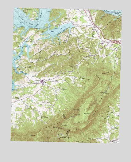
Chestnut Hill, TN USGS Topographic Map
Click on map above to begin viewing in our Map Viewer.

This topographic map contains these locations and features:
Feature Name Type Latitude Longitude GNIS ID View Map
Allen CemeteryCemeteryN35.9631°W83.2871°1275587View Map
Antioch Baptist ChurchChurchN35.9854°W83.3249°1304855View Map
Antioch CemeteryCemeteryN35.9851°W83.3246°1318590View Map
Bailey TownPopulated PlaceN35.9573°W83.2807°1276119View Map
Ball CemeteryCemeteryN35.9781°W83.2896°1276234View Map
Ball CreekStreamN35.9834°W83.3052°1276236View Map
Bear BranchStreamN35.9948°W83.2502°1276571View Map
Betsy BranchStreamN35.9106°W83.3743°1277184View Map
Bird CrossroadPopulated PlaceN35.9140°W83.3635°1312978View Map
Bird School (historical)SchoolN35.9079°W83.3535°1323346View Map
Blowing Cave SchoolSchoolN35.8984°W83.3404°1277725View Map
Bogard ChapelChurchN35.9531°W83.3446°1305333View Map
Bridges ChapelChurchN35.9532°W83.2927°1305414View Map
Bridges Chapel CemeteryCemeteryN35.9529°W83.2924°1318602View Map
Briner Heights School (historical)SchoolN35.9879°W83.3146°1318603View Map
Burchfield CemeteryCemeteryN35.9056°W83.3579°1645389View Map
Burchfield ChurchChurchN35.9062°W83.3574°1305531View Map
Butler CemeteryCemeteryN35.8806°W83.2743°1279178View Map
Byrd CemeteryCemeteryN35.8776°W83.2521°1279247View Map
Camp Bell BranchStreamN35.8995°W83.2607°1305619View Map
Carson SpringsPopulated PlaceN35.9273°W83.2640°1279767View Map
Chestnut HillPopulated PlaceN35.9301°W83.3402°1305891View Map
Chestnut Hill CemeteryCemeteryN35.9287°W83.3382°1318609View Map
Chestnut Hill Division (historical)CensusN35.9629°W83.3418°1648795View Map
Chestnut Hill Elementary SchoolSchoolN35.9304°W83.3360°1318610View Map
Chestnut Hill Volunteer Fire DepartmentBuildingN35.9285°W83.3370°2654849View Map
Civilian Conservation Corps Camp Number 1467 (historical)LocaleN35.9070°W83.3532°1323353View Map
Clear CreekStreamN35.9481°W83.3729°1280654View Map
ClevengerPopulated PlaceN35.9690°W83.2638°1647135View Map
Commissioner District 4CivilN35.9319°W83.2536°2464023View Map
Commissioner District 8CivilN35.9675°W83.3644°2464680View Map
Denton HollowValleyN35.9748°W83.3262°1282356View Map
Dickey School ChurchChurchN35.9265°W83.3646°1282447View Map
Dickeys School (historical)SchoolN35.9268°W83.3646°1318621View Map
Dooley HollowValleyN35.9336°W83.3171°1282645View Map
Douglas EstatesPopulated PlaceN35.9990°W83.3610°1282735View Map
Dunn CemeteryCemeteryN35.9543°W83.2532°1283201View Map
EdgemontPopulated PlaceN35.9648°W83.2554°1283517View Map
Edgemont Church (historical)ChurchN35.9543°W83.2560°1309142View Map
Edgemont Elementary SchoolSchoolN35.9623°W83.2554°1309143View Map
Elliot Ferry (historical)CrossingN35.9840°W83.3482°1311214View Map
Elliots ShoalsBarN35.9926°W83.3443°1644969View Map
English MountainSummitN35.9012°W83.2979°1283800View Map
English Mountain Volunteer Fire Department Station 2BuildingN35.8802°W83.3149°2654881View Map
Fain CoveValleyN35.8882°W83.3023°1283964View Map
Frances CemeteryCemeteryN35.9554°W83.2802°1284800View Map
Garner CemeteryCemeteryN35.9687°W83.2924°1318638View Map
Gibson HollowValleyN35.9362°W83.3058°1285349View Map
Glenn Alpine SpringSpringN35.8799°W83.3178°1285515View Map
Grapevine HollowValleyN35.9330°W83.3167°1285863View Map
Gray School (historical)SchoolN35.9537°W83.2941°1318643View Map
Grindstone MountainSummitN35.9398°W83.2688°1286315View Map
Gunter HollowValleyN35.9365°W83.3502°1647472View Map
Hall BranchStreamN35.9437°W83.3710°1286550View Map
Henderson CemeteryCemeteryN35.9629°W83.3368°1318650View Map
Hills Chapel (historical)ChurchN35.9584°W83.3702°1318652View Map
Huff BranchStreamN35.9962°W83.2510°1288633View Map
Huff CemeteryCemeteryN35.8845°W83.2593°1288639View Map
Indian CreekStreamN35.9876°W83.3357°1288946View Map
Indian Creek ChurchChurchN35.9654°W83.2982°1288972View Map
Indian Creek DockLocaleN35.9773°W83.3396°1288976View Map
Interchange 432CrossingN35.9701°W83.2565°1309141View Map
Jenkins ChapelChurchN35.8765°W83.2571°1289350View Map
Jones BranchStreamN35.9707°W83.2763°1289696View Map
Kyker CemeteryCemeteryN35.8951°W83.2527°1290417View Map
Lane CemeteryCemeteryN35.8790°W83.2502°1290597View Map
Lawson ChapelChurchN35.9876°W83.3060°1290811View Map
Lawson Chapel CemeteryCemeteryN35.9876°W83.3063°1318676View Map
Lewis CemeteryCemeteryN35.9837°W83.3374°1318679View Map
Maple SpringPopulated PlaceN35.9018°W83.2888°1315461View Map
McAndrew SpringSpringN35.9249°W83.3176°1293074View Map
McGaha ChapelChurchN35.8890°W83.2565°1293296View Map
Moore BranchStreamN35.9987°W83.3332°1294247View Map
Muddy Hollow BranchStreamN35.9840°W83.3093°1311246View Map
Nazarene CemeteryCemeteryN35.9965°W83.2818°1318695View Map
Nazarene ChurchChurchN35.9798°W83.2813°1309144View Map
North Fork Bogard CreekStreamN35.8782°W83.2821°1295865View Map
Old Griffin CemeteryCemeteryN35.9690°W83.3135°1318707View Map
Old Holt CemeteryCemeteryN35.9879°W83.3179°1296325View Map
Open Door Union ChurchChurchN35.9709°W83.2704°1296447View Map
Promised LandPopulated PlaceN35.9532°W83.2932°1311249View Map
Pruitt HollowValleyN35.9824°W83.3089°1298628View Map
Rainwater School (historical)SchoolN35.9518°W83.3438°1318718View Map
Ray CemeteryCemeteryN35.9598°W83.3152°1318719View Map
Ray HollowValleyN35.9540°W83.3555°1299000View Map
ReidtownPopulated PlaceN35.9807°W83.2796°1299208View Map
Resthaven Memorial GardensCemeteryN35.9845°W83.2846°1299233View Map
Reynolds HollowValleyN35.9578°W83.3266°1299260View Map
Rinehart CemeteryCemeteryN35.9712°W83.2993°1318720View Map
Round MountainSummitN35.9418°W83.2846°1300164View Map
Sand MountainSummitN35.9329°W83.2746°1300674View Map
Shropshire HollowValleyN35.9779°W83.3088°1647478View Map
Slatey BranchStreamN35.9354°W83.3529°1270483View Map
South Fork Bogard CreekStreamN35.8782°W83.2821°1270850View Map
Split GapGapN35.8990°W83.3015°1271016View Map
Still House HollowValleyN35.9812°W83.3585°1647480View Map
Stinnett GapGapN35.8801°W83.3524°1271446View Map
Stokely ChapelChurchN35.9223°W83.2674°1271461View Map
Strange CemeteryCemeteryN35.9531°W83.3382°1271574View Map
Strange HollowValleyN35.9504°W83.3416°1303875View Map
Sugar HollowValleyN35.9976°W83.2691°1271684View Map
Taff CemeteryCemeteryN35.9379°W83.3132°1318739View Map
Taylor CemeteryCemeteryN35.9856°W83.3035°1272208View Map
The BenchBenchN35.8976°W83.2818°1272367View Map
The LookoffSummitN35.9012°W83.3052°1272409View Map
The PinnacleSummitN35.8909°W83.3171°1272429View Map
TryonPopulated PlaceN35.9843°W83.3229°1311263View Map
Tryon CemeteryCemeteryN35.9843°W83.3240°1304179View Map
Turkeypen BranchStreamN35.8993°W83.2599°1304198View Map
Webb CemeteryCemeteryN35.9162°W83.3382°1318746View Map
Yellow Spring GapGapN35.8890°W83.3260°1275288View Map

Note: Coordinates in the location and feature list above are referenced to NAD83 datum.


Copyright (C) 2008-2024 Ryan Niemi / Sunset Dynamics ... All Rights Reserved