TopoQuest Logo
Do you find TopoQuest useful?
Help keep TopoQuest running and adding new maps/features by donating!
Bitcoin:  19c7KJd3qBynnjoSw5npx9KScwjBe4ifkT
Litecoin:  LXs6TkuXGGXo1vDsWCkWVdjQX94eUKd6ui
Home View Maps Find Maps Find Places Resources & Links


Jones Cove, Tennessee Topographic Map

USGS Map Title: Jones Cove, TN
USGS Map MRC: 35083G3
DRG (GeoTIFF) Download: o35083g3.tif


Neighboring USGS Topographic Map Quads:


  Shady Grove, TN  
35083H4
 

  Chestnut Hill, TN  
35083H3
 

  Newport, TN  
35083H2
 

  Richardson Cove, TN  
35083G4
 

  Jones Cove, TN  
35083G3
 

  Hartford, TN  
35083G2
 

  Mount Le Conte, TN  
35083F4
 

  Mount Guyot, TN  
35083F3
 

  Luftee Knob, NC  
35083F2


Map MRC Location:

N36°
W84°
N36°
W83°
H8 H7 H6 H5 H4 H3 H2 H1
G8 G7 G6 G5 G4 G3 G2 G1
F8 F7 F6 F5 F4 F3 F2 F1
E8 E7 E6 E5 E4 E3 E2 E1
D8 D7 D6 D5 D4 D3 D2 D1
C8 C7 C6 C5 C4 C3 C2 C1
B8 B7 B6 B5 B4 B3 B2 B1
A8 A7 A6 A5 A4 A3 A2 A1
N35°
W84°
N35°
W83°

Jones Cove, TN USGS 1:24K Topographic Map Preview:
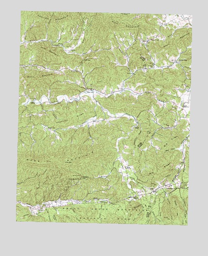
Jones Cove, TN USGS Topographic Map
Click on map above to begin viewing in our Map Viewer.

This topographic map contains these locations and features:
Feature Name Type Latitude Longitude GNIS ID View Map
Baxter's OrchardLocaleN35.7683°W83.2825°2678178View Map
Big RidgeRidgeN35.7807°W83.2683°1277361View Map
Birdsville (historical)Populated PlaceN35.8684°W83.2724°1309117View Map
Blackgun GapGapN35.7776°W83.3277°1277607View Map
Bogard School (historical)SchoolN35.8709°W83.2593°1309116View Map
Bradley ChapelChurchN35.8076°W83.2904°1305380View Map
Breeden-Rolen CemeteryCemeteryN35.8412°W83.3579°1645387View Map
Bryant CemeteryCemeteryN35.8723°W83.2521°1278739View Map
Buckeye CreekStreamN35.7704°W83.2665°1305497View Map
Butler BranchStreamN35.7629°W83.3454°1279169View Map
Camp HollowValleyN35.8388°W83.3289°1279395View Map
Chavis School (historical)SchoolN35.8090°W83.2599°1309114View Map
Chestnut RidgeRidgeN35.8156°W83.3303°1280411View Map
Chucky CreekStreamN35.8226°W83.3185°1280539View Map
Civilian Conservation Corps Camp Number 423 (historical)LocaleN35.7668°W83.2652°1309176View Map
Clear Spring CemeteryCemeteryN35.7601°W83.3552°1305960View Map
Cole CreekStreamN35.7676°W83.2721°1280931View Map
Cricket BranchStreamN35.7879°W83.2538°1281618View Map
Darky BranchStreamN35.7612°W83.3549°1282064View Map
Dixon MountainSummitN35.8334°W83.3631°1282526View Map
Dockery BranchStreamN35.8198°W83.3704°1282546View Map
Dockery CemeteryCemeteryN35.7987°W83.3590°1645401View Map
Elvin BranchStreamN35.8568°W83.3715°1283735View Map
English Mountain Volunteer Fire Department Station 1BuildingN35.8659°W83.3285°2654384View Map
Fairview School (historical)SchoolN35.7579°W83.3607°1323360View Map
Flats School (historical)SchoolN35.7804°W83.2943°1323369View Map
Fowler CemeteryCemeteryN35.7706°W83.2754°1284744View Map
Frazier CemeteryCemeteryN35.7515°W83.3676°1645410View Map
Gabes CreekStreamN35.7595°W83.2524°1328241View Map
Hartsell CemeteryCemeteryN35.8440°W83.2779°1287062View Map
Henry CemeteryCemeteryN35.8109°W83.3204°1287438View Map
Henry CemeteryCemeteryN35.8090°W83.3207°1645420View Map
Henry School (historical)SchoolN35.8062°W83.3557°1323377View Map
Holder Grove ChurchChurchN35.8204°W83.2554°1288034View Map
Howard View CemeteryCemeteryN35.8054°W83.3527°1645424View Map
Howard View ChurchChurchN35.8054°W83.3521°1306591View Map
Huff CemeteryCemeteryN35.8295°W83.3002°1288638View Map
Hurst CemeteryCemeteryN35.8540°W83.3368°1288845View Map
Hurst GapGapN35.8468°W83.3288°1288849View Map
Husky CemeteryCemeteryN35.7631°W83.3068°1645426View Map
Johnnie Ramsey CemeteryCemeteryN35.7555°W83.3030°2775261View Map
Jones BranchStreamN35.7543°W83.2735°1289708View Map
Jones BranchStreamN35.8115°W83.3240°1306635View Map
Jones CovePopulated PlaceN35.8295°W83.3263°1306638View Map
Jones Cove Elementary SchoolSchoolN35.8262°W83.3107°1323381View Map
Jones GapGapN35.7865°W83.3352°1289790View Map
Juniper School (historical)SchoolN35.8526°W83.3418°1323383View Map
Large BranchStreamN35.8304°W83.2985°1290633View Map
Laurel Spring ChurchChurchN35.7723°W83.2582°1290762View Map
Lin CreekStreamN35.8640°W83.3299°1291302View Map
Long BranchStreamN35.8279°W83.3274°1291877View Map
Maddron CemeteryCemeteryN35.7581°W83.2743°2775271View Map
Maddron CreekStreamN35.7590°W83.2768°1292474View Map
Matthew CreekStreamN35.7926°W83.3018°1292951View Map
McCarter-Williams CemeteryCemeteryN35.7645°W83.2946°1645440View Map
McKinney BranchStreamN35.7854°W83.2571°1293370View Map
McMahan CemeteryCemeteryN35.8262°W83.3538°1645441View Map
McMahan CemeteryCemeteryN35.8201°W83.3527°1645442View Map
McMahan CemeteryCemeteryN35.8212°W83.2690°1645443View Map
McMahan School (historical)SchoolN35.8251°W83.3713°1323391View Map
Mill Dam BranchStreamN35.7601°W83.3577°1293857View Map
Miller CemeteryCemeteryN35.8231°W83.3529°1645447View Map
Mitchell Wilson Mill (historical)LocaleN35.8015°W83.2763°1309113View Map
Mount Olive ChurchChurchN35.8548°W83.3446°1294706View Map
New Salem ChurchChurchN35.8290°W83.3224°1323401View Map
Noisy CreekStreamN35.7640°W83.3352°1295799View Map
Ogle Spring BranchStreamN35.7870°W83.2999°1306855View Map
Pearl Valley ChurchChurchN35.8218°W83.3638°1306887View Map
Pine MountainSummitN35.8515°W83.3549°1297565View Map
Pittman Center Community Volunteer Fire DepartmentBuildingN35.7595°W83.3661°2654323View Map
Pleasant Valley ChurchChurchN35.8468°W83.2593°1297935View Map
Pleasant Valley School (historical)SchoolN35.8465°W83.2593°1309115View Map
Proffitt CemeteryCemeteryN35.8123°W83.2929°1645462View Map
Proffitt CemeteryCemeteryN35.8215°W83.3427°1645463View Map
Ramsey CreekStreamN35.7620°W83.3493°1298892View Map
Redwine CreekStreamN35.7576°W83.3457°1299109View Map
Rich MountainSummitN35.8717°W83.3087°1269890View Map
Ringen Memorial ChurchChurchN35.7759°W83.3285°1306952View Map
Rocky GrovePopulated PlaceN35.7668°W83.2879°1647680View Map
Rocky Grove ChurchChurchN35.7648°W83.2879°1299893View Map
Rolen CemeteryCemeteryN35.8420°W83.3388°1645471View Map
Rolen CemeteryCemeteryN35.8115°W83.3104°1645472View Map
Sandy HollowValleyN35.7951°W83.2573°1300760View Map
Sheep Pen BranchStreamN35.7707°W83.3582°1269962View Map
Short MountainSummitN35.8621°W83.2528°1327000View Map
Shults Grove ChurchChurchN35.7840°W83.2963°1303614View Map
Shults-Whaley CemeteryCemeteryN35.7590°W83.3646°1645479View Map
Snag BranchStreamN35.7598°W83.2827°1270745View Map
Spurgeon CemeteryCemeteryN35.7584°W83.3590°1645482View Map
Spurgeon ChurchChurchN35.7573°W83.3588°1271167View Map
Spurgeon HollowValleyN35.8573°W83.3518°1271168View Map
Stillhouse HollowValleyN35.8649°W83.3557°1271430View Map
Stinnett CemeteryCemeteryN35.8131°W83.3054°1645484View Map
Sugar Camp BranchStreamN35.8509°W83.3415°1303890View Map
Sugar CoveValleyN35.7580°W83.2520°1271657View Map
Sunset GapPopulated PlaceN35.8584°W83.2827°1647132View Map
Sunset GapGapN35.8595°W83.2902°1647133View Map
Sunset Gap School (historical)SchoolN35.8593°W83.2915°1323436View Map
Sutton CemeteryCemeteryN35.7779°W83.3293°1271904View Map
Texas CreekStreamN35.7640°W83.3127°1272349View Map
Texas Settlement (historical)Populated PlaceN35.7509°W83.3124°1313014View Map
Timothy CreekStreamN35.7601°W83.3654°1272659View Map
Upper Falling BranchStreamN35.7665°W83.2513°1327287View Map
Valentine BranchStreamN35.8212°W83.3599°1273326View Map
Warden BranchStreamN35.7618°W83.3543°1273797View Map
Webb MountainSummitN35.7856°W83.3507°1304430View Map
Webb Springs School (historical)SchoolN35.7718°W83.2513°1309112View Map
Webbs Creek CemeteryCemeteryN35.7634°W83.3246°1645497View Map
Webbs Creek School (historical)SchoolN35.7632°W83.3238°1323445View Map
Webbs Creek United Methodist ChurchChurchN35.7632°W83.3238°1645498View Map
Whaley Church (historical)ChurchN35.7718°W83.2521°1309111View Map
Wilhite ChurchChurchN35.8523°W83.3377°1274578View Map
Wilhite School (historical)SchoolN35.8529°W83.3371°1323446View Map
Williams CemeteryCemeteryN35.8587°W83.3377°1274659View Map
Williams CemeteryCemeteryN35.8281°W83.3113°1645504View Map
Williams CemeteryCemeteryN35.7765°W83.2910°1645505View Map
Williams CemeteryCemeteryN35.8256°W83.3185°1645506View Map
Yellow Breeches CreekStreamN35.8287°W83.3224°1275271View Map
Youngblood BranchStreamN35.8098°W83.2879°1275338View Map

Note: Coordinates in the location and feature list above are referenced to NAD83 datum.


Copyright (C) 2008-2024 Ryan Niemi / Sunset Dynamics ... All Rights Reserved