TopoQuest Logo
Do you find TopoQuest useful?
Help keep TopoQuest running and adding new maps/features by donating!
Bitcoin:  19c7KJd3qBynnjoSw5npx9KScwjBe4ifkT
Litecoin:  LXs6TkuXGGXo1vDsWCkWVdjQX94eUKd6ui
Home View Maps Find Maps Find Places Resources & Links


Chief Joseph Mountain, Oregon Topographic Map

USGS Map Title: Chief Joseph Mountain, OR
USGS Map MRC: 45117C3
DRG (GeoTIFF) Download: o45117c3.tif


Neighboring USGS Topographic Map Quads:


  Lostine, OR  
45117D4
 

  Enterprise, OR  
45117D3
 

  Joseph NW, OR  
45117D2
 

  North Minam Meadows, OR  
45117C4
 

  Chief Joseph Mountain, OR  
45117C3
 

  Joseph, OR  
45117C2
 

  Steamboat Lake, OR  
45117B4
 

  Eagle Cap, OR  
45117B3
 

  Aneroid Mountain, OR  
45117B2


Map MRC Location:

N46°
W118°
N46°
W117°
H8 H7 H6 H5 H4 H3 H2 H1
G8 G7 G6 G5 G4 G3 G2 G1
F8 F7 F6 F5 F4 F3 F2 F1
E8 E7 E6 E5 E4 E3 E2 E1
D8 D7 D6 D5 D4 D3 D2 D1
C8 C7 C6 C5 C4 C3 C2 C1
B8 B7 B6 B5 B4 B3 B2 B1
A8 A7 A6 A5 A4 A3 A2 A1
N45°
W118°
N45°
W117°

Chief Joseph Mountain, OR USGS 1:24K Topographic Map Preview:
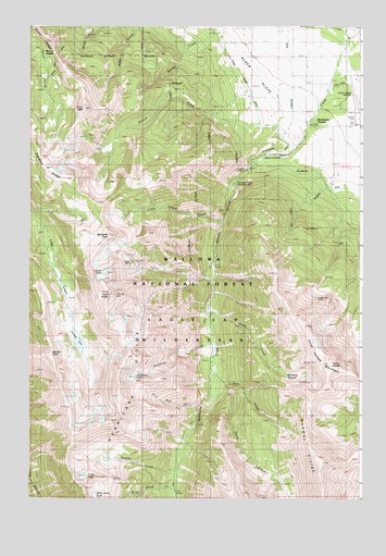
Chief Joseph Mountain, OR USGS Topographic Map
Click on map above to begin viewing in our Map Viewer.

This topographic map contains these locations and features:
Feature Name Type Latitude Longitude GNIS ID View Map
Billy Jones CreekStreamN45.2538°W117.3199°1138123View Map
Billy Jones LakeLakeN45.2503°W117.3501°1138124View Map
Chief Joseph MountainSummitN45.2852°W117.2618°1139638View Map
Consolidated DitchCanalN45.3421°W117.2827°1140048View Map
Deadman CreekStreamN45.2907°W117.3060°1140734View Map
Deadman LakeLakeN45.2822°W117.3364°1140744View Map
Dunn CreekStreamN45.2993°W117.3074°1141411View Map
Echo LakeLakeN45.2559°W117.3547°1141665View Map
Falls CreekStreamN45.3079°W117.3057°1142003View Map
Falls Creek Forest CampLocaleN45.3107°W117.3060°1142006View Map
Francis LakeLakeN45.2921°W117.3573°1142406View Map
Granite CreekStreamN45.2579°W117.3193°1142920View Map
Granite MeadowFlatN45.2610°W117.3510°1152886View Map
Hurricane Creek Recreation SiteLocaleN45.3299°W117.2996°1143959View Map
Hurricane Creek TrailheadLocaleN45.3088°W117.3074°1156508View Map
Hurricane DitchCanalN45.3638°W117.2766°1143960View Map
Hurricane DivideRidgeN45.2765°W117.3418°1143961View Map
Hurricane GrangeLocaleN45.3496°W117.2707°1143962View Map
Hurricane PointSummitN45.3346°W117.3274°1152880View Map
Hurricane RapidsRapidsN45.2745°W117.3080°1152879View Map
Hurwal DivideRidgeN45.2596°W117.2657°1143965View Map
Joseph CemeteryCemeteryN45.3504°W117.2516°1144406View Map
Joseph Mountain MinesMineN45.3029°W117.2677°1144408View Map
Joseph State AirportAirportN45.3558°W117.2526°1154026View Map
Legore LakeLakeN45.3100°W117.3466°1144926View Map
Legore MineMineN45.3121°W117.3357°1144927View Map
Little Granite CreekStreamN45.3224°W117.3030°1145173View Map
Mill CreekStreamN45.3318°W117.2621°1152877View Map
Miners BasinBasinN45.2843°W117.2810°1146318View Map
Murray SaddleGapN45.3663°W117.3582°1146690View Map
Newby CreekStreamN45.3471°W117.2557°1146807View Map
Point JosephSummitN45.2860°W117.2621°1152878View Map
Ruby PeakSummitN45.3529°W117.3541°1148828View Map
Sawtooth PeakSummitN45.3193°W117.3449°1149102View Map
Silver Grange DitchCanalN45.3668°W117.3657°1149497View Map
Slick Rock CreekStreamN45.2735°W117.3116°1149685View Map
Spring CreekStreamN45.3249°W117.2538°1152882View Map
Thorp CreekStreamN45.2768°W117.3063°1151141View Map
Traverse RidgeRidgeN45.3374°W117.3668°1151407View Map
Twin CreekStreamN45.2824°W117.3063°1151560View Map
Twin PeaksSummitN45.3038°W117.3438°1151575View Map

Note: Coordinates in the location and feature list above are referenced to NAD83 datum.


Copyright (C) 2008-2025 Ryan Niemi / Sunset Dynamics ... All Rights Reserved