TopoQuest Logo
Do you find TopoQuest useful?
Help keep TopoQuest running and adding new maps/features by donating!
Bitcoin:  19c7KJd3qBynnjoSw5npx9KScwjBe4ifkT
Litecoin:  LXs6TkuXGGXo1vDsWCkWVdjQX94eUKd6ui
Home View Maps Find Maps Find Places Resources & Links


Aneroid Mountain, Oregon Topographic Map

USGS Map Title: Aneroid Mountain, OR
USGS Map MRC: 45117B2
DRG (GeoTIFF) Download: o45117b2.tif


Neighboring USGS Topographic Map Quads:


  Chief Joseph Mountain, OR  
45117C3
 

  Joseph, OR  
45117C2
 

  Kinney Lake, OR  
45117C1
 

  Eagle Cap, OR  
45117B3
 

  Aneroid Mountain, OR  
45117B2
 

  Lick Creek, OR  
45117B1
 

  Krag Peak, OR  
45117A3
 

  Cornucopia, OR  
45117A2
 

  Deadman Point, OR  
45117A1


Map MRC Location:

N46°
W118°
N46°
W117°
H8 H7 H6 H5 H4 H3 H2 H1
G8 G7 G6 G5 G4 G3 G2 G1
F8 F7 F6 F5 F4 F3 F2 F1
E8 E7 E6 E5 E4 E3 E2 E1
D8 D7 D6 D5 D4 D3 D2 D1
C8 C7 C6 C5 C4 C3 C2 C1
B8 B7 B6 B5 B4 B3 B2 B1
A8 A7 A6 A5 A4 A3 A2 A1
N45°
W118°
N45°
W117°

Aneroid Mountain, OR USGS 1:24K Topographic Map Preview:
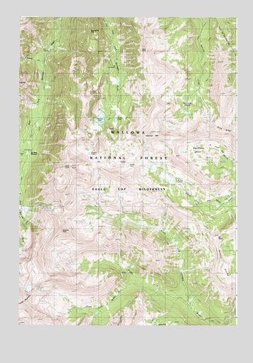
Aneroid Mountain, OR USGS Topographic Map
Click on map above to begin viewing in our Map Viewer.

This topographic map contains these locations and features:
Feature Name Type Latitude Longitude GNIS ID View Map
Adam CreekStreamN45.2321°W117.2368°1137011View Map
Aneroid LakeLakeN45.2087°W117.2037°1137217View Map
Aneroid MountainSummitN45.2032°W117.1746°1137218View Map
Big Sheep BasinBasinN45.1929°W117.1357°1153050View Map
Bonneville MountainSummitN45.2438°W117.2102°1138424View Map
Bonny LakesLakeN45.1833°W117.1609°1138432View Map
Dollar LakeLakeN45.1899°W117.1880°1141157View Map
East PeakSummitN45.2368°W117.1766°1141633View Map
Jewett LakeLakeN45.1945°W117.2099°1144267View Map
Joseph DivisionCivilN45.2308°W117.1333°1938036View Map
Lake CreekStreamN45.1952°W117.2474°1144770View Map
McCully BasinBasinN45.2115°W117.1546°1145959View Map
Middle Fork Imhaha RiverStreamN45.1329°W117.1524°1146147View Map
Mount NeboSummitN45.1610°W117.1374°1146744View Map
North Fork of Middle Fork Imnaha RiverStreamN45.1418°W117.1793°1156527View Map
Petes PointSummitN45.1890°W117.2204°1147622View Map
Rogers LakeLakeN45.2085°W117.1949°1167689View Map
Sentinel PeakSummitN45.1635°W117.2263°1149234View Map
Six Mile MeadowFlatN45.1949°W117.2427°1116476View Map
South Fork Middle Fork Imhaha RiverStreamN45.1418°W117.1799°1149919View Map
Tenderfoot PassGapN45.1902°W117.2079°1167125View Map
Wing RidgeRidgeN45.2049°W117.1379°1152532View Map

Note: Coordinates in the location and feature list above are referenced to NAD83 datum.


Copyright (C) 2008-2024 Ryan Niemi / Sunset Dynamics ... All Rights Reserved