TopoQuest Logo
Do you find TopoQuest useful?
Help keep TopoQuest running and adding new maps/features by donating!
Bitcoin:  19c7KJd3qBynnjoSw5npx9KScwjBe4ifkT
Litecoin:  LXs6TkuXGGXo1vDsWCkWVdjQX94eUKd6ui
Home View Maps Find Maps Find Places Resources & Links


Chimney Rock, Wyoming Topographic Map

USGS Map Title: Chimney Rock, WY
USGS Map MRC: 44109D7
DRG (GeoTIFF) Download: o44109d7.tif


Neighboring USGS Topographic Map Quads:


  Pahaska Tepee, WY  
44109E8
 

  Sunlight Peak, WY  
44109E7
 

  Jaggar Peak, WY  
44109E6
 

  Eagle Creek, WY  
44109D8
 

  Chimney Rock, WY  
44109D7
 

  Clayton Mountain, WY  
44109D6
 

  Pinnacle Mountain, WY  
44109C8
 

  Sheep Mesa, WY  
44109C7
 

  Lake Creek, WY  
44109C6


Map MRC Location:

N45°
W110°
N45°
W109°
H8 H7 H6 H5 H4 H3 H2 H1
G8 G7 G6 G5 G4 G3 G2 G1
F8 F7 F6 F5 F4 F3 F2 F1
E8 E7 E6 E5 E4 E3 E2 E1
D8 D7 D6 D5 D4 D3 D2 D1
C8 C7 C6 C5 C4 C3 C2 C1
B8 B7 B6 B5 B4 B3 B2 B1
A8 A7 A6 A5 A4 A3 A2 A1
N44°
W110°
N44°
W109°

Chimney Rock, WY USGS 1:24K Topographic Map Preview:
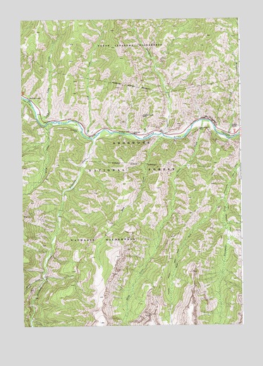
Chimney Rock, WY USGS Topographic Map
Click on map above to begin viewing in our Map Viewer.

This topographic map contains these locations and features:
Feature Name Type Latitude Longitude GNIS ID View Map
Blackwater TrailTrailN44.4333°W109.7574°1585643View Map
Chimney CreekStreamN44.4536°W109.8163°1608722View Map
Chimney RockPillarN44.4538°W109.8121°1586665View Map
Elephant Head RockPillarN44.4608°W109.8068°1588210View Map
Fire Memorial TrailTrailN44.4152°W109.7585°1588478View Map
Fishhawk CreekStreamN44.4513°W109.8341°1599737View Map
Goff CreekStreamN44.4524°W109.8393°1599960View Map
Gunbarrel CreekStreamN44.4533°W109.7946°1600138View Map
Henry Ford RockPillarN44.4552°W109.7743°1589485View Map
Kitty Creek Summer HomesLocaleN44.4536°W109.8599°1608723View Map
Libby CreekStreamN44.4597°W109.8660°1600905View Map
Mesa CreekStreamN44.4524°W109.7949°1591478View Map
Natural Bridge TrailTrailN44.3913°W109.7932°1597186View Map
Newton CreekStreamN44.4513°W109.7566°1592021View Map
Newton Creek CampgroundLocaleN44.4530°W109.7568°1592022View Map
Newton SpringSpringN44.4566°W109.7557°1592025View Map
Newton Spring Picnic GroundLocaleN44.4544°W109.7557°1604659View Map
Norris CreekStreamN44.3952°W109.8624°1592086View Map
Sheep CreekStreamN44.4588°W109.7721°1602843View Map
The PalisadesCliffN44.4602°W109.7685°1595456View Map
Wayfares ChapelLocaleN44.4683°W109.8710°1596093View Map
West Fork Blackwater CreekStreamN44.4266°W109.7607°1604045View Map
Window RockArchN44.4558°W109.7980°1679052View Map

Note: Coordinates in the location and feature list above are referenced to NAD83 datum.


Copyright (C) 2008-2025 Ryan Niemi / Sunset Dynamics ... All Rights Reserved