TopoQuest Logo
Do you find TopoQuest useful?
Help keep TopoQuest running and adding new maps/features by donating!
Bitcoin:  19c7KJd3qBynnjoSw5npx9KScwjBe4ifkT
Litecoin:  LXs6TkuXGGXo1vDsWCkWVdjQX94eUKd6ui
Home View Maps Find Maps Find Places Resources & Links


Clayton Mountain, Wyoming Topographic Map

USGS Map Title: Clayton Mountain, WY
USGS Map MRC: 44109D6
DRG (GeoTIFF) Download: o44109d6.tif


Neighboring USGS Topographic Map Quads:


  Sunlight Peak, WY  
44109E7
 

  Jaggar Peak, WY  
44109E6
 

  Dead Indian Peak, WY  
44109E5
 

  Chimney Rock, WY  
44109D7
 

  Clayton Mountain, WY  
44109D6
 

  Flag Peak, WY  
44109D5
 

  Sheep Mesa, WY  
44109C7
 

  Lake Creek, WY  
44109C6
 

  Ptarmigan Mountain, WY  
44109C5


Map MRC Location:

N45°
W110°
N45°
W109°
H8 H7 H6 H5 H4 H3 H2 H1
G8 G7 G6 G5 G4 G3 G2 G1
F8 F7 F6 F5 F4 F3 F2 F1
E8 E7 E6 E5 E4 E3 E2 E1
D8 D7 D6 D5 D4 D3 D2 D1
C8 C7 C6 C5 C4 C3 C2 C1
B8 B7 B6 B5 B4 B3 B2 B1
A8 A7 A6 A5 A4 A3 A2 A1
N44°
W110°
N44°
W109°

Clayton Mountain, WY USGS 1:24K Topographic Map Preview:
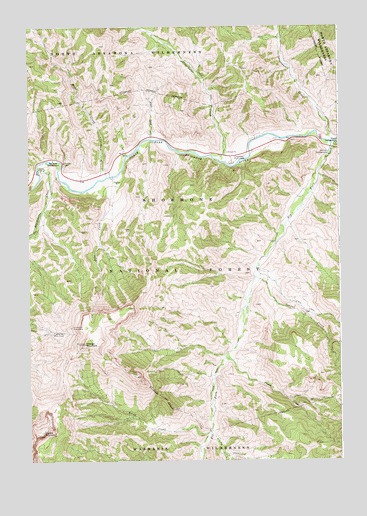
Clayton Mountain, WY USGS Topographic Map
Click on map above to begin viewing in our Map Viewer.

This topographic map contains these locations and features:
Feature Name Type Latitude Longitude GNIS ID View Map
Aspen CreekStreamN44.4677°W109.7007°1584976View Map
Aspen Creek Summer HomesLocaleN44.4699°W109.7007°1608766View Map
Blackwater CreekStreamN44.4591°W109.7463°1598235View Map
Blackwater LodgeLocaleN44.4597°W109.7441°1604795View Map
Blackwater Pond Picnic GroundLocaleN44.4597°W109.7485°1608772View Map
Blind CreekStreamN44.3833°W109.6785°1585657View Map
Clayton MountainSummitN44.4088°W109.7291°1586756View Map
Clearwater campgroundLocaleN44.4611°W109.6691°1604793View Map
Clearwater CreekStreamN44.4613°W109.6738°1598795View Map
Clearwater Picnic AreaParkN44.4624°W109.6677°1586767View Map
Cougar CreekStreamN44.4274°W109.6596°1598948View Map
Double MountainSummitN44.3827°W109.7471°1587741View Map
Elk ForkStreamN44.4666°W109.6271°1599582View Map
Elk Fork CampgroundLocaleN44.4630°W109.6293°1588224View Map
Elk Fork Creek Watershed ProjectLocaleN44.4322°W109.6499°1604797View Map
Firefighter MonumentLocaleN44.4116°W109.7413°1588479View Map
Frost CreekStreamN44.4047°W109.6716°1588766View Map
Grace CreekStreamN44.4572°W109.6338°1600001View Map
Icy CreekStreamN44.3830°W109.6777°1600481View Map
June CreekStreamN44.4566°W109.7168°1590253View Map
Moss CreekStreamN44.4569°W109.7188°1601577View Map
Post PointSummitN44.4136°W109.7332°1597075View Map
Rex Hale CampgroundLocaleN44.4619°W109.7405°1593407View Map
Sweetwater CreekStreamN44.4666°W109.6282°1604501View Map
Sweetwater Creek MineMineN44.4958°W109.6291°1725965View Map
UXU LodgeLocaleN44.4552°W109.7088°1604794View Map
Wapiti CampgroundLocaleN44.4658°W109.6266°1596028View Map

Note: Coordinates in the location and feature list above are referenced to NAD83 datum.


Copyright (C) 2008-2024 Ryan Niemi / Sunset Dynamics ... All Rights Reserved