TopoQuest Logo
Do you find TopoQuest useful?
Help keep TopoQuest running and adding new maps/features by donating!
Bitcoin:  19c7KJd3qBynnjoSw5npx9KScwjBe4ifkT
Litecoin:  LXs6TkuXGGXo1vDsWCkWVdjQX94eUKd6ui
Home View Maps Find Maps Find Places Resources & Links


Chimney Rock, Montana Topographic Map

USGS Map Title: Chimney Rock, MT
USGS Map MRC: 45110E6
DRG (GeoTIFF) Download: o45110e6.tif


Neighboring USGS Topographic Map Quads:


  Bozeman Pass, MT  
45110F7
 

  Hoppers, MT  
45110F6
 

  Livingston, MT  
45110F5
 

  Bald Knob, MT  
45110E7
 

  Chimney Rock, MT  
45110E6
 

  Brisbin, MT  
45110E5
 

  Big Draw, MT  
45110D7
 

  Pray, MT  
45110D6
 

  Dexter Point, MT  
45110D5


Map MRC Location:

N46°
W111°
N46°
W110°
H8 H7 H6 H5 H4 H3 H2 H1
G8 G7 G6 G5 G4 G3 G2 G1
F8 F7 F6 F5 F4 F3 F2 F1
E8 E7 E6 E5 E4 E3 E2 E1
D8 D7 D6 D5 D4 D3 D2 D1
C8 C7 C6 C5 C4 C3 C2 C1
B8 B7 B6 B5 B4 B3 B2 B1
A8 A7 A6 A5 A4 A3 A2 A1
N45°
W111°
N45°
W110°

Chimney Rock, MT USGS 1:24K Topographic Map Preview:
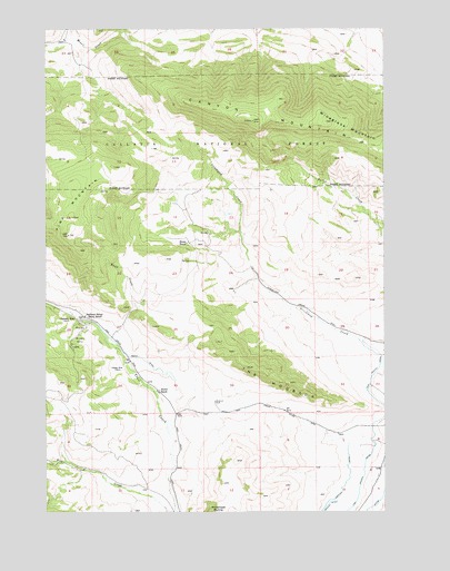
Chimney Rock, MT USGS Topographic Map
Click on map above to begin viewing in our Map Viewer.

This topographic map contains these locations and features:
Feature Name Type Latitude Longitude GNIS ID View Map
Blome RanchLocaleN45.5694°W110.6980°780123View Map
Canyon MountainSummitN45.6010°W110.6744°780916View Map
Chimney RockPopulated PlaceN45.5499°W110.7388°806921View Map
Chimney Rock School (historical)SchoolN45.5499°W110.7388°1743261View Map
Chimneyrock (historical)LocaleN45.5499°W110.7388°1743205View Map
Chimneyrock Post Office (historical)Post OfficeN45.5499°W110.7388°1743190View Map
Eagle CreekStreamN45.5438°W110.7280°782750View Map
Hoffman School (historical)SchoolN45.5505°W110.7363°800946View Map
Maxey DitchCanalN45.5397°W110.7152°786944View Map
Maxey MineMineN45.5374°W110.7263°786945View Map
Maxey MinesMineN45.5433°W110.7410°786946View Map
Nesbit RanchLocaleN45.5308°W110.7088°787952View Map
Pine MountainSummitN45.5760°W110.7410°788900View Map
The HogbackRidgeN45.5366°W110.6710°792036View Map
Wineglass MountainSummitN45.6008°W110.6472°793415View Map

Note: Coordinates in the location and feature list above are referenced to NAD83 datum.


Copyright (C) 2008-2024 Ryan Niemi / Sunset Dynamics ... All Rights Reserved