TopoQuest Logo
Do you find TopoQuest useful?
Help keep TopoQuest running and adding new maps/features by donating!
Bitcoin:  19c7KJd3qBynnjoSw5npx9KScwjBe4ifkT
Litecoin:  LXs6TkuXGGXo1vDsWCkWVdjQX94eUKd6ui
Home View Maps Find Maps Find Places Resources & Links


Bozeman Pass, Montana Topographic Map

USGS Map Title: Bozeman Pass, MT
USGS Map MRC: 45110F7
DRG (GeoTIFF) Download: o45110f7.tif


Neighboring USGS Topographic Map Quads:


  Saddle Peak, MT  
45110G8
 

  Grassy Mountain, MT  
45110G7
 

  Gobblers Knob, MT  
45110G6
 

  Kelly Creek, MT  
45110F8
 

  Bozeman Pass, MT  
45110F7
 

  Hoppers, MT  
45110F6
 

  Mount Ellis, MT  
45110E8
 

  Bald Knob, MT  
45110E7
 

  Chimney Rock, MT  
45110E6


Map MRC Location:

N46°
W111°
N46°
W110°
H8 H7 H6 H5 H4 H3 H2 H1
G8 G7 G6 G5 G4 G3 G2 G1
F8 F7 F6 F5 F4 F3 F2 F1
E8 E7 E6 E5 E4 E3 E2 E1
D8 D7 D6 D5 D4 D3 D2 D1
C8 C7 C6 C5 C4 C3 C2 C1
B8 B7 B6 B5 B4 B3 B2 B1
A8 A7 A6 A5 A4 A3 A2 A1
N45°
W111°
N45°
W110°

Bozeman Pass, MT USGS 1:24K Topographic Map Preview:
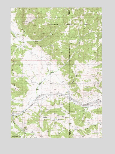
Bozeman Pass, MT USGS Topographic Map
Click on map above to begin viewing in our Map Viewer.

This topographic map contains these locations and features:
Feature Name Type Latitude Longitude GNIS ID View Map
Anaconda Copper MinesMineN45.6277°W110.8363°779017View Map
Bozeman PassGapN45.6672°W110.8077°780344View Map
Bozeman Pass Historical MarkerParkN45.6677°W110.8063°1737974View Map
Bozeman TunnelTunnelN45.6658°W110.8080°780345View Map
Buckskin MineMineN45.6377°W110.7533°780532View Map
Coulston (historical)LocaleN45.6388°W110.7966°1743891View Map
Coulston MineMineN45.6388°W110.7966°781757View Map
Di Lulo MineMineN45.6255°W110.7794°782349View Map
Doyle CabinLocaleN45.7477°W110.7899°782525View Map
Five MineMineN45.6438°W110.8091°783477View Map
Goose CreekStreamN45.6283°W110.8452°784110View Map
Green MountainSummitN45.6980°W110.8741°784295View Map
Hudson CreekStreamN45.6330°W110.8619°785138View Map
Interchange 319CrossingN45.6649°W110.8358°1737982View Map
Jackson CreekStreamN45.6624°W110.8430°785387View Map
KCTZ-TV (Bozeman)TowerN45.6733°W110.8680°806724View Map
KUUB-FM (Bozeman)TowerN45.6733°W110.8680°806657View Map
KYBS-FM (Livingston)TowerN45.6572°W110.8069°806697View Map
Malmborg SchoolSchoolN45.6713°W110.8388°786800View Map
Meadow CreekStreamN45.6474°W110.8713°787149View Map
Meadow Creek School (historical)SchoolN45.6444°W110.8230°1743489View Map
Miller MineMineN45.6366°W110.8586°787425View Map
Mountain Side (historical)LocaleN45.6480°W110.8694°1743851View Map
Mountainside MineMineN45.6458°W110.8711°787775View Map
MuirPopulated PlaceN45.6630°W110.7936°802146View Map
MuirLocaleN45.6630°W110.7936°1743363View Map
Muir CemeteryCemeteryN45.6670°W110.7927°1743124View Map
Muir Post Office (historical)Post OfficeN45.6630°W110.7936°1743362View Map
Muir School (historical)SchoolN45.6630°W110.7936°1743364View Map
Murphy MineMineN45.6322°W110.8558°787866View Map
North Fork Spring CreekStreamN45.7249°W110.8730°788252View Map
Number Four MineMineN45.6452°W110.8230°788336View Map
Number Thirty MineMineN45.6330°W110.7888°788338View Map
Quinn CreekStreamN45.6669°W110.7974°789301View Map
Radke SawmillLocaleN45.7074°W110.7888°789326View Map
Ross MineMineN45.6460°W110.8052°789792View Map
Shadoan SawmillLocaleN45.6594°W110.8733°790259View Map
Stinking Water MineMineN45.6447°W110.8327°791531View Map
Storrs (historical)LocaleN45.6297°W110.8430°1743828View Map
Storrs (historical)Populated PlaceN45.6297°W110.8430°1743829View Map
Storrs MineMineN45.6310°W110.8458°791574View Map
Storrs Post Office (historical)Post OfficeN45.6297°W110.8430°1743812View Map
Storrs School (historical)SchoolN45.6305°W110.8480°1738059View Map
Timberline (historical)LocaleN45.6647°W110.8274°1743825View Map
Timberline CemeteryCemeteryN45.6499°W110.8258°1743528View Map
Timberline CreekStreamN45.6624°W110.8430°792198View Map
Timberline Post Office (historical)Post OfficeN45.6647°W110.8274°1743816View Map
Upper Ross MineMineN45.6449°W110.8027°792650View Map
Vaters CemeteryCemeteryN45.6623°W110.7754°1743321View Map
Vaters Post Office (historical)Post OfficeN45.6577°W110.7744°1743379View Map
Vaters School (historical)SchoolN45.6577°W110.7744°1743380View Map
West EndPopulated PlaceN45.6658°W110.8255°802233View Map
Woodland MineMineN45.6463°W110.8113°793505View Map

Note: Coordinates in the location and feature list above are referenced to NAD83 datum.


Copyright (C) 2008-2025 Ryan Niemi / Sunset Dynamics ... All Rights Reserved