TopoQuest Logo
Do you find TopoQuest useful?
Help keep TopoQuest running and adding new maps/features by donating!
Bitcoin:  19c7KJd3qBynnjoSw5npx9KScwjBe4ifkT
Litecoin:  LXs6TkuXGGXo1vDsWCkWVdjQX94eUKd6ui
Home View Maps Find Maps Find Places Resources & Links


Chrisman, Illinois Topographic Map

USGS Map Title: Chrisman, IL
USGS Map MRC: 39087G6
DRG (GeoTIFF) Download: o39087g6.tif


Neighboring USGS Topographic Map Quads:


  Sidell, IL  
39087H7
 

  Georgetown, IL  
39087H6
 

  Humrick, IL  
39087H5
 

  Hume, IL  
39087G7
 

  Chrisman, IL  
39087G6
 

  Scottland, IL  
39087G5
 

  Redmon, IL  
39087F7
 

  Paris North, IL  
39087F6
 

  Saint Bernice, IN  
39087F5


Map MRC Location:

N40°
W88°
N40°
W87°
H8 H7 H6 H5 H4 H3 H2 H1
G8 G7 G6 G5 G4 G3 G2 G1
F8 F7 F6 F5 F4 F3 F2 F1
E8 E7 E6 E5 E4 E3 E2 E1
D8 D7 D6 D5 D4 D3 D2 D1
C8 C7 C6 C5 C4 C3 C2 C1
B8 B7 B6 B5 B4 B3 B2 B1
A8 A7 A6 A5 A4 A3 A2 A1
N39°
W88°
N39°
W87°

Chrisman, IL USGS 1:24K Topographic Map Preview:
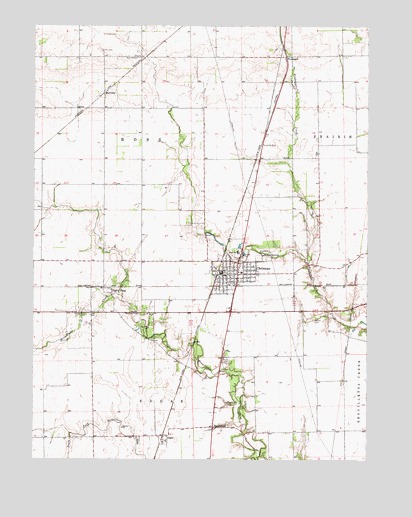
Chrisman, IL USGS Topographic Map
Click on map above to begin viewing in our Map Viewer.

This topographic map contains these locations and features:
Feature Name Type Latitude Longitude GNIS ID View Map
BloomfieldPopulated PlaceN39.7595°W87.6825°422476View Map
Bloomfield CemeteryCemeteryN39.7664°W87.6778°404572View Map
Bloomfield School (historical)SchoolN39.7584°W87.6667°1736477View Map
Cherry PointPopulated PlaceN39.7992°W87.7211°422543View Map
Cherry Point CemeteryCemeteryN39.7917°W87.7289°406022View Map
ChrismanPopulated PlaceN39.8036°W87.6736°406082View Map
Chrisman Christian ChurchChurchN39.8050°W87.6786°1984572View Map
Chrisman Elementary SchoolSchoolN39.8039°W87.6720°1808097View Map
Chrisman Fire Protection DistrictBuildingN39.8046°W87.6774°2681767View Map
Chrisman First Baptist ChurchChurchN39.8048°W87.6747°1984573View Map
Chrisman High SchoolSchoolN39.8100°W87.6736°1736483View Map
Chrisman Police DepartmentBuildingN39.8044°W87.6803°2759027View Map
Chrisman Post OfficePost OfficeN39.8047°W87.6797°1984570View Map
Chrisman United Methodist ChurchChurchN39.8036°W87.6767°1984574View Map
City of ChrismanCivilN39.8044°W87.6752°2393520View Map
EdgarPopulated PlaceN39.7556°W87.7011°407771View Map
Four-H Club FairgroundsParkN39.7903°W87.7378°446831View Map
Gaines CemeteryCemeteryN39.8676°W87.7251°408839View Map
Hoult CemeteryCemeteryN39.7786°W87.6779°410595View Map
Legate School (historical)SchoolN39.8067°W87.6328°1736510View Map
Manning School (historical)SchoolN39.7795°W87.6722°1736514View Map
Maple Grove School (historical)SchoolN39.8153°W87.7464°1736515View Map
McKee CemeteryCemeteryN39.7902°W87.6450°413286View Map
Mitchell School (historical)SchoolN39.8370°W87.6634°1736522View Map
MortimerPopulated PlaceN39.8553°W87.7245°423003View Map
Mount Olive School (historical)SchoolN39.8642°W87.7245°1736524View Map
Northern Edgar County Ambulance ServiceBuildingN39.8030°W87.6808°2673955View Map
Prairie Union School (historical)SchoolN39.8589°W87.6328°1736535View Map
Rogers School (historical)SchoolN39.7814°W87.7284°1736540View Map
Ross CemeteryCemeteryN39.8656°W87.7121°416973View Map
ScottsPopulated PlaceN39.8453°W87.6628°1736547View Map
Township of RossCivilN39.8366°W87.7096°429675View Map
Woodland CemeteryCemeteryN39.8089°W87.6659°421430View Map
WoodyardPopulated PlaceN39.8656°W87.6561°423338View Map

Note: Coordinates in the location and feature list above are referenced to NAD83 datum.


Copyright (C) 2008-2025 Ryan Niemi / Sunset Dynamics ... All Rights Reserved