TopoQuest Logo
Do you find TopoQuest useful?
Help keep TopoQuest running and adding new maps/features by donating!
Bitcoin:  19c7KJd3qBynnjoSw5npx9KScwjBe4ifkT
Litecoin:  LXs6TkuXGGXo1vDsWCkWVdjQX94eUKd6ui
Home View Maps Find Maps Find Places Resources & Links


Church Mountain, New Mexico Topographic Map

USGS Map Title: Church Mountain, NM
USGS Map MRC: 33105E7
DRG (GeoTIFF) Download: o33105e7.tif


Neighboring USGS Topographic Map Quads:


  Carrizozo East, NM  
33105F7
 

  White Oaks South, NM  
33105F6
 

  Cub Mountain, NM  
33105E8
 

  Church Mountain, NM  
33105E7
 

  Nogal, NM  
33105E6
 

  Godfrey Peak, NM  
33105D8
 

  Nogal Peak, NM  
33105D7
 

  Angus, NM  
33105D6


Map MRC Location:

N34°
W106°
N34°
W105°
H8 H7 H6 H5 H4 H3 H2 H1
G8 G7 G6 G5 G4 G3 G2 G1
F8 F7 F6 F5 F4 F3 F2 F1
E8 E7 E6 E5 E4 E3 E2 E1
D8 D7 D6 D5 D4 D3 D2 D1
C8 C7 C6 C5 C4 C3 C2 C1
B8 B7 B6 B5 B4 B3 B2 B1
A8 A7 A6 A5 A4 A3 A2 A1
N33°
W106°
N33°
W105°

Church Mountain, NM USGS 1:24K Topographic Map Preview:
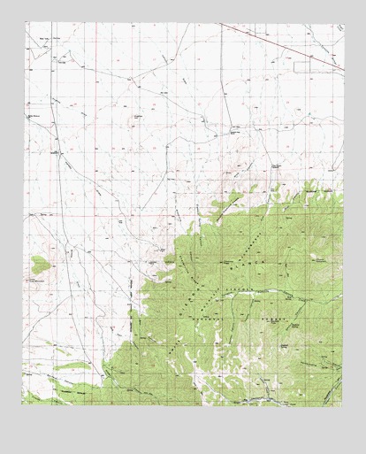
Church Mountain, NM USGS Topographic Map
Click on map above to begin viewing in our Map Viewer.

This topographic map contains these locations and features:
Feature Name Type Latitude Longitude GNIS ID View Map
10079 Water WellWellN33.5937°W105.8725°931741View Map
Ball Hornet ClaimsMineN33.5145°W105.7961°916932View Map
Bear CanyonValleyN33.5345°W105.8339°1985263View Map
Betty and Stella ClaimsMineN33.5490°W105.8217°916212View Map
Bornite MineMineN33.5404°W105.8194°939821View Map
Bull Dyker MineMineN33.5490°W105.8217°939945View Map
Buster Brown MineMineN33.5598°W105.8208°939822View Map
Butcher BoyMineN33.5565°W105.8144°916221View Map
C and M Number One and Two ClaimsMineN33.5151°W105.7714°916223View Map
Cap ClaimMineN33.5490°W105.8217°916224View Map
Church MountainSummitN33.5495°W105.7625°905143View Map
Cinnamon MineMineN33.5404°W105.8194°939825View Map
City WindmillLocaleN33.5820°W105.8622°1985249View Map
Clipper ClaimsMineN33.5176°W105.7558°916950View Map
Columbia MineMineN33.5542°W105.8192°916952View Map
Commercial MineMineN33.5504°W105.8205°916227View Map
Copper Glance ClaimMineN33.5154°W105.8380°916232View Map
Copper Matte ClaimMineN33.5042°W105.8367°916234View Map
Couger MineMineN33.5092°W105.7811°916958View Map
D and B TunnelMineN33.5204°W105.7739°916237View Map
Delaware MineMineN33.5404°W105.8194°939828View Map
Diamond PeakSummitN33.5473°W105.7972°912581View Map
Diamond Peak RanchLocaleN33.5895°W105.7950°1985250View Map
Diamond Spring CanyonValleyN33.5804°W105.8100°1985255View Map
Double Diamond PeaksSummitN33.5648°W105.7955°1985257View Map
DuggersLocaleN33.5859°W105.7955°929573View Map
Gaylord CanyonValleyN33.5351°W105.7644°906513View Map
Gaylord PeakSummitN33.5279°W105.7783°906514View Map
Gaylord SpringSpringN33.5201°W105.7747°1985272View Map
Goat CanyonValleyN33.5840°W105.7705°912586View Map
Grub Stake MineMineN33.5598°W105.8208°915406View Map
Harkey WindmillLocaleN33.5934°W105.8739°1985248View Map
Harry Allen MineMineN33.5490°W105.8217°939601View Map
Hart ProspectMineN33.5054°W105.7783°915583View Map
Hat ClaimMineN33.5490°W105.8217°915408View Map
Hatfield SpringSpringN33.5267°W105.7703°1985271View Map
Hog Pen CanyonValleyN33.5287°W105.8486°1985261View Map
Homestake MineMineN33.5573°W105.8230°915305View Map
Homesteak ClaimMineN33.5223°W105.8283°917167View Map
Hughes HillSummitN33.5929°W105.8328°907156View Map
Idaho MIneMineN33.5401°W105.8192°915308View Map
Illinois MineMineN33.5084°W105.8119°939568View Map
Indian CreekStreamN33.5034°W105.7783°907198View Map
Iron BlossomMineN33.5123°W105.8408°915412View Map
Junction MineMineN33.5470°W105.8258°907481View Map
Kountz CanyonValleyN33.5198°W105.7869°907588View Map
Last Chance Claim Number 1MineN33.5145°W105.7961°915318View Map
Little Cub MountainSummitN33.5406°W105.8730°1985259View Map
Little Hecla ClaimsMineN33.5020°W105.8519°914801View Map
Magma Number 1 and 2 ClaimsMineN33.5456°W105.8283°915581View Map
May SpringSpringN33.5359°W105.7703°1985270View Map
Midnight MineMineN33.5084°W105.8119°915327View Map
Minnie Lea MineMineN33.5490°W105.8217°939489View Map
Moscow MineMineN33.5598°W105.8208°939607View Map
New Mexico Copper Corp ClaimsMineN33.5084°W105.8314°915416View Map
Norman CanyonValleyN33.5365°W105.7930°909119View Map
Oakridge TrailTrailN33.5256°W105.8139°1985268View Map
Park Gold Number 3 MineMineN33.5037°W105.7811°914821View Map
Park Gold TunnelMineN33.5015°W105.8178°914822View Map
Pennsylvania TrailTrailN33.5154°W105.7847°1985273View Map
Pine CanyonValleyN33.5840°W105.7705°912604View Map
Pine Canyon WindmillLocaleN33.5781°W105.7786°1985252View Map
PinoLocaleN33.5859°W105.7955°929617View Map
Privateer MineMineN33.5404°W105.8194°939801View Map
R and L ClaimMineN33.5015°W105.7908°916148View Map
Red Jim MineMineN33.5404°W105.8194°939954View Map
Richardson ClaimsMineN33.5323°W105.7980°916154View Map
Rochford ClaimsMineN33.5176°W105.7558°916980View Map
Sailor Boy MineMineN33.5598°W105.8208°939804View Map
Shelerville RidgeRidgeN33.5437°W105.8111°1985258View Map
Silver Dollar ClaimMineN33.5154°W105.8380°916159View Map
Silver-Copper ClaimMineN33.5490°W105.8217°916984View Map
Sugar Stake ClaimMineN33.5273°W105.8244°916169View Map
Surprise Contact ClaimMineN33.5037°W105.8311°914767View Map
Surprise MineMineN33.5084°W105.8314°939475View Map
Sylvanite MineMineN33.5456°W105.8283°939476View Map
Telluride MineMineN33.5456°W105.8283°939808View Map
Tortolita SpringSpringN33.5356°W105.7978°936620View Map
Trust MineMineN33.5404°W105.8194°939477View Map
Union Jack MineMineN33.5404°W105.8194°939478View Map
Water CanyonValleyN33.5170°W105.8444°912176View Map
Wind CanyonValleyN33.5862°W105.7839°912623View Map

Note: Coordinates in the location and feature list above are referenced to NAD83 datum.


Copyright (C) 2008-2024 Ryan Niemi / Sunset Dynamics ... All Rights Reserved