TopoQuest Logo
Do you find TopoQuest useful?
Help keep TopoQuest running and adding new maps/features by donating!
Bitcoin:  19c7KJd3qBynnjoSw5npx9KScwjBe4ifkT
Litecoin:  LXs6TkuXGGXo1vDsWCkWVdjQX94eUKd6ui
Home View Maps Find Maps Find Places Resources & Links


Godfrey Peak, New Mexico Topographic Map

USGS Map Title: Godfrey Peak, NM
USGS Map MRC: 33105D8
DRG (GeoTIFF) Download: o33105d8.tif


Neighboring USGS Topographic Map Quads:


  Cub Mountain, NM  
33105E8
 

  Church Mountain, NM  
33105E7
 

  Oscura, NM  
33106D1
 

  Godfrey Peak, NM  
33105D8
 

  Nogal Peak, NM  
33105D7
 

  Three Rivers, NM  
33106C1
 

  Golondrina Draw, NM  
33105C8
 

  Sierra Blanca Peak, NM  
33105C7


Map MRC Location:

N34°
W106°
N34°
W105°
H8 H7 H6 H5 H4 H3 H2 H1
G8 G7 G6 G5 G4 G3 G2 G1
F8 F7 F6 F5 F4 F3 F2 F1
E8 E7 E6 E5 E4 E3 E2 E1
D8 D7 D6 D5 D4 D3 D2 D1
C8 C7 C6 C5 C4 C3 C2 C1
B8 B7 B6 B5 B4 B3 B2 B1
A8 A7 A6 A5 A4 A3 A2 A1
N33°
W106°
N33°
W105°

Godfrey Peak, NM USGS 1:24K Topographic Map Preview:
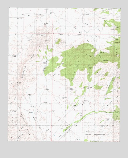
Godfrey Peak, NM USGS Topographic Map
Click on map above to begin viewing in our Map Viewer.

This topographic map contains these locations and features:
Feature Name Type Latitude Longitude GNIS ID View Map
Barber RidgeRidgeN33.4501°W105.8753°903554View Map
Bataan LodgeLocaleN33.4631°W105.9039°915943View Map
Bessie Case SpringSpringN33.4112°W105.9607°900845View Map
Brownfield CanyonValleyN33.3920°W105.9294°900847View Map
Brownfield SpringSpringN33.4136°W105.9146°900844View Map
Brownfield WindmillLocaleN33.4106°W105.9236°900846View Map
Brush CanyonValleyN33.4067°W105.8955°912570View Map
Buck Pasture SpringSpringN33.4849°W105.9614°900842View Map
Candelaria CanyonValleyN33.3795°W105.9589°1985408View Map
Candelaria SpringSpringN33.4479°W105.9578°1985403View Map
Coal Mine TankReservoirN33.4016°W105.9732°1985407View Map
Cottonwood SpringSpringN33.4901°W105.8958°1985399View Map
Crawford CanyonValleyN33.4290°W105.9097°1985405View Map
Crawford WellWellN33.3812°W105.9847°1985410View Map
Daugherty RidgeRidgeN33.4801°W105.8822°1985400View Map
Daugherty SpringSpringN33.4820°W105.8768°912579View Map
Elder CanyonValleyN33.4926°W105.9055°906110View Map
Gamble CanyonValleyN33.3795°W105.9589°1985409View Map
Gamble WindmillLocaleN33.4340°W105.9286°901148View Map
Goat CanyonValleyN33.4206°W105.8897°906582View Map
Godfrey HillsRangeN33.4694°W105.9583°920602View Map
Godfrey PeakSummitN33.4690°W105.9586°900938View Map
Halfway WindmillLocaleN33.4031°W105.9944°900917View Map
Hall WindmillLocaleN33.4240°W105.9575°900918View Map
Hide SpringSpringN33.4240°W105.9286°901127View Map
I Bar X SpringSpringN33.4959°W105.9530°914409View Map
I-X RanchLocaleN33.4981°W105.9575°900910View Map
Lincoln CanyonValleyN33.4040°W105.8989°907970View Map
Lincoln SpringSpringN33.4329°W105.8847°1985406View Map
Maverick SpringSpringN33.4750°W105.9643°900712View Map
Mc Iver CanyonValleyN33.4742°W105.8794°1986851View Map
New Brownfield WellWellN33.4162°W105.9394°900843View Map
North WindmillLocaleN33.4754°W105.9189°1985401View Map
Padilla SpringSpringN33.3871°W105.9415°900742View Map
Rattlesnake CanyonValleyN33.4365°W105.8761°912607View Map
Robinson CanyonValleyN33.4748°W105.9075°1985402View Map
Robinson SpringSpringN33.4516°W105.8952°900759View Map
Rock House SpringSpringN33.3968°W105.8904°901126View Map
Rocky Point SpringSpringN33.4701°W105.9760°900741View Map
Rose PeakSummitN33.4295°W105.9889°910429View Map
SnaggletoothSummitN33.4673°W105.9422°900779View Map
Snaggletooth WellWellN33.4762°W105.9436°900778View Map
Tanner CanyonValleyN33.4912°W105.9442°911543View Map
Tanner SpringSpringN33.4588°W105.8954°900780View Map
Three Rivers CampgroundLocaleN33.4012°W105.8850°924234View Map
Three Rivers RanchLocaleN33.3870°W105.9317°900760View Map
Tramble WindmillLocaleN33.3990°W105.9175°900800View Map
Trinidad SpringSpringN33.4240°W105.9286°900783View Map
Twin Wells WindmillLocaleN33.4551°W105.9955°900799View Map
Walker WindmillLocaleN33.4717°W105.8817°915944View Map
Wingfield SpringSpringN33.4443°W105.9109°900782View Map
Winston CanyonValleyN33.4340°W105.9522°1985404View Map
Winston SpringSpringN33.4481°W105.9387°900781View Map

Note: Coordinates in the location and feature list above are referenced to NAD83 datum.


Copyright (C) 2008-2025 Ryan Niemi / Sunset Dynamics ... All Rights Reserved