TopoQuest Logo
Do you find TopoQuest useful?
Help keep TopoQuest running and adding new maps/features by donating!
Bitcoin:  19c7KJd3qBynnjoSw5npx9KScwjBe4ifkT
Litecoin:  LXs6TkuXGGXo1vDsWCkWVdjQX94eUKd6ui
Home View Maps Find Maps Find Places Resources & Links


Clark, Missouri Topographic Map

USGS Map Title: Clark, MO
USGS Map MRC: 39092C3
DRG (GeoTIFF) Download: o39092c3.tif


Neighboring USGS Topographic Map Quads:


  Moberly, MO  
39092D4
 

  Middle Grove, MO  
39092D3
 

  Madison, MO  
39092D2
 

  Renick, MO  
39092C4
 

  Clark, MO  
39092C3
 

  Tulip, MO  
39092C2
 

  Harrisburg, MO  
39092B4
 

  Sturgeon, MO  
39092B3
 

  Centralia, MO  
39092B2


Map MRC Location:

N40°
W93°
N40°
W92°
H8 H7 H6 H5 H4 H3 H2 H1
G8 G7 G6 G5 G4 G3 G2 G1
F8 F7 F6 F5 F4 F3 F2 F1
E8 E7 E6 E5 E4 E3 E2 E1
D8 D7 D6 D5 D4 D3 D2 D1
C8 C7 C6 C5 C4 C3 C2 C1
B8 B7 B6 B5 B4 B3 B2 B1
A8 A7 A6 A5 A4 A3 A2 A1
N39°
W93°
N39°
W92°

Clark, MO USGS 1:24K Topographic Map Preview:
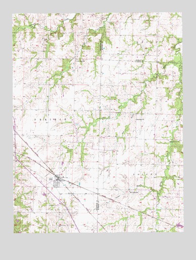
Clark, MO USGS Topographic Map
Click on map above to begin viewing in our Map Viewer.

This topographic map contains these locations and features:
Feature Name Type Latitude Longitude GNIS ID View Map
Big CreekStreamN39.3236°W92.2927°714150View Map
Boat BranchStreamN39.3306°W92.2793°714458View Map
Bormet Lake DamDamN39.2534°W92.2552°762286View Map
Chapel Grove CemeteryCemeteryN39.2659°W92.3427°715726View Map
Chapel Grove School (historical)SchoolN39.2620°W92.3507°743997View Map
City of ClarkCivilN39.2700°W92.3431°2393537View Map
ClarkPopulated PlaceN39.2811°W92.3427°729293View Map
Clark Post OfficePost OfficeN39.2809°W92.3435°2782661View Map
DavenportLocaleN39.3425°W92.2960°740334View Map
Davenport Post Office (historical)Post OfficeN39.3425°W92.2960°759497View Map
Edwards School (historical)SchoolN39.3131°W92.3399°743995View Map
Garrett School (historical)SchoolN39.3503°W92.2766°743998View Map
Hanak Lake DamDamN39.2617°W92.2518°762287View Map
Harry Freeman DamDamN39.2800°W92.2502°760713View Map
Macedonia School (historical)SchoolN39.3142°W92.2850°721724View Map
Martin LakeReservoirN39.3200°W92.3502°761839View Map
Martin Lake DamDamN39.3200°W92.3502°761838View Map
Milnes LakeReservoirN39.2502°W92.3705°761422View Map
Milnes Lake DamDamN39.2500°W92.3718°761421View Map
Mount Pisgah CemeteryCemeteryN39.2738°W92.2899°2099586View Map
Mount Pisgah School (historical)SchoolN39.2731°W92.2899°722848View Map
New Hope ChurchChurchN39.3481°W92.3285°723259View Map
Pisgah Baptist Church (historical)ChurchN39.2734°W92.2898°744151View Map
Pisgah BranchStreamN39.2725°W92.2691°724434View Map
Pleasant Grove ChurchChurchN39.3020°W92.2530°729609View Map
Saling CreekStreamN39.3464°W92.2516°735837View Map
Southeastern Randolph Fire Protection District ClarkBuildingN39.2812°W92.3434°2621572View Map
Vernon School (historical)SchoolN39.2936°W92.3741°743996View Map

Note: Coordinates in the location and feature list above are referenced to NAD83 datum.


Copyright (C) 2008-2025 Ryan Niemi / Sunset Dynamics ... All Rights Reserved