TopoQuest Logo
Do you find TopoQuest useful?
Help keep TopoQuest running and adding new maps/features by donating!
Bitcoin:  19c7KJd3qBynnjoSw5npx9KScwjBe4ifkT
Litecoin:  LXs6TkuXGGXo1vDsWCkWVdjQX94eUKd6ui
Home View Maps Find Maps Find Places Resources & Links


Clatonia, Nebraska Topographic Map

USGS Map Title: Clatonia, NE
USGS Map MRC: 40096D7
DRG (GeoTIFF) Download: o40096d7.tif


Neighboring USGS Topographic Map Quads:


  Crete South, NE  
40096E8
 

  Hallam, NE  
40096E7
 

  Cortland, NE  
40096E6
 

  Wilber, NE  
40096D8
 

  Clatonia, NE  
40096D7
 

  Pickrell, NE  
40096D6
 

  Plymouth, NE  
40096C8
 

  Beatrice West, NE  
40096C7
 

  Beatrice East, NE  
40096C6


Map MRC Location:

N41°
W97°
N41°
W96°
H8 H7 H6 H5 H4 H3 H2 H1
G8 G7 G6 G5 G4 G3 G2 G1
F8 F7 F6 F5 F4 F3 F2 F1
E8 E7 E6 E5 E4 E3 E2 E1
D8 D7 D6 D5 D4 D3 D2 D1
C8 C7 C6 C5 C4 C3 C2 C1
B8 B7 B6 B5 B4 B3 B2 B1
A8 A7 A6 A5 A4 A3 A2 A1
N40°
W97°
N40°
W96°

Clatonia, NE USGS 1:24K Topographic Map Preview:
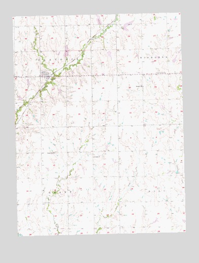
Clatonia, NE USGS Topographic Map
Click on map above to begin viewing in our Map Viewer.

This topographic map contains these locations and features:
Feature Name Type Latitude Longitude GNIS ID View Map
Barkley School (historical)SchoolN40.4586°W96.7795°827185View Map
ClatoniaPopulated PlaceN40.4653°W96.8497°828165View Map
ClatoniaLocaleN40.4650°W96.8495°1883296View Map
Clatonia Creek Dam 2-ADamN40.4526°W96.8694°1769714View Map
Clatonia Creek Dam 2-BDamN40.4608°W96.8642°1769706View Map
Clatonia Creek Dam 3-ADamN40.4816°W96.8597°1769742View Map
Clatonia Creek Dam 4-ADamN40.4766°W96.8361°1769058View Map
Clatonia Creek Dam 6-ADamN40.4789°W96.8048°1769750View Map
Clatonia Creek Dam 7-ADamN40.4943°W96.8100°1768689View Map
Clatonia Creek Dam 8-DDamN40.4919°W96.7935°1769830View Map
Clatonia Creek Reservoir 2-ALakeN40.4534°W96.8713°1769715View Map
Clatonia Creek Reservoir 2-BLakeN40.4623°W96.8648°1769707View Map
Clatonia Creek Reservoir 3-AReservoirN40.4843°W96.8597°1769743View Map
Clatonia Creek Reservoir 4-ALakeN40.4794°W96.8358°1769059View Map
Clatonia Creek Reservoir 6-ALakeN40.4769°W96.8036°1769751View Map
Clatonia Creek Reservoir 7-AReservoirN40.4967°W96.8112°1768690View Map
Clatonia Creek Reservoir 8-DLakeN40.4925°W96.7914°1769831View Map
Clatonia Post OfficePost OfficeN40.4656°W96.8495°1883292View Map
Clatonia Rescue SquadBuildingN40.4652°W96.8507°2553750View Map
Clatonia School (historical)SchoolN40.4664°W96.8561°1883295View Map
Clatonia Suburban Fire DepartmentBuildingN40.4652°W96.8507°1883294View Map
Farmers Cooperative ElevatorLocaleN40.4653°W96.8497°1883293View Map
Highland Center CemeteryCemeteryN40.4661°W96.7614°829972View Map
Indian Creek Dam 16-1DamN40.3929°W96.7642°1768970View Map
Indian Creek Dam 16-ADamN40.3807°W96.7506°1768531View Map
Indian Creek Dam 2-ADamN40.4454°W96.7647°1768547View Map
Indian Creek Dam 3-ADamN40.4895°W96.7597°1768537View Map
Indian Creek Dam 3-BDamN40.4751°W96.7670°1768535View Map
Indian Creek Dam 3-CDamN40.4720°W96.7570°1768561View Map
Indian Creek Reservoir 16-1LakeN40.3934°W96.7639°1768971View Map
Indian Creek Reservoir 16-ALakeN40.3812°W96.7512°1768532View Map
Indian Creek Reservoir 2-ALakeN40.4461°W96.7652°1768548View Map
Indian Creek Reservoir 3-ALakeN40.4898°W96.7592°1768538View Map
Indian Creek Reservoir 3-BReservoirN40.4750°W96.7682°1768536View Map
Indian Creek Reservoir 3-CLakeN40.4728°W96.7561°1768562View Map
Little Indian Creek Dam 15-ADamN40.4084°W96.7554°1767695View Map
Little Indian Creek Reservoir 15ReservoirN40.4093°W96.7562°1767696View Map
Moon School (historical)SchoolN40.4217°W96.8147°831397View Map
Prairie Star School (historical)SchoolN40.3789°W96.8567°832376View Map
Prince Henry School (historical)SchoolN40.4072°W96.7631°832393View Map
Rose Hill CemeteryCemeteryN40.3936°W96.8556°832689View Map
Russell School (historical)SchoolN40.3933°W96.8092°832792View Map
Saint Pauls ChurchChurchN40.4189°W96.8178°833072View Map
School Number 42 (historical)SchoolN40.4219°W96.8464°836718View Map
Township of ClatoniaCivilN40.4798°W96.8559°837922View Map
Township of GrantCivilN40.3931°W96.8564°838038View Map
Village of ClatoniaCivilN40.4654°W96.8512°2397635View Map

Note: Coordinates in the location and feature list above are referenced to NAD83 datum.


Copyright (C) 2008-2025 Ryan Niemi / Sunset Dynamics ... All Rights Reserved