TopoQuest Logo
Do you find TopoQuest useful?
Help keep TopoQuest running and adding new maps/features by donating!
Bitcoin:  19c7KJd3qBynnjoSw5npx9KScwjBe4ifkT
Litecoin:  LXs6TkuXGGXo1vDsWCkWVdjQX94eUKd6ui
Home View Maps Find Maps Find Places Resources & Links


Clayton, Idaho Topographic Map

USGS Map Title: Clayton, ID
USGS Map MRC: 44114C4
DRG (GeoTIFF) Download: o44114c4.tif


Neighboring USGS Topographic Map Quads:


  Elevenmile Creek, ID  
44114D5
 

  Bayhorse Lake, ID  
44114D4
 

  Bayhorse, ID  
44114D3
 

  Thompson Creek, ID  
44114C5
 

  Clayton, ID  
44114C4
 

  Bald Mountain, ID  
44114C3
 

  Livingston Creek, ID  
44114B5
 

  Potaman Peak, ID  
44114B4
 

  Ziegler Basin, ID  
44114B3


Map MRC Location:

N45°
W115°
N45°
W114°
H8 H7 H6 H5 H4 H3 H2 H1
G8 G7 G6 G5 G4 G3 G2 G1
F8 F7 F6 F5 F4 F3 F2 F1
E8 E7 E6 E5 E4 E3 E2 E1
D8 D7 D6 D5 D4 D3 D2 D1
C8 C7 C6 C5 C4 C3 C2 C1
B8 B7 B6 B5 B4 B3 B2 B1
A8 A7 A6 A5 A4 A3 A2 A1
N44°
W115°
N44°
W114°

Clayton, ID USGS 1:24K Topographic Map Preview:
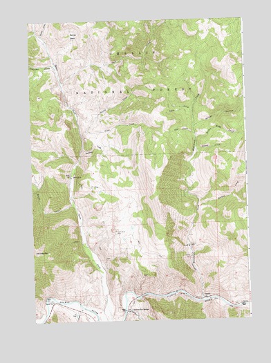
Clayton, ID USGS Topographic Map
Click on map above to begin viewing in our Map Viewer.

This topographic map contains these locations and features:
Feature Name Type Latitude Longitude GNIS ID View Map
Boundary CreekStreamN44.3216°W114.4703°378116View Map
Broken Ridge CreekStreamN44.3255°W114.4040°378248View Map
Bruno CreekStreamN44.2988°W114.4765°378317View Map
Cabin CreekStreamN44.3363°W114.4056°378628View Map
Cash CreekStreamN44.3491°W114.4820°378990View Map
Cinnabar CreekStreamN44.3552°W114.4848°397549View Map
City of ClaytonCivilN44.2592°W114.3996°2409475View Map
ClaytonPopulated PlaceN44.2591°W114.4004°396298View Map
Clayton MineMineN44.2808°W114.4106°379384View Map
Clayton Mine Number One-Upper DamDamN44.2849°W114.4092°398891View Map
Clayton Mine Number Two-Lower DamDamN44.2833°W114.4076°398890View Map
Clayton Post OfficePost OfficeN44.2590°W114.3997°2766879View Map
Clayton Primary SchoolSchoolN44.2621°W114.4028°401275View Map
Clayton Ranger StationLocaleN44.2585°W114.4898°379385View Map
Clayton Volunteer Fire DistrictBuildingN44.2589°W114.4035°2619287View Map
Coal CreekStreamN44.3274°W114.4048°379468View Map
Corral CreekStreamN44.3208°W114.4048°379778View Map
First CreekStreamN44.3263°W114.4709°381728View Map
French CreekStreamN44.2563°W114.4728°382062View Map
Happy HollowValleyN44.3308°W114.4042°382888View Map
Kinnikinic CreekStreamN44.2585°W114.4020°384248View Map
Redbird MineMineN44.3099°W114.4759°389250View Map
Saturday MountainSummitN44.2785°W114.4967°389927View Map
Sawmill CreekStreamN44.2983°W114.4040°389968View Map
Second CreekStreamN44.3291°W114.4684°390079View Map
South Butte MineMineN44.2874°W114.4520°400100View Map
Spring BasinBasinN44.3691°W114.4740°391151View Map
Sullivan CreekStreamN44.2546°W114.4473°391595View Map
Sullivan Hot SpringsSpringN44.2546°W114.4440°391596View Map
Transfer CreekStreamN44.3402°W114.4045°394655View Map
Trealor CreekStreamN44.3685°W114.4928°392368View Map

Note: Coordinates in the location and feature list above are referenced to NAD83 datum.


Copyright (C) 2008-2024 Ryan Niemi / Sunset Dynamics ... All Rights Reserved