TopoQuest Logo
Do you find TopoQuest useful?
Help keep TopoQuest running and adding new maps/features by donating!
Bitcoin:  19c7KJd3qBynnjoSw5npx9KScwjBe4ifkT
Litecoin:  LXs6TkuXGGXo1vDsWCkWVdjQX94eUKd6ui
Home View Maps Find Maps Find Places Resources & Links


Cle Elum Lake, Washington Topographic Map

USGS Map Title: Cle Elum Lake, WA
USGS Map MRC: 47121C1
DRG (GeoTIFF) Download: o47121c1.tif


Neighboring USGS Topographic Map Quads:


  Polallie Ridge, WA  
47121D2
 

  Davis Peak, WA  
47121D1
 

  Mount Stuart, WA  
47120D8
 

  Kachess Lake, WA  
47121C2
 

  Cle Elum Lake, WA  
47121C1
 

  Teanaway Butte, WA  
47120C8
 

  Easton, WA  
47121B2
 

  Ronald, WA  
47121B1
 

  Cle Elum, WA  
47120B8


Map MRC Location:

N48°
W122°
N48°
W121°
H8 H7 H6 H5 H4 H3 H2 H1
G8 G7 G6 G5 G4 G3 G2 G1
F8 F7 F6 F5 F4 F3 F2 F1
E8 E7 E6 E5 E4 E3 E2 E1
D8 D7 D6 D5 D4 D3 D2 D1
C8 C7 C6 C5 C4 C3 C2 C1
B8 B7 B6 B5 B4 B3 B2 B1
A8 A7 A6 A5 A4 A3 A2 A1
N47°
W122°
N47°
W121°

Cle Elum Lake, WA USGS 1:24K Topographic Map Preview:
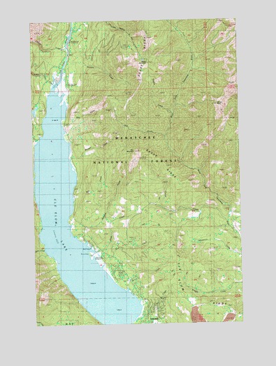
Cle Elum Lake, WA USGS Topographic Map
Click on map above to begin viewing in our Map Viewer.

This topographic map contains these locations and features:
Feature Name Type Latitude Longitude GNIS ID View Map
Bear CreekStreamN47.2740°W121.0859°1516233View Map
Bell CreekStreamN47.3015°W121.1023°1516388View Map
Cle Elum DivisionCivilN47.3469°W121.0295°1939476View Map
Cle Elum LakeReservoirN47.2667°W121.0937°1517820View Map
Cle Elum River CampgroundLocaleN47.3498°W121.1045°1529393View Map
Corral CreekStreamN47.2915°W121.0087°1518119View Map
Davis CreekStreamN47.2812°W121.0859°1518503View Map
Driftwood AcresPopulated PlaceN47.2726°W121.0745°1529391View Map
Dry CreekStreamN47.3329°W121.1098°1518942View Map
Dry Creek CampgroundLocaleN47.3332°W121.1095°1529885View Map
Elbow PeakSummitN47.3396°W121.0145°1519235View Map
French Cabin CreekStreamN47.3490°W121.1145°1519789View Map
Hex CreekStreamN47.3268°W121.0462°1520734View Map
Hex MountainSummitN47.3210°W121.0651°1520735View Map
Howson CreekStreamN47.3590°W121.1056°1521005View Map
LakedalePopulated PlaceN47.2540°W121.0573°1521863View Map
Mill CreekStreamN47.2546°W121.0623°1523153View Map
Morgan CreekStreamN47.3176°W121.1040°1523360View Map
Morgan Creek CampgroundLocaleN47.3187°W121.1034°1529838View Map
Newport CreekStreamN47.2840°W121.0956°1523645View Map
Para CreekStreamN47.2804°W121.1198°1524182View Map
Red Mountain CampgroundLocaleN47.3665°W121.1026°1524947View Map
Sasse MountainSummitN47.3571°W121.0559°1525440View Map
Sasse Mountain TrailTrailN47.3426°W121.0679°1525441View Map
Sasse RidgeRidgeN47.3501°W121.0590°1525442View Map
Spring CreekStreamN47.2640°W121.0701°1526409View Map
Thorp CreekStreamN47.3643°W121.1054°1527128View Map
Tumble CreekStreamN47.3368°W121.0406°1527440View Map
Wish Poosh CampgroundLocaleN47.2798°W121.0868°1529392View Map

Note: Coordinates in the location and feature list above are referenced to NAD83 datum.


Copyright (C) 2008-2025 Ryan Niemi / Sunset Dynamics ... All Rights Reserved