TopoQuest Logo
Do you find TopoQuest useful?
Help keep TopoQuest running and adding new maps/features by donating!
Bitcoin:  19c7KJd3qBynnjoSw5npx9KScwjBe4ifkT
Litecoin:  LXs6TkuXGGXo1vDsWCkWVdjQX94eUKd6ui
Home View Maps Find Maps Find Places Resources & Links


Clements, California Topographic Map

USGS Map Title: Clements, CA
USGS Map MRC: 38121B1
DRG (GeoTIFF) Download: o38121b1.tif


Neighboring USGS Topographic Map Quads:


  Clay, CA  
38121C2
 

  Goose Creek, CA  
38121C1
 

  Ione, CA  
38120C8
 

  Lockeford, CA  
38121B2
 

  Clements, CA  
38121B1
 

  Wallace, CA  
38120B8
 

  Waterloo, CA  
38121A2
 

  Linden, CA  
38121A1
 

  Valley Springs SW, CA  
38120A8


Map MRC Location:

N39°
W122°
N39°
W121°
H8 H7 H6 H5 H4 H3 H2 H1
G8 G7 G6 G5 G4 G3 G2 G1
F8 F7 F6 F5 F4 F3 F2 F1
E8 E7 E6 E5 E4 E3 E2 E1
D8 D7 D6 D5 D4 D3 D2 D1
C8 C7 C6 C5 C4 C3 C2 C1
B8 B7 B6 B5 B4 B3 B2 B1
A8 A7 A6 A5 A4 A3 A2 A1
N38°
W122°
N38°
W121°

Clements, CA USGS 1:24K Topographic Map Preview:
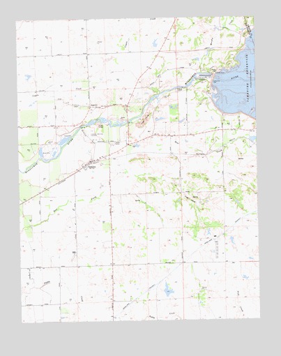
Clements, CA USGS Topographic Map
Click on map above to begin viewing in our Map Viewer.

This topographic map contains these locations and features:
Feature Name Type Latitude Longitude GNIS ID View Map
Camanche 31-016 DamDamN38.2249°W121.0211°1663403View Map
Camanche DamDamN38.2241°W121.0233°220423View Map
ClementsPopulated PlaceN38.1908°W121.0883°221206View Map
Clements Buckaroos Rodeo GroundsLocaleN38.1985°W121.0761°1827284View Map
Clements Elementary SchoolSchoolN38.1927°W121.0833°1827285View Map
Clements Glen View CemeteryCemeteryN38.2021°W121.0894°221207View Map
Clements PitMineN38.2069°W121.0878°2676087View Map
Clements Post OfficePost OfficeN38.1912°W121.0854°1827286View Map
Clements Rural Fire Protection DistrictBuildingN38.1923°W121.0860°2623813View Map
DogtownPopulated PlaceN38.2138°W121.0886°1655976View Map
Featherstone Ranch PitMineN38.2008°W121.1039°2677522View Map
Justice School (historical)SchoolN38.2144°W121.0963°1662185View Map
Lockeford DivisionCivilN38.1598°W121.0853°1935174View Map
Mokelumne BeachBeachN38.2066°W121.0794°1701253View Map
Mokelumne River Fish InstallationLocaleN38.2255°W121.0283°1654334View Map
Murphy CreekStreamN38.2271°W121.0299°229349View Map
Stillman Magee ParkParkN38.2038°W121.0936°1827327View Map
Top of the Hill First Southern Baptist ChurchChurchN38.1896°W121.0897°1827332View Map
Washington School (historical)SchoolN38.2038°W121.0224°1662194View Map

Note: Coordinates in the location and feature list above are referenced to NAD83 datum.


Copyright (C) 2008-2024 Ryan Niemi / Sunset Dynamics ... All Rights Reserved