TopoQuest Logo
Do you find TopoQuest useful?
Help keep TopoQuest running and adding new maps/features by donating!
Bitcoin:  19c7KJd3qBynnjoSw5npx9KScwjBe4ifkT
Litecoin:  LXs6TkuXGGXo1vDsWCkWVdjQX94eUKd6ui
Home View Maps Find Maps Find Places Resources & Links


Wallace, California Topographic Map

USGS Map Title: Wallace, CA
USGS Map MRC: 38120B8
DRG (GeoTIFF) Download: o38120b8.tif


Neighboring USGS Topographic Map Quads:


  Goose Creek, CA  
38121C1
 

  Ione, CA  
38120C8
 

  Jackson, CA  
38120C7
 

  Clements, CA  
38121B1
 

  Wallace, CA  
38120B8
 

  Valley Springs, CA  
38120B7
 

  Linden, CA  
38121A1
 

  Valley Springs SW, CA  
38120A8
 

  Jenny Lind, CA  
38120A7


Map MRC Location:

N39°
W121°
N39°
W120°
H8 H7 H6 H5 H4 H3 H2 H1
G8 G7 G6 G5 G4 G3 G2 G1
F8 F7 F6 F5 F4 F3 F2 F1
E8 E7 E6 E5 E4 E3 E2 E1
D8 D7 D6 D5 D4 D3 D2 D1
C8 C7 C6 C5 C4 C3 C2 C1
B8 B7 B6 B5 B4 B3 B2 B1
A8 A7 A6 A5 A4 A3 A2 A1
N38°
W121°
N38°
W120°

Wallace, CA USGS 1:24K Topographic Map Preview:
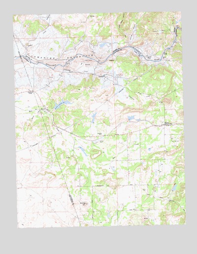
Wallace, CA USGS Topographic Map
Click on map above to begin viewing in our Map Viewer.

This topographic map contains these locations and features:
Feature Name Type Latitude Longitude GNIS ID View Map
Bald MountainSummitN38.1383°W120.9505°218586View Map
Bevanda 495 DamDamN38.1416°W120.8844°1663913View Map
BursonPopulated PlaceN38.1838°W120.8905°1658180View Map
Burson Post OfficePost OfficeN38.1832°W120.8895°1804833View Map
Camanche (historical)Populated PlaceN38.2133°W120.9352°1657884View Map
Camanche CreekStreamN38.2191°W120.9652°220422View Map
Camanche North Shore Census Designated PlaceCensusN38.2442°W120.9539°2582959View Map
Camanche ReservoirReservoirN38.2228°W120.9736°254692View Map
Cat CampLocaleN38.2063°W120.9463°220717View Map
China GulchValleyN38.2302°W120.9166°221046View Map
Evergreen School (historical)SchoolN38.1480°W120.9141°1670509View Map
Ferrario 506 DamDamN38.1866°W120.9161°1663920View Map
Foothill Fire Protection District Station 1 HeadquartersBuildingN38.1835°W120.8918°2624496View Map
Goodmans CornerPopulated PlaceN38.2049°W120.9872°252685View Map
Hein 1491 DamDamN38.1583°W120.9311°1664332View Map
Jackson Valley Fire Protection District Station 171BuildingN38.2498°W120.9537°2624154View Map
Lake Camanche RanchesPopulated PlaceN38.1944°W120.9358°1804842View Map
Lancha Plana (historical)Populated PlaceN38.2246°W120.9019°253642View Map
Little China GulchValleyN38.2385°W120.9199°227224View Map
Mine Run 31-032 DamDamN38.2316°W120.8794°1664460View Map
Oregon BarBarN38.2285°W120.8844°217922View Map
Poverty BarBarN38.2255°W120.9094°253644View Map
Rabbit CreekStreamN38.2252°W120.9924°231152View Map
Rocabella RanchLocaleN38.1791°W120.9374°231701View Map
Sand Hill (historical)SummitN38.2191°W120.9488°253645View Map
South Camanche ShorePopulated PlaceN38.2083°W120.8969°1804854View Map
SugarloafSummitN38.2216°W120.9294°235645View Map
WallacePopulated PlaceN38.1941°W120.9780°1660118View Map
Wallace Census Designated PlaceCensusN38.1978°W120.9585°2409523View Map
Wallace Post OfficePost OfficeN38.1981°W120.9803°2769521View Map
Winter BarBarN38.2230°W120.8910°253646View Map

Note: Coordinates in the location and feature list above are referenced to NAD83 datum.


Copyright (C) 2008-2025 Ryan Niemi / Sunset Dynamics ... All Rights Reserved