TopoQuest Logo
Do you find TopoQuest useful?
Help keep TopoQuest running and adding new maps/features by donating!
Bitcoin:  19c7KJd3qBynnjoSw5npx9KScwjBe4ifkT
Litecoin:  LXs6TkuXGGXo1vDsWCkWVdjQX94eUKd6ui
Home View Maps Find Maps Find Places Resources & Links


Clifton, Kansas Topographic Map

USGS Map Title: Clifton, KS
USGS Map MRC: 39097E3
DRG (GeoTIFF) Download: o39097e3.tif


Neighboring USGS Topographic Map Quads:


  Agenda, KS  
39097F4
 

  Brantford, KS  
39097F3
 

  Palmer, KS  
39097F2
 

  Clyde, KS  
39097E4
 

  Clifton, KS  
39097E3
 

  Linn SW, KS  
39097E2
 

  Miltonvale NW, KS  
39097D4
 

  Miltonvale NE, KS  
39097D3
 

  Clay Center NW, KS  
39097D2


Map MRC Location:

N40°
W98°
N40°
W97°
H8 H7 H6 H5 H4 H3 H2 H1
G8 G7 G6 G5 G4 G3 G2 G1
F8 F7 F6 F5 F4 F3 F2 F1
E8 E7 E6 E5 E4 E3 E2 E1
D8 D7 D6 D5 D4 D3 D2 D1
C8 C7 C6 C5 C4 C3 C2 C1
B8 B7 B6 B5 B4 B3 B2 B1
A8 A7 A6 A5 A4 A3 A2 A1
N39°
W98°
N39°
W97°

Clifton, KS USGS 1:24K Topographic Map Preview:
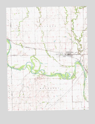
Clifton, KS USGS Topographic Map
Click on map above to begin viewing in our Map Viewer.

This topographic map contains these locations and features:
Feature Name Type Latitude Longitude GNIS ID View Map
City of CliftonCivilN39.5680°W97.2806°2393563View Map
City of ViningCivilN39.5675°W97.2936°2397147View Map
CliftonPopulated PlaceN39.5672°W97.2786°473360View Map
Clifton - Clyde Grade SchoolSchoolN39.5692°W97.2824°480265View Map
Clifton - Clyde Middle SchoolSchoolN39.5672°W97.2848°2497559View Map
Clifton City AmbulanceBuildingN39.5665°W97.2826°2696585View Map
Clifton City HallBuildingN39.5665°W97.2801°2694389View Map
Clifton Community Historical Society MuseumBuildingN39.5678°W97.2802°2694303View Map
Clifton Fire District 5BuildingN39.5665°W97.2826°2111203View Map
Clifton Post OfficePost OfficeN39.5669°W97.2803°2693669View Map
Clifton Public LibraryBuildingN39.5665°W97.2800°2694819View Map
Clifton Sewer Treatment PlantLocaleN39.5602°W97.2665°2692062View Map
Dry CreekStreamN39.5486°W97.3250°473113View Map
East Branch Parsons CreekStreamN39.6231°W97.2611°473117View Map
Faith United Presbyterian ChurchChurchN39.5705°W97.2851°473366View Map
Mud CreekStreamN39.5467°W97.3381°473358View Map
Parsons CreekStreamN39.5581°W97.2628°473116View Map
Pleasant View CemeteryCemeteryN39.5729°W97.3080°473362View Map
Riverdale CemeteryCemeteryN39.5107°W97.2934°473359View Map
Saint Mary's CemeteryCemeteryN39.6152°W97.2745°473363View Map
Saint Marys Catholic ChurchChurchN39.5703°W97.2801°2692603View Map
Scribner CreekStreamN39.5542°W97.2695°473114View Map
Township of CliftonCivilN39.6104°W97.3123°473110View Map
Township of MulberryCivilN39.5216°W97.3077°472568View Map
ViningPopulated PlaceN39.5669°W97.2953°473361View Map
West Branch Scribner CreekStreamN39.6208°W97.3239°473115View Map

Note: Coordinates in the location and feature list above are referenced to NAD83 datum.


Copyright (C) 2008-2025 Ryan Niemi / Sunset Dynamics ... All Rights Reserved