TopoQuest Logo
Do you find TopoQuest useful?
Help keep TopoQuest running and adding new maps/features by donating!
Bitcoin:  19c7KJd3qBynnjoSw5npx9KScwjBe4ifkT
Litecoin:  LXs6TkuXGGXo1vDsWCkWVdjQX94eUKd6ui
Home View Maps Find Maps Find Places Resources & Links


Clinton, Maine Topographic Map

USGS Map Title: Clinton, ME
USGS Map MRC: 44069F5
DRG (GeoTIFF) Download: o44069f5.tif


Neighboring USGS Topographic Map Quads:


  Skowhegan, ME  
44069G6
 

  Canaan, ME  
44069G5
 

  Pittsfield, ME  
44069G4
 

  Hinckley, ME  
44069F6
 

  Clinton, ME  
44069F5
 

  Burnham, ME  
44069F4
 

  Waterville, ME  
44069E6
 

  Fairfield, ME  
44069E5
 

  Albion, ME  
44069E4


Map MRC Location:

N45°
W70°
N45°
W69°
H8 H7 H6 H5 H4 H3 H2 H1
G8 G7 G6 G5 G4 G3 G2 G1
F8 F7 F6 F5 F4 F3 F2 F1
E8 E7 E6 E5 E4 E3 E2 E1
D8 D7 D6 D5 D4 D3 D2 D1
C8 C7 C6 C5 C4 C3 C2 C1
B8 B7 B6 B5 B4 B3 B2 B1
A8 A7 A6 A5 A4 A3 A2 A1
N44°
W70°
N44°
W69°

Clinton, ME USGS 1:24K Topographic Map Preview:
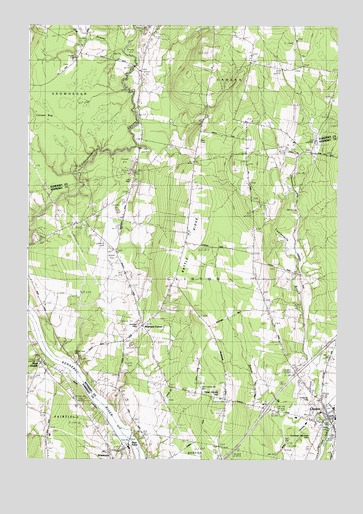
Clinton, ME USGS Topographic Map
Click on map above to begin viewing in our Map Viewer.

This topographic map contains these locations and features:
Feature Name Type Latitude Longitude GNIS ID View Map
Battle RidgeRidgeN44.6912°W69.5581°561732View Map
Beaver BrookStreamN44.6381°W69.5075°561895View Map
Bray PointCapeN44.6295°W69.5831°562921View Map
Brown Memorial LibraryBuildingN44.6389°W69.5031°2738349View Map
Canaan BogSwampN44.7251°W69.6198°563446View Map
ClintonPopulated PlaceN44.6378°W69.5031°564107View Map
Clinton Elementary SchoolSchoolN44.6399°W69.5008°2737996View Map
Clinton Fire and Rescue DepartmentBuildingN44.6377°W69.5021°2552908View Map
Clinton Police DepartmentBuildingN44.6368°W69.5076°2735891View Map
Clinton Post OfficePost OfficeN44.6375°W69.5026°2768919View Map
Decker CornerPopulated PlaceN44.6934°W69.5864°579234View Map
Evergreen CemeteryCemeteryN44.6431°W69.5100°565971View Map
Hilton BridgeBridgeN44.7383°W69.5822°568088View Map
Joy CemeteryCemeteryN44.7052°W69.5831°569009View Map
Kennebec River ReservoirReservoirN44.6307°W69.5831°1773658View Map
Morrison CornerPopulated PlaceN44.6634°W69.5773°579543View Map
Morrison SchoolSchoolN44.6665°W69.5789°571690View Map
Nobles Ferry CemeteryCemeteryN44.6545°W69.6045°573753View Map
Nyes CornerPopulated PlaceN44.6534°W69.6181°572558View Map
Nyes Corner CemeteryCemeteryN44.6537°W69.6192°2727585View Map
Oak StreamStreamN44.7423°W69.5870°572637View Map
Pooler CemeteryCemeteryN44.7402°W69.6063°573621View Map
Saul CemeteryCemeteryN44.7167°W69.5553°574937View Map
ShawmutPopulated PlaceN44.6278°W69.5864°575333View Map
Shawmut DamDamN44.6307°W69.5831°1773657View Map
Shawmut Post OfficePost OfficeN44.6274°W69.5863°1908680View Map
Town House HillSummitN44.6443°W69.5468°577233View Map
Town of ClintonCivilN44.6703°W69.5359°582412View Map
Twelvemile BrookStreamN44.6345°W69.5028°577466View Map
Twelvemile BrookReservoirN44.6969°W69.5281°1774375View Map
Twelvemile Brook Pond DamDamN44.6953°W69.5273°1774374View Map
WEZO-FM (Fairfield)TowerN44.6881°W69.5606°582294View Map
Wing CemeteryCemeteryN44.6629°W69.5799°2736788View Map

Note: Coordinates in the location and feature list above are referenced to NAD83 datum.


Copyright (C) 2008-2025 Ryan Niemi / Sunset Dynamics ... All Rights Reserved