TopoQuest Logo
Do you find TopoQuest useful?
Help keep TopoQuest running and adding new maps/features by donating!
Bitcoin:  19c7KJd3qBynnjoSw5npx9KScwjBe4ifkT
Litecoin:  LXs6TkuXGGXo1vDsWCkWVdjQX94eUKd6ui
Home View Maps Find Maps Find Places Resources & Links


Clouds, Tennessee Topographic Map

USGS Map Title: Clouds, TN
USGS Map MRC: 36083D6
DRG (GeoTIFF) Download: o36083d6.tif


Neighboring USGS Topographic Map Quads:


  Fork Ridge, TN  
36083E7
 

  Middlesboro South, KY  
36083E6
 

  Wheeler, VA  
36083E5
 

  Ausmus, TN  
36083D7
 

  Clouds, TN  
36083D6
 

  Tazewell, TN  
36083D5
 

  Maynardville, TN  
36083C7
 

  Powder Springs, TN  
36083C6
 

  Dutch Valley, TN  
36083C5


Map MRC Location:

N37°
W84°
N37°
W83°
H8 H7 H6 H5 H4 H3 H2 H1
G8 G7 G6 G5 G4 G3 G2 G1
F8 F7 F6 F5 F4 F3 F2 F1
E8 E7 E6 E5 E4 E3 E2 E1
D8 D7 D6 D5 D4 D3 D2 D1
C8 C7 C6 C5 C4 C3 C2 C1
B8 B7 B6 B5 B4 B3 B2 B1
A8 A7 A6 A5 A4 A3 A2 A1
N36°
W84°
N36°
W83°

Clouds, TN USGS 1:24K Topographic Map Preview:
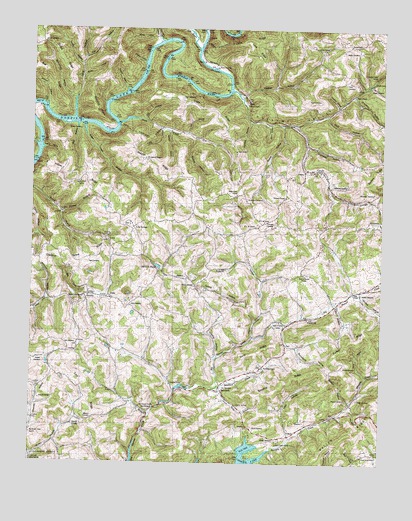
Clouds, TN USGS Topographic Map
Click on map above to begin viewing in our Map Viewer.

This topographic map contains these locations and features:
Feature Name Type Latitude Longitude GNIS ID View Map
Bailey HollowValleyN36.4903°W83.7105°1276112View Map
Beasons Store (historical)LocaleN36.4012°W83.7419°1317024View Map
Big BarrenPopulated PlaceN36.3892°W83.7077°1652598View Map
Big Barren Creek ChurchChurchN36.3834°W83.7494°1305199View Map
Big Barren Creek Division (historical)CensusN36.4142°W83.6844°1648642View Map
Big SinkBasinN36.4240°W83.7355°1277388View Map
Bull RidgeRidgeN36.4856°W83.7432°1278953View Map
Bunch Hollow MineMineN36.4423°W83.7385°1650667View Map
Bunchs Store (historical)LocaleN36.4495°W83.6721°1317028View Map
Bunky HollowValleyN36.4865°W83.7323°1279011View Map
Burch CemeteryCemeteryN36.3851°W83.6699°1279020View Map
Burchfield HollowValleyN36.4792°W83.7354°1279028View Map
Burke HollowValleyN36.3771°W83.7488°1279052View Map
Capps Hollow BendBendN36.4776°W83.7491°1310696View Map
Carr BranchStreamN36.3890°W83.7071°1279714View Map
Carr BranchPopulated PlaceN36.3898°W83.7077°1652599View Map
Carr Branch ChurchChurchN36.3912°W83.7102°1305693View Map
Carr CemeteryCemeteryN36.3970°W83.6810°1279719View Map
Carr RidgeRidgeN36.3959°W83.7285°1279728View Map
Cat BranchStreamN36.4737°W83.6935°1310697View Map
Cat HollowValleyN36.4737°W83.7098°1279872View Map
Cave RidgeRidgeN36.4942°W83.6696°1279939View Map
Chance HollowValleyN36.4056°W83.6833°1280228View Map
Chestnut Grove RidgeRidgeN36.4345°W83.7319°1280389View Map
Civilian Conservation Corps Camp Number 19 (historical)LocaleN36.4515°W83.6285°1317031View Map
Claiborne CountyCivilN36.4859°W83.6604°1639733View Map
Claiborne County LandfillLocaleN36.4008°W83.6483°2677882View Map
Cline RidgeRidgeN36.4976°W83.6666°1280750View Map
Cline SchoolSchoolN36.4945°W83.6482°1280752View Map
CloudsPopulated PlaceN36.4592°W83.6491°1280763View Map
Clouds Memorial Baptist ChurchChurchN36.4592°W83.6471°1644774View Map
Clouds School (historical)SchoolN36.4584°W83.6466°1317035View Map
Cole CemeteryCemeteryN36.4090°W83.7332°1280923View Map
Cole HollowValleyN36.4211°W83.6402°1306033View Map
Commissioner District 2CivilN36.4353°W83.6919°2463906View Map
Cox CemeteryCemeteryN36.3904°W83.7074°1281498View Map
Cupp CemeteryCemeteryN36.4798°W83.6963°1281880View Map
Cupp MillPopulated PlaceN36.3965°W83.6980°1647381View Map
Cupp RidgeRidgeN36.4770°W83.6846°1281882View Map
Cupp SchoolSchoolN36.4648°W83.6769°1306241View Map
Daniel HollowValleyN36.4725°W83.6609°1282027View Map
Days Store (historical)LocaleN36.4431°W83.6874°1317039View Map
Drummond CemeteryCemeteryN36.4509°W83.6730°1282815View Map
Duncan HollowValleyN36.4541°W83.6265°1269545View Map
DuoPopulated PlaceN36.4831°W83.6316°1314985View Map
Edmondson (historical)Populated PlaceN36.4117°W83.6713°1310707View Map
Edwards CemeteryCemeteryN36.3859°W83.7346°1283553View Map
Edwards SchoolSchoolN36.3931°W83.7463°1283564View Map
Flat HollowValleyN36.4913°W83.7317°1284401View Map
Ford Chapel CemeteryCemeteryN36.4284°W83.6949°1317045View Map
Ford HollowValleyN36.4686°W83.6902°1310709View Map
Ford HollowValleyN36.4755°W83.6446°1284573View Map
Fords Chapel Methodist ChurchChurchN36.4262°W83.6910°1284568View Map
Fortner Branch ProspectMineN36.4479°W83.7352°1650680View Map
GoinPopulated PlaceN36.4234°W83.7221°1315129View Map
Goin CemeteryCemeteryN36.4201°W83.7141°1285575View Map
Goins ChapelChurchN36.4956°W83.6366°1285580View Map
Greaver HollowValleyN36.4810°W83.6755°1286056View Map
Hall HollowValleyN36.4651°W83.7466°1286593View Map
Hamlet HollowValleyN36.4734°W83.6723°1286667View Map
Hauser SpringSpringN36.3919°W83.6764°1287155View Map
Hauser Spring BranchStreamN36.3967°W83.6830°1287156View Map
Head of BarrenPopulated PlaceN36.4206°W83.6416°1310711View Map
Head of Barren ChurchChurchN36.4295°W83.6524°1287274View Map
Head of Barren SchoolSchoolN36.4162°W83.6610°1287275View Map
Hen HollowValleyN36.4725°W83.7341°1287369View Map
Hickory HollowValleyN36.4778°W83.7452°1287610View Map
Holt Cave SpringSpringN36.4854°W83.6282°1644785View Map
Honeysuck ProspectMineN36.4392°W83.7360°1650687View Map
Hopper CemeteryCemeteryN36.4040°W83.7455°1288336View Map
Hopper HollowValleyN36.4778°W83.6407°1288339View Map
Island Ford (historical)CrossingN36.4815°W83.6866°1310715View Map
Johnson HollowValleyN36.4219°W83.7444°1289627View Map
Keck CemeteryCemeteryN36.4323°W83.7296°1289932View Map
Kecks Store (historical)LocaleN36.4379°W83.7102°1317051View Map
Killion RidgeRidgeN36.4576°W83.7335°1290159View Map
Kingdom HallChurchN36.4167°W83.6510°1317053View Map
Lily GrovePopulated PlaceN36.4426°W83.7135°1315401View Map
Lily Grove Missionary Baptist ChurchChurchN36.4442°W83.7146°1644794View Map
Lily Grove School (historical)SchoolN36.4437°W83.7149°1317055View Map
Locust Grove SchoolSchoolN36.4559°W83.7327°1291791View Map
Lonesome ValleyValleyN36.4823°W83.6792°1291860View Map
Lonesome Valley CreekStreamN36.4823°W83.6791°1644797View Map
Lonesome Valley Elementary SchoolSchoolN36.4865°W83.6271°1648418View Map
Long HollowValleyN36.4741°W83.7351°1291973View Map
Loop HollowValleyN36.3829°W83.6568°1292056View Map
Lundy HollowValleyN36.4893°W83.7327°1292285View Map
M C M ChurchChurchN36.4431°W83.6699°1292386View Map
M C M SchoolSchoolN36.4445°W83.6671°1292387View Map
Mathis HollowValleyN36.4686°W83.6926°1292937View Map
Mayes CemeteryCemeteryN36.4837°W83.6288°1293008View Map
Mayes Chapel United Methodist ChurchChurchN36.4809°W83.6352°1293009View Map
Mayes Mill (historical)LocaleN36.4834°W83.6310°1644800View Map
McBee HollowValleyN36.3929°W83.6355°1293083View Map
McNew HollowValleyN36.4705°W83.7013°1293449View Map
Meyer Grove ChurchChurchN36.4523°W83.6769°1293640View Map
Meyers BranchStreamN36.4112°W83.6705°1293641View Map
Meyers CemeteryCemeteryN36.3931°W83.6374°1293642View Map
Meyers Mill (historical)LocaleN36.4117°W83.6707°1317060View Map
Minkton (historical)Populated PlaceN36.4412°W83.6791°1310719View Map
Minton CemeteryCemeteryN36.4026°W83.6380°1294069View Map
Minton CemeteryCemeteryN36.4240°W83.6321°1294070View Map
Minton HollowValleyN36.4233°W83.6320°1294071View Map
Miracle PondLakeN36.4316°W83.7048°1294074View Map
Moody CemeteryCemeteryN36.4931°W83.6385°1294214View Map
Myers Store (historical)LocaleN36.4090°W83.6585°1317062View Map
New Hope Missionary Baptist ChurchChurchN36.4026°W83.6669°1295561View Map
North RidgeRidgeN36.4073°W83.6699°1295942View Map
Old Town CreekStreamN36.4937°W83.6907°1296384View Map
Oxford HollowValleyN36.4200°W83.6727°1296621View Map
Perry HollowValleyN36.4002°W83.6301°1297220View Map
Phelps CemeteryCemeteryN36.3937°W83.6330°1297300View Map
Pleasant Point Primitive Baptist ChurchChurchN36.4231°W83.7307°1644806View Map
Pleasant Point SchoolSchoolN36.4229°W83.7313°1297904View Map
Polecat HollowValleyN36.4275°W83.6677°1298048View Map
Poore CemeteryCemeteryN36.4795°W83.6471°1298145View Map
Poore CemeteryCemeteryN36.4845°W83.6380°1298146View Map
Poore CemeteryCemeteryN36.4890°W83.6838°1298147View Map
Powell RiverStreamN36.4996°W83.6772°1306921View Map
Reason RidgeRidgeN36.3909°W83.7394°1647392View Map
Robinson CemeteryCemeteryN36.4551°W83.6424°1299697View Map
Robinson HollowValleyN36.4964°W83.7045°1299714View Map
Russell CemeteryCemeteryN36.4712°W83.7324°1300320View Map
Russell Ford (historical)CrossingN36.4731°W83.7357°1310725View Map
Russell HollowValleyN36.4821°W83.7165°1300340View Map
SandlickPopulated PlaceN36.3965°W83.6819°1315872View Map
Sandlick CreekStreamN36.3973°W83.6824°1300718View Map
Sandlick RidgeRidgeN36.3987°W83.6596°1300719View Map
Sandlick SchoolSchoolN36.3976°W83.6996°1300721View Map
Sheep HollowValleyN36.4977°W83.7059°1269959View Map
Sheeplick PointCliffN36.4740°W83.7249°1269969View Map
Sherman HollowValleyN36.4810°W83.6356°1270043View Map
Shiflet CemeteryCemeteryN36.4956°W83.7463°1270066View Map
Shiflet RidgeRidgeN36.4906°W83.7391°1270067View Map
Short HollowValleyN36.4724°W83.6654°1270203View Map
Shumaker CemeteryCemeteryN36.4529°W83.6274°1270238View Map
Shumaker HollowValleyN36.4665°W83.6521°1303615View Map
Simmons CemeteryCemeteryN36.4440°W83.6632°1270308View Map
Simmons ChapelChurchN36.4517°W83.6594°1303630View Map
Skaggs CemeteryCemeteryN36.3815°W83.6630°1270418View Map
Slate CreekStreamN36.4740°W83.7124°1270472View Map
SnodgrassPopulated PlaceN36.4454°W83.6257°1314309View Map
South Claiborne Volunteer Fire Department Station 41BuildingN36.3961°W83.6923°2654902View Map
South Claiborne Volunteer Fire Department Station 42BuildingN36.4460°W83.6707°2654960View Map
Stansbury HollowValleyN36.4085°W83.6547°1271249View Map
Still BranchStreamN36.4698°W83.6949°1271384View Map
Straight Creek Boat DockLocaleN36.3806°W83.6710°1317083View Map
Straight Creek ChurchChurchN36.3817°W83.6616°1303873View Map
Straight Creek MinesMineN36.3892°W83.6427°1317084View Map
Straight Creek School (historical)SchoolN36.3812°W83.6702°1317085View Map
Sugar Creek HollowValleyN36.4723°W83.7319°1271677View Map
Sugar Grove ChurchChurchN36.3773°W83.6313°1303898View Map
Sweet HollowValleyN36.3789°W83.7389°1647396View Map
Tuttle HollowValleyN36.4708°W83.7034°1273110View Map
Upper Straight Creek School (historical)SchoolN36.3962°W83.6330°1317093View Map
Water Treece CemeteryCemeteryN36.4784°W83.6738°1273889View Map
Watson ChapelChurchN36.4626°W83.7096°1304418View Map
Watson RidgeRidgeN36.4615°W83.7066°1273933View Map
Watson School (historical)SchoolN36.4623°W83.7091°1317095View Map
Williams CemeteryCemeteryN36.3876°W83.7277°1274677View Map

Note: Coordinates in the location and feature list above are referenced to NAD83 datum.


Copyright (C) 2008-2025 Ryan Niemi / Sunset Dynamics ... All Rights Reserved