TopoQuest Logo
Do you find TopoQuest useful?
Help keep TopoQuest running and adding new maps/features by donating!
Bitcoin:  19c7KJd3qBynnjoSw5npx9KScwjBe4ifkT
Litecoin:  LXs6TkuXGGXo1vDsWCkWVdjQX94eUKd6ui
Home View Maps Find Maps Find Places Resources & Links


Coal Mountain, Georgia Topographic Map

USGS Map Title: Coal Mountain, GA
USGS Map MRC: 34084C1
DRG (GeoTIFF) Download: o34084c1.tif


Neighboring USGS Topographic Map Quads:


  Juno, GA  
34084D2
 

  Dawsonville, GA  
34084D1
 

  Murrayville, GA  
34083D8
 

  Matt, GA  
34084C2
 

  Coal Mountain, GA  
34084C1
 

  Chestatee, GA  
34083C8
 

  Cumming, GA  
34084B2
 

  Buford Dam, GA  
34084B1
 

  Flowery Branch, GA  
34083B8


Map MRC Location:

N35°
W85°
N35°
W84°
H8 H7 H6 H5 H4 H3 H2 H1
G8 G7 G6 G5 G4 G3 G2 G1
F8 F7 F6 F5 F4 F3 F2 F1
E8 E7 E6 E5 E4 E3 E2 E1
D8 D7 D6 D5 D4 D3 D2 D1
C8 C7 C6 C5 C4 C3 C2 C1
B8 B7 B6 B5 B4 B3 B2 B1
A8 A7 A6 A5 A4 A3 A2 A1
N34°
W85°
N34°
W84°

Coal Mountain, GA USGS 1:24K Topographic Map Preview:
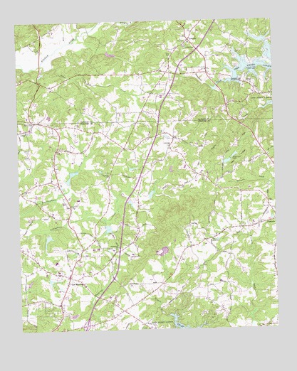
Coal Mountain, GA USGS Topographic Map
Click on map above to begin viewing in our Map Viewer.

This topographic map contains these locations and features:
Feature Name Type Latitude Longitude GNIS ID View Map
Adams HeliportAirportN34.2932°W84.1096°351739View Map
Anderson Dam Number OneDamN34.3184°W84.0216°336700View Map
Anderson Dam Number TwoDamN34.3201°W84.0182°336704View Map
Anderson LakeReservoirN34.3203°W84.0195°310526View Map
Anderson Lake Number OneReservoirN34.3179°W84.0229°336701View Map
Anderson Lake Number TwoReservoirN34.3201°W84.0182°336705View Map
Beaverdam Creek Structure Number Four DamDamN34.3118°W84.0932°336462View Map
Beaverdam Creek Watershed Structure Number Five DamDamN34.2934°W84.0882°336458View Map
Bethel ChurchChurchN34.3665°W84.0424°311202View Map
Black Mill CreekStreamN34.3582°W84.1127°311489View Map
Black's Mill Elementary SchoolSchoolN34.3527°W84.0826°2545786View Map
Blacks MillLocaleN34.3540°W84.0932°351310View Map
Bruce LakeReservoirN34.3618°W84.0789°336076View Map
Byrd Family CemeteryCemeteryN34.3608°W84.0495°312132View Map
Chestatee DivisionCivilN34.2906°W84.0067°1936175View Map
Coal MountainPopulated PlaceN34.2715°W84.1007°331421View Map
Coal Mountain CemeteryCemeteryN34.2749°W84.1004°1673343View Map
Coal Mountain ChurchChurchN34.2695°W84.1010°1673344View Map
Coal Mountain Elementary SchoolSchoolN34.2739°W84.1059°1673345View Map
Concord Baptist CemeteryCemeteryN34.3305°W84.1200°1673346View Map
Concord ChurchChurchN34.3304°W84.1210°355263View Map
Crossroads ChurchChurchN34.3243°W84.0513°313178View Map
Dawson County Fire Department Station 2BuildingN34.3395°W84.0229°2604339View Map
Ebenezer CemeteryCemeteryN34.2501°W84.0638°313818View Map
Etowah River Watershed Dam Number NineDamN34.3618°W84.0816°336075View Map
Forsyth County Fire Department Station 12BuildingN34.2713°W84.0944°2604665View Map
Forsyth County Fire Department Station 7BuildingN34.3306°W84.1047°2604370View Map
Forsyth County Fire Department Station 8BuildingN34.2913°W84.0176°2604337View Map
Forsyth County Fire Department Station 9BuildingN34.2516°W84.0037°2346539View Map
Georgia State Patrol Troop B Post 37 CummingBuildingN34.2696°W84.0851°2733983View Map
Harmony Grove ChurchChurchN34.2859°W84.0319°315155View Map
Hopewell ChurchChurchN34.3126°W84.0810°315662View Map
Hopewell Methodist CemeteryCemeteryN34.3140°W84.0824°1673365View Map
Kalb DamDamN34.3284°W84.0532°339032View Map
Kalb LakeReservoirN34.3281°W84.0519°339033View Map
Kilough ChurchChurchN34.3726°W84.0249°351323View Map
Kilough Elementary SchoolSchoolN34.3677°W84.0158°2545626View Map
Lake MarieReservoirN34.3334°W84.0416°339131View Map
Lake Marie DamDamN34.3334°W84.0416°339130View Map
Liberty ChurchChurchN34.3490°W84.0107°316821View Map
Logan CreekStreamN34.3696°W84.0128°2784206View Map
LumpkinPopulated PlaceN34.3673°W84.0407°332284View Map
Lumpkin CampgroundLocaleN34.3645°W84.0427°351324View Map
Mill CreekStreamN34.3665°W84.1005°356391View Map
Norrell LakeReservoirN34.2692°W84.1094°339031View Map
Norrell Lake DamDamN34.2718°W84.1099°339030View Map
North Forsyth High SchoolSchoolN34.2776°W84.1073°2545926View Map
North Forsyth Middle SchoolSchoolN34.2780°W84.1038°1673385View Map
Oak Grove Baptist ChurchChurchN34.3065°W84.1221°319816View Map
Pea RidgeRidgeN34.3179°W84.0182°320304View Map
Rendering Plant LakeReservoirN34.2818°W84.0545°336703View Map
Rendering Plant Lake DamDamN34.2818°W84.0532°336702View Map
Reservoir 59ReservoirN34.3049°W84.0603°336710View Map
Reservoir FiveReservoirN34.2934°W84.0882°336459View Map
Reservoir FourReservoirN34.3014°W84.0705°336712View Map
Reservoir FourReservoirN34.3118°W84.0932°336463View Map
Reservoir SixReservoirN34.2913°W84.0814°336714View Map
Riverview Middle SchoolSchoolN34.3546°W84.1155°2545627View Map
Salem Baptist ChurchChurchN34.2923°W84.0080°322369View Map
Settingdown ChurchChurchN34.2832°W84.0774°322712View Map
Settingdown Creek Structure 10 DamDamN34.2884°W84.1116°336736View Map
Settingdown Creek Structure 59 DamDamN34.3034°W84.0599°336709View Map
Settingdown Creek Structure Four DamDamN34.3018°W84.0716°336711View Map
Settingdown Creek Structure Six DamDamN34.2918°W84.0816°336713View Map
Settingdown Creek Watershed 10 ReservoirReservoirN34.2868°W84.1110°336737View Map
Settingdown Creek Watershed Number 54 DamDamN34.3134°W84.1016°336706View Map
Settingdown Creek Watershed Reservoir Number 54ReservoirN34.3134°W84.1016°336707View Map
Settingdown Reservoir Number 56ReservoirN34.3134°W84.0699°336708View Map
Silver CityPopulated PlaceN34.3343°W84.1160°333054View Map
Silver City Elementary SchoolSchoolN34.3279°W84.1026°2546142View Map
Thomas LakeReservoirN34.3366°W84.1094°339888View Map
Thomas Lake DamDamN34.3368°W84.1082°339887View Map
Thompson Creek Access PointLocaleN34.3501°W84.0160°324117View Map
War Hill Christian AcademySchoolN34.3348°W84.0184°2545776View Map
Westbrook CemeteryCemeteryN34.2936°W84.0081°1673406View Map

Note: Coordinates in the location and feature list above are referenced to NAD83 datum.


Copyright (C) 2008-2024 Ryan Niemi / Sunset Dynamics ... All Rights Reserved