TopoQuest Logo
Do you find TopoQuest useful?
Help keep TopoQuest running and adding new maps/features by donating!
Bitcoin:  19c7KJd3qBynnjoSw5npx9KScwjBe4ifkT
Litecoin:  LXs6TkuXGGXo1vDsWCkWVdjQX94eUKd6ui
Home View Maps Find Maps Find Places Resources & Links


Coffee, Georgia Topographic Map

USGS Map Title: Coffee, GA
USGS Map MRC: 31082E3
DRG (GeoTIFF) Download: o31082e3.tif


Neighboring USGS Topographic Map Quads:


  Alma NW, GA  
31082F4
 

  Alma NE, GA  
31082F3
 

  Surrency, GA  
31082F2
 

  Alma, GA  
31082E4
 

  Coffee, GA  
31082E3
 

  K'Ville, GA  
31082E2
 

  Crawley, GA  
31082D4
 

  Mershon, GA  
31082D3
 

  Patterson, GA  
31082D2


Map MRC Location:

N32°
W83°
N32°
W82°
H8 H7 H6 H5 H4 H3 H2 H1
G8 G7 G6 G5 G4 G3 G2 G1
F8 F7 F6 F5 F4 F3 F2 F1
E8 E7 E6 E5 E4 E3 E2 E1
D8 D7 D6 D5 D4 D3 D2 D1
C8 C7 C6 C5 C4 C3 C2 C1
B8 B7 B6 B5 B4 B3 B2 B1
A8 A7 A6 A5 A4 A3 A2 A1
N31°
W83°
N31°
W82°

Coffee, GA USGS 1:24K Topographic Map Preview:
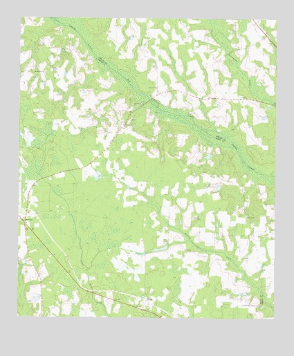
Coffee, GA USGS Topographic Map
Click on map above to begin viewing in our Map Viewer.

This topographic map contains these locations and features:
Feature Name Type Latitude Longitude GNIS ID View Map
Antioch CemeteryCemeteryN31.5285°W82.2901°1959734View Map
Antioch ChurchChurchN31.5283°W82.2896°310565View Map
Carter ChapelChurchN31.5427°W82.2635°312376View Map
Carters Chapel CemeteryCemeteryN31.5430°W82.2637°1959736View Map
Church of JesusChurchN31.5402°W82.2537°344790View Map
CoffeePopulated PlaceN31.5077°W82.3115°326223View Map
Coffee ChurchChurchN31.5035°W82.3143°344791View Map
Damascus CemeteryCemeteryN31.5410°W82.2865°1959738View Map
Damascus ChurchChurchN31.5413°W82.2862°313271View Map
Ebenezer ChurchChurchN31.5960°W82.3079°313822View Map
Fishing Creek Church (historical)ChurchN31.5155°W82.2548°349062View Map
LambrightPopulated PlaceN31.5127°W82.3443°344794View Map
Lee LakeReservoirN31.5295°W82.3041°342133View Map
Lee Lake DamDamN31.5302°W82.3015°342132View Map
Moody CemeteryCemeteryN31.5791°W82.2698°349181View Map
Mount Pleasant ChurchChurchN31.6021°W82.3635°318833View Map
New Lacey Volunteer Fire StationBuildingN31.5416°W82.3729°2604283View Map
New LacyPopulated PlaceN31.5394°W82.3715°332491View Map
New Lacy Church of GodChurchN31.5394°W82.3712°1959751View Map
Oak Hill ChurchChurchN31.5888°W82.3187°319827View Map
Turner CemeteryCemeteryN31.5641°W82.2962°344797View Map
Wesley ChapelChurchN31.5808°W82.3237°325005View Map
Wesley Chapel CemeteryCemeteryN31.5813°W82.3243°1959744View Map

Note: Coordinates in the location and feature list above are referenced to NAD83 datum.


Copyright (C) 2008-2025 Ryan Niemi / Sunset Dynamics ... All Rights Reserved