TopoQuest Logo
Do you find TopoQuest useful?
Help keep TopoQuest running and adding new maps/features by donating!
Bitcoin:  19c7KJd3qBynnjoSw5npx9KScwjBe4ifkT
Litecoin:  LXs6TkuXGGXo1vDsWCkWVdjQX94eUKd6ui
Home View Maps Find Maps Find Places Resources & Links


Coggon, Iowa Topographic Map

USGS Map Title: Coggon, IA
USGS Map MRC: 42091C5
DRG (GeoTIFF) Download: o42091c5.tif


Neighboring USGS Topographic Map Quads:


  Winthrop, IA  
42091D6
 

  Masonville, IA  
42091D5
 

  Manchester, IA  
42091D4
 

  Troy Mills, IA  
42091C6
 

  Coggon, IA  
42091C5
 

  Ryan, IA  
42091C4
 

  Lafayette, IA  
42091B6
 

  Central City, IA  
42091B5
 

  Prairieburg, IA  
42091B4


Map MRC Location:

N43°
W92°
N43°
W91°
H8 H7 H6 H5 H4 H3 H2 H1
G8 G7 G6 G5 G4 G3 G2 G1
F8 F7 F6 F5 F4 F3 F2 F1
E8 E7 E6 E5 E4 E3 E2 E1
D8 D7 D6 D5 D4 D3 D2 D1
C8 C7 C6 C5 C4 C3 C2 C1
B8 B7 B6 B5 B4 B3 B2 B1
A8 A7 A6 A5 A4 A3 A2 A1
N42°
W92°
N42°
W91°

Coggon, IA USGS 1:24K Topographic Map Preview:
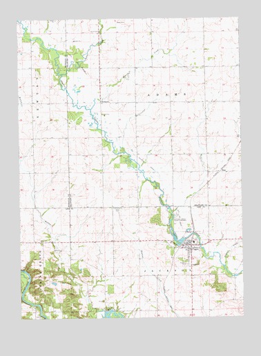
Coggon, IA USGS Topographic Map
Click on map above to begin viewing in our Map Viewer.

This topographic map contains these locations and features:
Feature Name Type Latitude Longitude GNIS ID View Map
Buffalo Creek County ParkwayParkN42.2894°W91.5354°454963View Map
Calvary Baptist ChurchChurchN42.2805°W91.5304°2047997View Map
City of CoggonCivilN42.2783°W91.5304°2393585View Map
CoggonPopulated PlaceN42.2808°W91.5304°455514View Map
CoggonLocaleN42.2808°W91.5335°2047993View Map
Coggon CemeteryCemeteryN42.2717°W91.5296°455515View Map
Coggon City Town HallBuildingN42.2808°W91.5307°2047989View Map
Coggon Elementary CenterSchoolN42.2815°W91.5278°2047998View Map
Coggon Fire DepartmentBuildingN42.2794°W91.5311°2047990View Map
Coggon Police DepartmentBuildingN42.2808°W91.5307°2047991View Map
Coggon Post OfficePost OfficeN42.2808°W91.5307°2047992View Map
Coggon Public LibraryBuildingN42.2805°W91.5293°2047988View Map
EhlerPopulated PlaceN42.3103°W91.5127°464161View Map
Ehler (historical)LocaleN42.3103°W91.5127°1999902View Map
Ehler Post Office (historical)Post OfficeN42.3103°W91.5127°1999901View Map
Erin Post Office (historical)Post OfficeN42.3694°W91.6002°2000057View Map
NugentLocaleN42.2667°W91.5029°466166View Map
Nugents CreekStreamN42.2714°W91.5104°459677View Map
RobinsonPopulated PlaceN42.3419°W91.5788°460701View Map
Robinson Post Office (historical)Post OfficeN42.3419°W91.5788°1999903View Map
Saint John's Catholic ChurchChurchN42.2817°W91.5288°2047996View Map
Saint Johns CemeteryCemeteryN42.2722°W91.5316°461023View Map
Silver CreekStreamN42.3522°W91.6004°461625View Map
Silver Creek CemeteryCemeteryN42.3693°W91.5788°2000013View Map
Silver Creek ChurchChurchN42.3697°W91.5790°461628View Map
Silvercreek Post Office (historical)Post OfficeN42.3611°W91.5779°1999900View Map
Spring Grove CemeteryCemeteryN42.2785°W91.6010°461894View Map
Spring Grove ChurchChurchN42.2814°W91.6138°461897View Map
Spring Grove Post Office (historical)Post OfficeN42.2678°W91.6085°2046612View Map
Tower HillLocaleN42.3708°W91.5199°466229View Map
Township of AdamsCivilN42.3400°W91.5389°467373View Map
Township of JacksonCivilN42.2528°W91.5387°468108View Map
United ParishChurchN42.2811°W91.5293°2047995View Map
Valley FarmLocaleN42.2542°W91.5752°466177View Map
Valley Farm Post Office (historical)Post OfficeN42.2542°W91.5752°2046749View Map
Zion Presbyterian ChurchChurchN42.2805°W91.5293°2047994View Map

Note: Coordinates in the location and feature list above are referenced to NAD83 datum.


Copyright (C) 2008-2025 Ryan Niemi / Sunset Dynamics ... All Rights Reserved