TopoQuest Logo
Do you find TopoQuest useful?
Help keep TopoQuest running and adding new maps/features by donating!
Bitcoin:  19c7KJd3qBynnjoSw5npx9KScwjBe4ifkT
Litecoin:  LXs6TkuXGGXo1vDsWCkWVdjQX94eUKd6ui
Home View Maps Find Maps Find Places Resources & Links


Prairieburg, Iowa Topographic Map

USGS Map Title: Prairieburg, IA
USGS Map MRC: 42091B4
DRG (GeoTIFF) Download: o42091b4.tif


Neighboring USGS Topographic Map Quads:


  Coggon, IA  
42091C5
 

  Ryan, IA  
42091C4
 

  Hopkinton West, IA  
42091C3
 

  Central City, IA  
42091B5
 

  Prairieburg, IA  
42091B4
 

  Anamosa NE, IA  
42091B3
 

  Marion, IA  
42091A5
 

  Springville, IA  
42091A4
 

  Anamosa, IA  
42091A3


Map MRC Location:

N43°
W92°
N43°
W91°
H8 H7 H6 H5 H4 H3 H2 H1
G8 G7 G6 G5 G4 G3 G2 G1
F8 F7 F6 F5 F4 F3 F2 F1
E8 E7 E6 E5 E4 E3 E2 E1
D8 D7 D6 D5 D4 D3 D2 D1
C8 C7 C6 C5 C4 C3 C2 C1
B8 B7 B6 B5 B4 B3 B2 B1
A8 A7 A6 A5 A4 A3 A2 A1
N42°
W92°
N42°
W91°

Prairieburg, IA USGS 1:24K Topographic Map Preview:
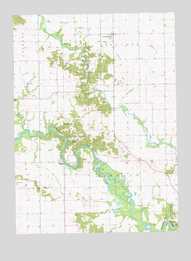
Prairieburg, IA USGS Topographic Map
Click on map above to begin viewing in our Map Viewer.

This topographic map contains these locations and features:
Feature Name Type Latitude Longitude GNIS ID View Map
Boulder CemeteryCemeteryN42.2029°W91.4542°454768View Map
Boulder CreekStreamN42.2350°W91.4624°454769View Map
Camp WakomdaLocaleN42.1883°W91.4593°455135View Map
Camp WaubeekLocaleN42.1653°W91.4602°455137View Map
City of PrairieburgCivilN42.2377°W91.4258°2396269View Map
Cousins Post Office (historical)Post OfficeN42.1664°W91.4043°2046625View Map
Flemingville Post Office (historical)Post OfficeN42.1667°W91.4996°466636View Map
Harts CemeteryCemeteryN42.1556°W91.3807°2048112View Map
Hazel Knoll CemeteryCemeteryN42.1398°W91.3807°457364View Map
Heatons CreekStreamN42.1842°W91.4918°457372View Map
Jay G Sigmund ParkParkN42.1653°W91.4602°457915View Map
Jordan's Grove CemeteryCemeteryN42.1525°W91.4999°2048125View Map
Jordans GrovePopulated PlaceN42.1558°W91.4985°464595View Map
Matsell BridgeBridgeN42.1306°W91.3832°2048140View Map
Matsell Bridge Public AccessParkN42.1297°W91.3816°458855View Map
NecotLocaleN42.1522°W91.4041°466173View Map
Necot Post Office (historical)Post OfficeN42.1472°W91.3766°2046627View Map
Paris (historical)Populated PlaceN42.2350°W91.4582°465537View Map
PrairieburgPopulated PlaceN42.2383°W91.4224°460429View Map
Prairieburg - Boulder CemeteryCemeteryN42.2416°W91.4465°460430View Map
Prairieburg (historical)LocaleN42.2333°W91.4263°2048098View Map
Prairieburg Fire DepartmentBuildingN42.2360°W91.4230°2577487View Map
Prairieburg Post Office (historical)Post OfficeN42.2383°W91.4224°2048099View Map
Saint Joseph ChurchChurchN42.2364°W91.4257°2048100View Map
Saint Josephs CemeteryCemeteryN42.2099°W91.4217°461118View Map
Township of BuffaloCivilN42.1656°W91.4227°467503View Map
WaubeekPopulated PlaceN42.1658°W91.4652°462744View Map
Waubeek Post Office (historical)Post OfficeN42.1658°W91.4652°2046626View Map

Note: Coordinates in the location and feature list above are referenced to NAD83 datum.


Copyright (C) 2008-2024 Ryan Niemi / Sunset Dynamics ... All Rights Reserved