TopoQuest Logo
Do you find TopoQuest useful?
Help keep TopoQuest running and adding new maps/features by donating!
Bitcoin:  19c7KJd3qBynnjoSw5npx9KScwjBe4ifkT
Litecoin:  LXs6TkuXGGXo1vDsWCkWVdjQX94eUKd6ui
Home View Maps Find Maps Find Places Resources & Links


Cole, Montana Topographic Map

USGS Map Title: Cole, MT
USGS Map MRC: 48107E4
DRG (GeoTIFF) Download: o48107e4.tif


Neighboring USGS Topographic Map Quads:


  Tattnall, MT  
48107F5
 

  Forks, MT  
48107F4
 

  Porcupine Coulee, MT  
48107F3
 

  Hewitt Lake, MT  
48107E5
 

  Cole, MT  
48107E4
 

  Double S Hill, MT  
48107E3
 

  Bowdoin, MT  
48107D5
 

  Robinson Ranch, MT  
48107D4
 

  Saco, MT  
48107D3


Map MRC Location:

N49°
W108°
N49°
W107°
H8 H7 H6 H5 H4 H3 H2 H1
G8 G7 G6 G5 G4 G3 G2 G1
F8 F7 F6 F5 F4 F3 F2 F1
E8 E7 E6 E5 E4 E3 E2 E1
D8 D7 D6 D5 D4 D3 D2 D1
C8 C7 C6 C5 C4 C3 C2 C1
B8 B7 B6 B5 B4 B3 B2 B1
A8 A7 A6 A5 A4 A3 A2 A1
N48°
W108°
N48°
W107°

Cole, MT USGS 1:24K Topographic Map Preview:
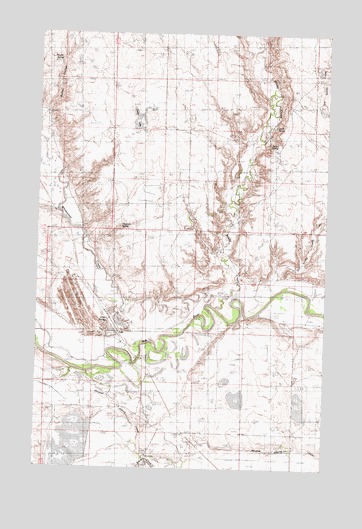
Cole, MT USGS Topographic Map
Click on map above to begin viewing in our Map Viewer.

This topographic map contains these locations and features:
Feature Name Type Latitude Longitude GNIS ID View Map
32N33E16BA__01 WellWellN48.5369°W107.4454°1635828View Map
32N33E17DAD_01 WellWellN48.5286°W107.4520°1635812View Map
32N33E25BCB_01 WellWellN48.5072°W107.3876°1635756View Map
Akins School (historical)SchoolN48.5114°W107.4540°1721862View Map
Bache School (historical)SchoolN48.5397°W107.4534°1721866View Map
Bellman School (historical)SchoolN48.5994°W107.3823°1721867View Map
Birums RanchLocaleN48.5519°W107.3845°768899View Map
Busche SpringSpringN48.6170°W107.4919°800204View Map
Carter LakeLakeN48.6000°W107.4580°800203View Map
ColePopulated PlaceN48.5411°W107.4687°806932View Map
Cole (historical)LocaleN48.5411°W107.4687°1722083View Map
Cole PondsReservoirN48.5423°W107.4655°800199View Map
Cole Ponds Fishing Access SiteLocaleN48.5389°W107.4684°1744284View Map
Cole Post Office (historical)Post OfficeN48.5411°W107.4687°1722084View Map
Cole School (historical)SchoolN48.5539°W107.4912°1721877View Map
Dry Stinky CreekStreamN48.5500°W107.3981°800198View Map
Frenchman Irrigation Company Number 1 DamDamN48.5400°W107.4106°796436View Map
Glascock SpringSpringN48.5692°W107.4645°800200View Map
Hedger's RanchLocaleN48.5311°W107.4562°772304View Map
Hill Top School (historical)SchoolN48.5542°W107.3881°1721897View Map
Huntley School (historical)SchoolN48.6181°W107.4381°1721903View Map
Latham School (historical)SchoolN48.6189°W107.4562°1721909View Map
Little CouleeValleyN48.5539°W107.3751°1721767View Map
Luvel SpringSpringN48.5983°W107.3980°800202View Map
Martin's RanchLocaleN48.5294°W107.4840°773904View Map
Mills' RanchLocaleN48.5458°W107.4626°774256View Map
Mills' RanchLocaleN48.5622°W107.4231°774257View Map
Nelson South CanalCanalN48.5064°W107.3815°774586View Map
New Minot School (historical)SchoolN48.5606°W107.4940°1721917View Map
Powell's RanchLocaleN48.5456°W107.3834°775422View Map
Stinky CreekStreamN48.5381°W107.4234°778373View Map
Whitewater CreekStreamN48.5475°W107.4262°778430View Map
Zenor SpringSpringN48.5932°W107.4005°800201View Map

Note: Coordinates in the location and feature list above are referenced to NAD83 datum.


Copyright (C) 2008-2025 Ryan Niemi / Sunset Dynamics ... All Rights Reserved