TopoQuest Logo
Do you find TopoQuest useful?
Help keep TopoQuest running and adding new maps/features by donating!
Bitcoin:  19c7KJd3qBynnjoSw5npx9KScwjBe4ifkT
Litecoin:  LXs6TkuXGGXo1vDsWCkWVdjQX94eUKd6ui
Home View Maps Find Maps Find Places Resources & Links


Columbine Pass, Colorado Topographic Map

USGS Map Title: Columbine Pass, CO
USGS Map MRC: 37107E5
DRG (GeoTIFF) Download: o37107e5.tif


Neighboring USGS Topographic Map Quads:


  Snowdon Peak, CO  
37107F6
 

  Storm King Peak, CO  
37107F5
 

  Rio Grande Pyramid, CO  
37107F4
 

  Mountain View Crest, CO  
37107E6
 

  Columbine Pass, CO  
37107E5
 

  Emerald Lake, CO  
37107E4
 

  Lemon Reservoir, CO  
37107D6
 

  Vallecito Reservoir, CO  
37107D5
 

  Granite Peak, CO  
37107D4


Map MRC Location:

N38°
W108°
N38°
W107°
H8 H7 H6 H5 H4 H3 H2 H1
G8 G7 G6 G5 G4 G3 G2 G1
F8 F7 F6 F5 F4 F3 F2 F1
E8 E7 E6 E5 E4 E3 E2 E1
D8 D7 D6 D5 D4 D3 D2 D1
C8 C7 C6 C5 C4 C3 C2 C1
B8 B7 B6 B5 B4 B3 B2 B1
A8 A7 A6 A5 A4 A3 A2 A1
N37°
W108°
N37°
W107°

Columbine Pass, CO USGS 1:24K Topographic Map Preview:
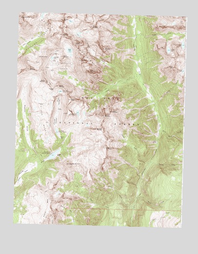
Columbine Pass, CO USGS Topographic Map
Click on map above to begin viewing in our Map Viewer.

This topographic map contains these locations and features:
Feature Name Type Latitude Longitude GNIS ID View Map
Aetna MineMineN37.6183°W107.6045°1735628View Map
Amherst MountainSummitN37.5653°W107.5595°188026View Map
Aztec MountainSummitN37.5917°W107.6159°187995View Map
Bullion MountainSummitN37.5847°W107.6042°187996View Map
Castilleja LakeReservoirN37.5663°W107.5792°188028View Map
Chicago BasinBasinN37.6094°W107.6092°187989View Map
City ReservoirReservoirN37.5412°W107.5965°188031View Map
Columbine LakeLakeN37.5983°W107.5993°187994View Map
Columbine PassGapN37.5989°W107.6034°187997View Map
Crystal ValleyValleyN37.5498°W107.5893°188005View Map
Dead Horse CreekStreamN37.5564°W107.5192°188023View Map
Durango Number 1 DamDamN37.5383°W107.6039°201390View Map
Durango Reservoir Number 1ReservoirN37.5383°W107.6039°201391View Map
Echo MountainSummitN37.5914°W107.5717°188013View Map
Emerson MountainSummitN37.5572°W107.5651°188025View Map
Endlich MesaSummitN37.5142°W107.5973°202970View Map
First CreekStreamN37.5161°W107.5337°188032View Map
Florida MountainSummitN37.5822°W107.5939°188000View Map
Gold Nugget ClaimMineN37.5033°W107.5256°1735633View Map
Greylock MountainSummitN37.6178°W107.5701°188009View Map
Grizzly GulchValleyN37.5865°W107.5431°188008View Map
Grizzly PeakSummitN37.6075°W107.5820°188010View Map
Hazel LakeLakeN37.6032°W107.5867°187993View Map
Hidden LakeLakeN37.6048°W107.5130°188018View Map
Hope MountainSummitN37.5994°W107.5912°187992View Map
Irving CreekStreamN37.5725°W107.5223°188022View Map
Irving LakeLakeN37.5925°W107.5021°188020View Map
Irving PeakSummitN37.5950°W107.5095°188019View Map
Johnson CreekStreamN37.5892°W107.5331°188015View Map
Jupiter MountainSummitN37.6125°W107.5920°187991View Map
Lake MarieReservoirN37.5550°W107.5943°188007View Map
Lillie LakeReservoirN37.5789°W107.5926°188001View Map
Logtown (historical)Populated PlaceN37.5517°W107.5914°188006View Map
Lost LakeLakeN37.6080°W107.5023°188017View Map
Lower ParkFlatN37.5297°W107.6192°203325View Map
McCauley PeakSummitN37.5975°W107.5781°188012View Map
Missouri GulchValleyN37.5357°W107.6075°187999View Map
Mount EolusSummitN37.6218°W107.6227°187988View Map
Mount ValoisSummitN37.5742°W107.5848°188002View Map
Needle MountainsRangeN37.6217°W107.6226°203319View Map
Organ MountainSummitN37.5678°W107.5537°188027View Map
Pittsburg MineMineN37.5711°W107.6056°188003View Map
Pittsburg MineMineN37.5367°W107.6070°1735635View Map
Roell CreekStreamN37.6128°W107.5384°188016View Map
Second CreekStreamN37.5383°W107.5242°188035View Map
Sheep DrawValleyN37.5373°W107.5256°188034View Map
Sheep MountainSummitN37.5461°W107.5577°188024View Map
Sheridan MountainSummitN37.5358°W107.5848°188029View Map
Silver MesaSummitN37.5822°W107.6012°188004View Map
Soda SpringSpringN37.5506°W107.5203°188021View Map
Taylor CreekStreamN37.5119°W107.5362°188033View Map
Thunder MountainSummitN37.6047°W107.5606°188011View Map
Trimble PassGapN37.5797°W107.5976°187998View Map
Upper ParkFlatN37.5417°W107.5937°188030View Map
Vallecito BasinBasinN37.5939°W107.5901°188014View Map
Vallecito Group MineMineN37.5922°W107.5864°1735631View Map
Windom PeakSummitN37.6212°W107.5919°187990View Map

Note: Coordinates in the location and feature list above are referenced to NAD83 datum.


Copyright (C) 2008-2024 Ryan Niemi / Sunset Dynamics ... All Rights Reserved