TopoQuest Logo
Do you find TopoQuest useful?
Help keep TopoQuest running and adding new maps/features by donating!
Bitcoin:  19c7KJd3qBynnjoSw5npx9KScwjBe4ifkT
Litecoin:  LXs6TkuXGGXo1vDsWCkWVdjQX94eUKd6ui
Home View Maps Find Maps Find Places Resources & Links


Lemon Reservoir, Colorado Topographic Map

USGS Map Title: Lemon Reservoir, CO
USGS Map MRC: 37107D6
DRG (GeoTIFF) Download: o37107d6.tif


Neighboring USGS Topographic Map Quads:


  Electra Lake, CO  
37107E7
 

  Mountain View Crest, CO  
37107E6
 

  Columbine Pass, CO  
37107E5
 

  Hermosa, CO  
37107D7
 

  Lemon Reservoir, CO  
37107D6
 

  Vallecito Reservoir, CO  
37107D5
 

  Durango East, CO  
37107C7
 

  Rules Hill, CO  
37107C6
 

  Ludwig Mountain, CO  
37107C5


Map MRC Location:

N38°
W108°
N38°
W107°
H8 H7 H6 H5 H4 H3 H2 H1
G8 G7 G6 G5 G4 G3 G2 G1
F8 F7 F6 F5 F4 F3 F2 F1
E8 E7 E6 E5 E4 E3 E2 E1
D8 D7 D6 D5 D4 D3 D2 D1
C8 C7 C6 C5 C4 C3 C2 C1
B8 B7 B6 B5 B4 B3 B2 B1
A8 A7 A6 A5 A4 A3 A2 A1
N37°
W108°
N37°
W107°

Lemon Reservoir, CO USGS 1:24K Topographic Map Preview:
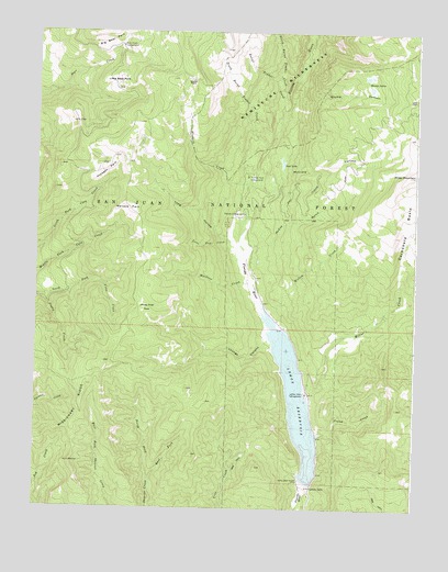
Lemon Reservoir, CO USGS Topographic Map
Click on map above to begin viewing in our Map Viewer.

This topographic map contains these locations and features:
Feature Name Type Latitude Longitude GNIS ID View Map
Bear Creek CampgroundLocaleN37.4961°W107.7228°183990View Map
Blodgett CreekStreamN37.4600°W107.6815°183984View Map
Burnt Timber CreekStreamN37.4792°W107.6692°183963View Map
Carbonate BasinBasinN37.4486°W107.6270°202969View Map
East Fork Shearer CreekStreamN37.3819°W107.7117°183968View Map
Florida CampgroundLocaleN37.4525°W107.6823°183981View Map
Horse ParkFlatN37.4869°W107.6998°183989View Map
Horse Thief ParkFlatN37.4278°W107.7137°183977View Map
Kroeger ParkFlatN37.4639°W107.7276°183991View Map
Lemon DamDamN37.3819°W107.6609°183992View Map
Lemon Dam CampgroundLocaleN37.4050°W107.6609°183972View Map
Lemon ReservoirReservoirN37.3998°W107.6628°183993View Map
Little Bear ParkFlatN37.4869°W107.7242°183985View Map
Lone Tree CreekStreamN37.4453°W107.6873°183978View Map
Long HollowValleyN37.4439°W107.6851°183979View Map
Lost LakeLakeN37.4658°W107.6697°183988View Map
McClure CanyonValleyN37.4603°W107.6785°183983View Map
McCoy GulchValleyN37.4411°W107.6809°183994View Map
Miller CreekStreamN37.4072°W107.6603°183974View Map
Miller MountainSummitN37.4631°W107.6262°202968View Map
North Burnt Timber CreekStreamN37.4842°W107.6701°183964View Map
North Fork Shearer CreekStreamN37.3819°W107.7117°183967View Map
Pound CreekStreamN37.3942°W107.6576°183971View Map
Pretty CreekStreamN37.4311°W107.7476°183956View Map
San Juan National ForestForestN37.4940°W107.6505°169577View Map
Silver PassGapN37.4544°W107.7295°190584View Map
South Burnt Timber CreekStreamN37.4700°W107.6748°183962View Map
Stump CanyonValleyN37.4813°W107.6671°183986View Map
Stump LakesLakeN37.4854°W107.6406°183987View Map
Transfer Park CampgroundLocaleN37.4625°W107.6809°183982View Map
Upper Lemon Picnic AreaLocaleN37.4231°W107.6695°197182View Map
Waldner CreekStreamN37.4267°W107.6762°183976View Map
Wallace ParkFlatN37.4539°W107.7201°183980View Map
Willow CreekStreamN37.4258°W107.6737°183975View Map
Youngs CanyonValleyN37.4194°W107.6733°183973View Map

Note: Coordinates in the location and feature list above are referenced to NAD83 datum.


Copyright (C) 2008-2024 Ryan Niemi / Sunset Dynamics ... All Rights Reserved