TopoQuest Logo
Do you find TopoQuest useful?
Help keep TopoQuest running and adding new maps/features by donating!
Bitcoin:  19c7KJd3qBynnjoSw5npx9KScwjBe4ifkT
Litecoin:  LXs6TkuXGGXo1vDsWCkWVdjQX94eUKd6ui
Home View Maps Find Maps Find Places Resources & Links


Comb Rock, Montana Topographic Map

USGS Map Title: Comb Rock, MT
USGS Map MRC: 47112B2
DRG (GeoTIFF) Download: o47112b2.tif


Neighboring USGS Topographic Map Quads:


  Krone Ranch, MT  
47112C3
 

  Bowmans Corners, MT  
47112C2
 

  Henry Creek, MT  
47112C1
 

  Johnson Mountain, MT  
47112B3
 

  Comb Rock, MT  
47112B2
 

  Coburn Mountain, MT  
47112B1
 

  Rogers Pass, MT  
47112A3
 

  Roberts Mountain, MT  
47112A2
 

  Wolf Creek, MT  
47112A1


Map MRC Location:

N48°
W113°
N48°
W112°
H8 H7 H6 H5 H4 H3 H2 H1
G8 G7 G6 G5 G4 G3 G2 G1
F8 F7 F6 F5 F4 F3 F2 F1
E8 E7 E6 E5 E4 E3 E2 E1
D8 D7 D6 D5 D4 D3 D2 D1
C8 C7 C6 C5 C4 C3 C2 C1
B8 B7 B6 B5 B4 B3 B2 B1
A8 A7 A6 A5 A4 A3 A2 A1
N47°
W113°
N47°
W112°

Comb Rock, MT USGS 1:24K Topographic Map Preview:
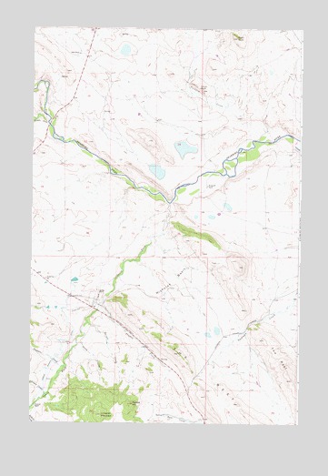
Comb Rock, MT USGS Topographic Map
Click on map above to begin viewing in our Map Viewer.

This topographic map contains these locations and features:
Feature Name Type Latitude Longitude GNIS ID View Map
Auchard CreekStreamN47.2147°W112.1381°800365View Map
Barrell CreekStreamN47.1566°W112.2236°800390View Map
Bessette CreekStreamN47.1430°W112.2336°800441View Map
Black RockSummitN47.2469°W112.1556°800471View Map
Blacktail RanchLocaleN47.1299°W112.2481°800483View Map
Burggraff RanchLocaleN47.1997°W112.1686°800514View Map
Comb RockSummitN47.2305°W112.1714°800611View Map
Dearborn CemeteryCemeteryN47.1644°W112.2311°800685View Map
Dearborn Memorial ChapelChurchN47.1649°W112.2311°1789358View Map
Fulton Post Office (historical)Post OfficeN47.1266°W112.1689°1789172View Map
Fulton School (historical)SchoolN47.1266°W112.1689°1789173View Map
Game CouleeValleyN47.1505°W112.2270°800824View Map
Gibson Rennig DitchCanalN47.1413°W112.2425°800841View Map
Jeffries CreekStreamN47.1686°W112.2117°800990View Map
Johnson CreekStreamN47.1336°W112.2433°800995View Map
Limekiln MountainSummitN47.1274°W112.2170°801062View Map
Middle Fork Dearborn RiverStreamN47.2199°W112.2431°801161View Map
Murphy RanchLocaleN47.1663°W112.2189°801206View Map
Nicholas BasinBasinN47.1724°W112.1872°801218View Map
Ostle RanchLocaleN47.2419°W112.2289°801265View Map
Painted HillSummitN47.1311°W112.2022°801272View Map
Pruden CreekStreamN47.1619°W112.2181°801324View Map
South Fork Dearborn RiverStreamN47.1944°W112.1861°801486View Map
South Fork School (historical)SchoolN47.1705°W112.2436°801495View Map

Note: Coordinates in the location and feature list above are referenced to NAD83 datum.


Copyright (C) 2008-2024 Ryan Niemi / Sunset Dynamics ... All Rights Reserved